
Date: September 21, 2025
Miles: 13.7 miles Elevation Gain: 1,760 ft. Elev./Mi: 128 Grade: 7%
Difficulty: Class 2.3 Hiking Time: 4:52 Pace: 22:21/mi. Avg. Temp.: 79
Trailhead: Abrams Creek
Trails: Cooper Road, Gold Mine, Cane Creek
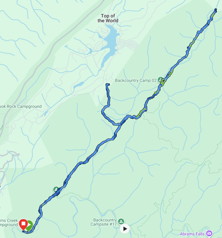

I arrived at Abrams Creek before 7:00 AM and it was still dark. I walked the half mile to the campground and it was full. I heard the campsite had been designated as closed for the summer early in the season and I was surprised to find it open and completely full. I quietly moved through the sleeping campers to the gate at the trailhead.
I offered tobacco to the four directions and headed in on Cooper Road Trail. I followed an easy hike as the sky lit up and the sun rose.
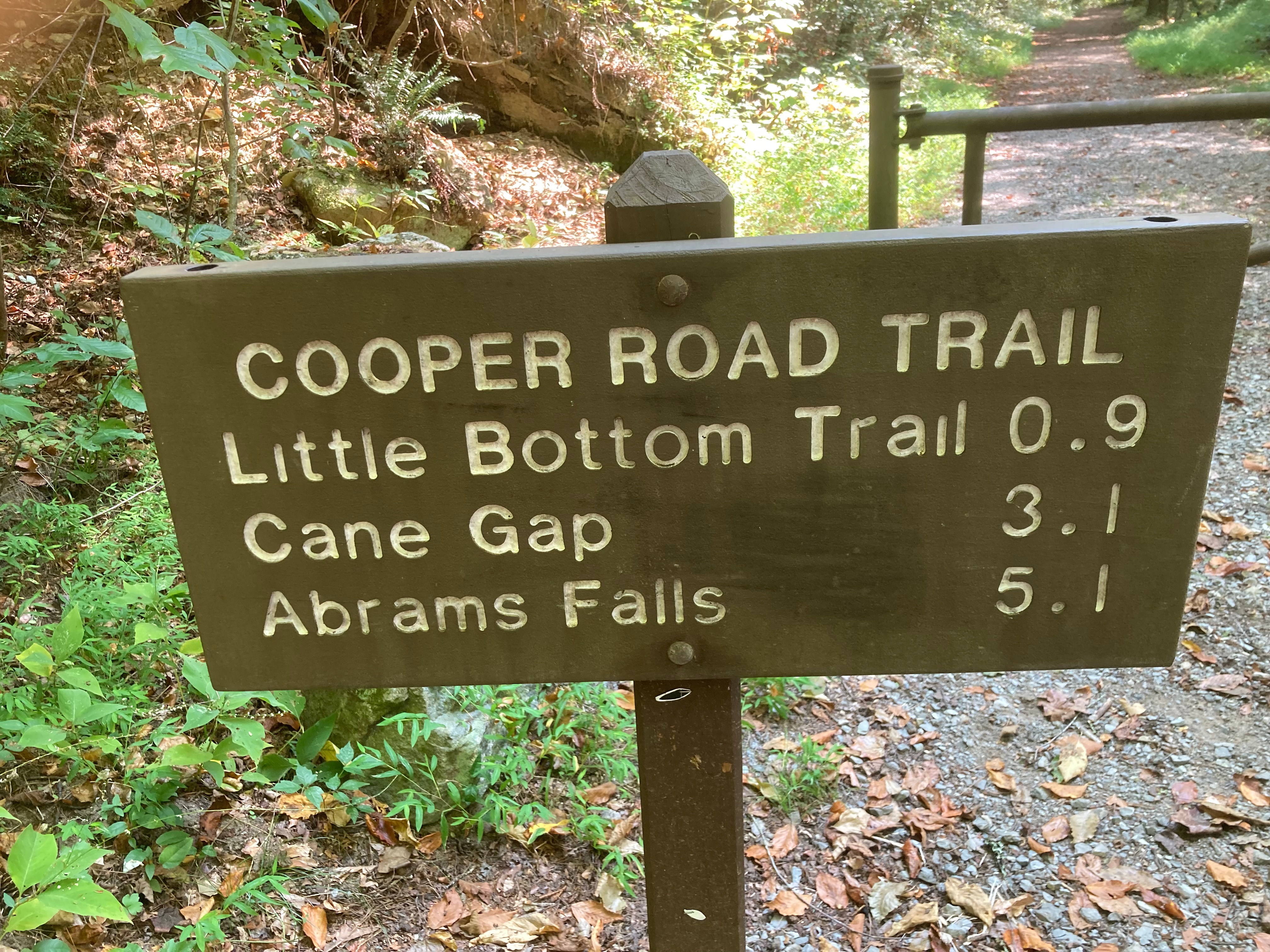
I took the Gold Mine trail at 2.6 miles and headed uphill. The park boundary is greeted by a the ruins of a horse barn on the edge of the Top of the World Community. Then I returned the 0.8 miles and continued on the Cooper Road Trail.
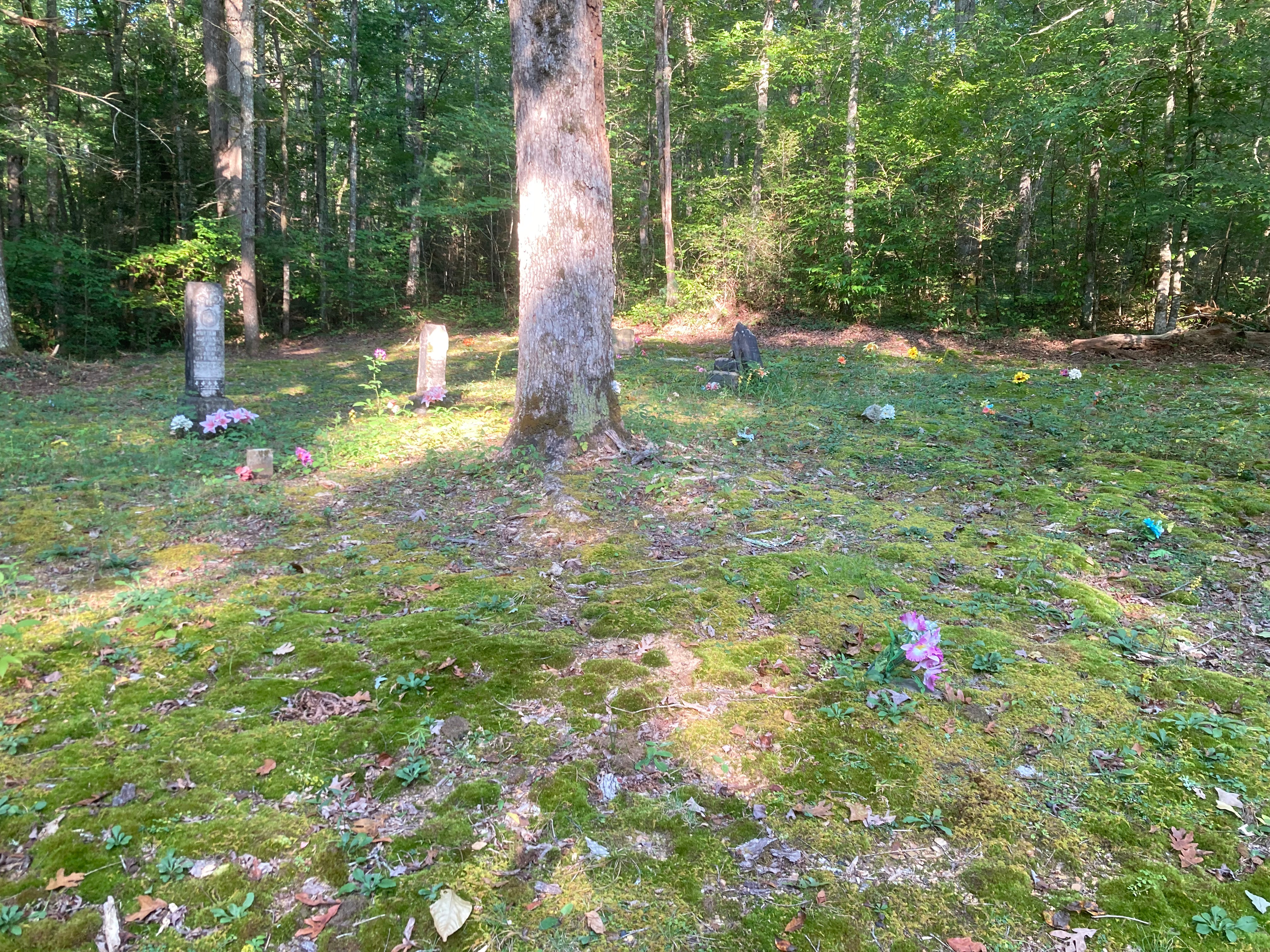
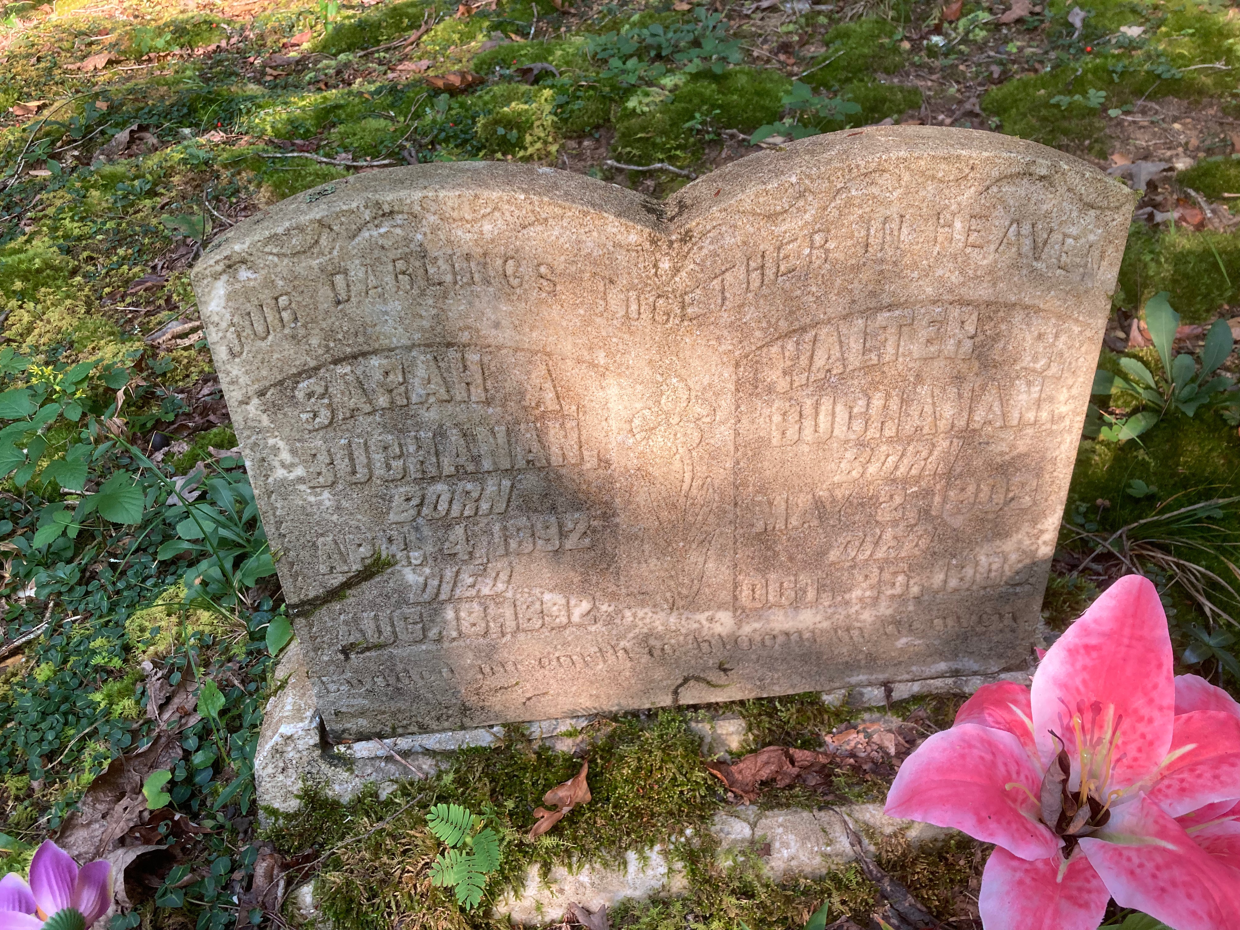
4.6 miles into the hike, Cooper Road turns right and Cane Creek Trail continues forward. About one mile into Cane Creek, a side trail leads to a small family cemetery with several children less than one year old. One grave had a brother and sister sharing a headstone Sarah Buchanan who was born April 4th 1892, and died August 8th 1892, and then presumably a brother, Walter Buchanan born May 2nd 1909, and dying October 22 1909. Surviving childhood was difficult in the Smokies back then. Although there were a few small headstones, several of these graves were marked only with small rocks. Many were decorated with colorful silk flowers.
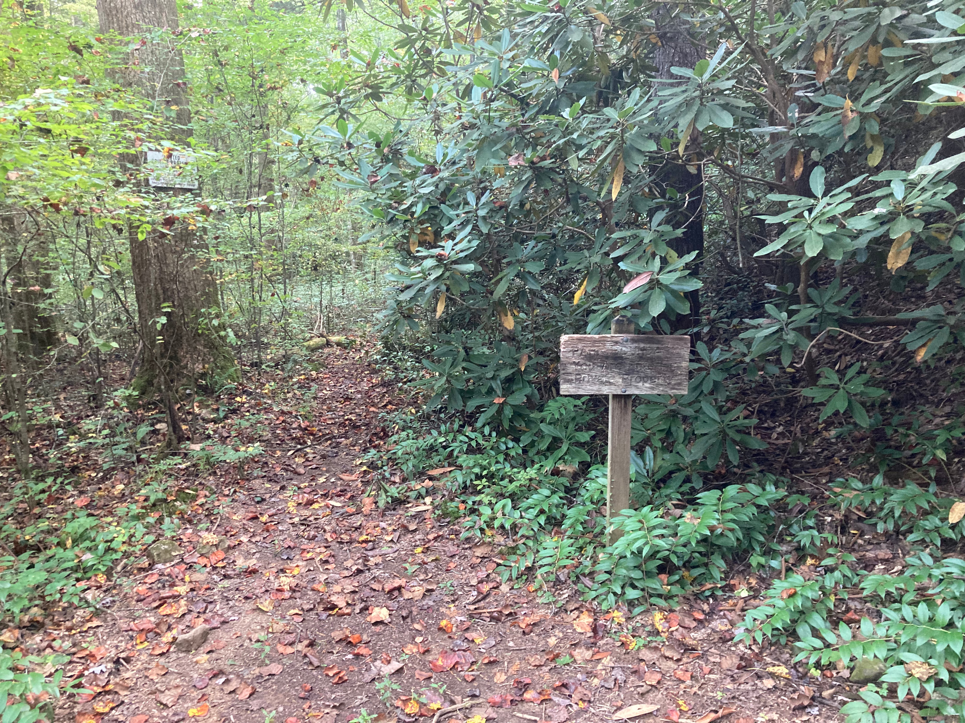
At 7.1 miles I reached the literal “end of the trail”. The Cane Creek Trail terminates at the park boundary, where there is a benchmark on a cement post marking the boundary. A small trail proceeds onto private land. I had held open the option to bushwack over to Beard Cane Trail but the vegetation was thick with rhododendron so I opted to turn back.

On the way back, I stopped to audit campsite #2. There was a tent when I came by earlier so I moved. This site is about .6 miles into the Cane Creek Trail. It is a small site with typical amenities like a fire ring and bear cables There’s good water in creeks on either side of the campsite. It’s level for maybe 2 tents overall score 3 out of five. I’m at a backpacker at campsite 2 who spent the night he said there was plenty of winged people active throughout the night.
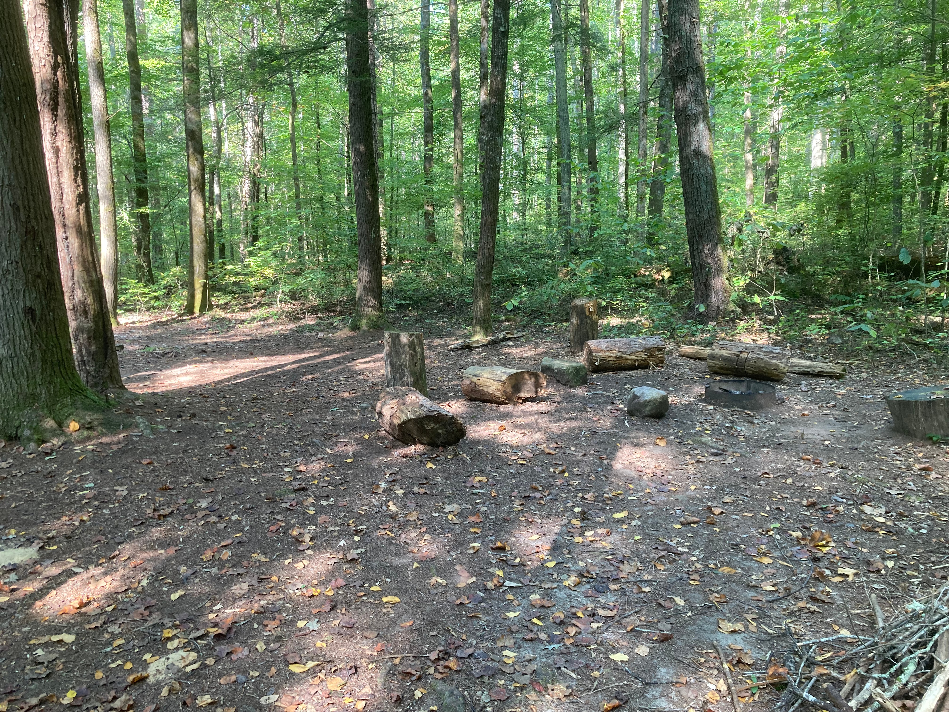
Easy hiking continued back to Campsite #1. It is off the trail although not well hidden. It’s low impact except for some unburied TP. There’s good water from a nearby Creek. The amenities include cables and fire rings. There are three sites, 2 have fire rings, and there are two sets of bear cables. Overall score 4/5.
On the way into the campsite I met a half a dozen girls backpacking out it looked like they were having a great time. When I got back to Abrams Creek campsite, most of the people had left. Scotch was offered to the four directions and I was out by noon.
Difficulty Rating:
Length: 4 Elevation: 1 Barriers: 2 Average: 2.3
