Category Archives: Trail Log

The Winds of Mt. Sterling

Mt.Sterling Loop

Date: May 21 – 22, 2018

Miles: 21.1       

Having completed the first loop of my backpacking trip, I enjoyed some lunch while catching glimpses of elk at the edge of the trees in Cataloochee Valley.  Plus, I had to dry out my shoes, not to mention my feet pickled by the miry swamp that was the Caldwell Fork Trail.  For this loop, there were three entry points depending on how much hiking I wanted to do the second half of the day.  I did a quick check of the mileage if I stayed in Cataloochee and started up Pretty Hollow Gap,  taking Little Cataloochee Trail to Long Bunk and then up Mt Sterling Trail.  With about 7 miles done in the morning, I figured another 10 or so would get me to the top of Mt. Sterling and CS# 38.  Not only did I miscalculate the mileage by about 4 miles short, I also failed to realize the magnitude of the 13.7 mile climb that was in store for me that afternoon.  Pretty Hollow Gap leaves Cataloochee Road at 2,717 feet and the day ended at the top of Mt. Sterling at 5,840.  Overall, it was a 21.4 mile day and a 3,823 ft. climb ending in a 12% grade up Mt. Sterling Trail.

But enough whining.

With after a lunch of summer sausage, Tillamook cheddar, pistachio nuts and a few granola bars, I started out on Pretty Hollow Gap Trail refreshed and dry of feet at about 12:45.  The trail is a gravel road for a quarter mile or so, passing the Cataloochee horse camp at 0.2 miles.  I took the right onto Little Cataloochee Trail and started a easy climb up toward NC 284.  There are a few rock-hopper stream crossings in the first mile and a half making for damp feet but the climb is moderate until you reach a switchback and a ridge crest a tenth of a mile ahead, where there is a nice clearing for a rest.  At about 2 miles, the trail bends at a rock fence typical of this area.  Not too far beyond the bend, the DSC01164trail arrives at the Dan Cook Cabin at 2.5 miles, which is a delightful setting with notched joints and a split rail fenced yard.  Across the trail from the cabin is a ruin of a rock walled building the guidebook called an apple house.  The trail becomes a gravel road past the cabin.  I noticed on this section there was fire damage on the right side down in the hollow, yet the fire did not jump the road as the upper left side was DSC01178pristine.  The Little Cataloochee Baptist Church appears at 3.2 miles with its large cemetery.  I did not spend time investigating either spot as I wanted to get the afternoon’s hiking done but I remember there being graves dating back to the civil war.

Continuing down the road, the fire damage picked back up just past the yard of the church.  I noted that whatever the fire event was, it burned right up to the edge of the church property and stopped.  Less than a mile past the church, a side trail leads to the DSC01185Hannah Cabin, which is unique for it’s brick chimney.  Just 0.2 miles past Hannah Cabin is the Long Bunk Trail intersection.  From there it’s a mile to NC 284.  I took a brief water and granola bar break at the road.  900 Miler purists will note that I did hike the mile out and then back to Long Bunk Trail rather than call it even, but that ethical decision added two of the miles I failed to calculate in the afternoon mileage.  This trailhead was the second choice for starting the loop and would have only required a 7.8 mile hike to Mt. Sterling.  In retrospect, it would have been a better choice for this loop.

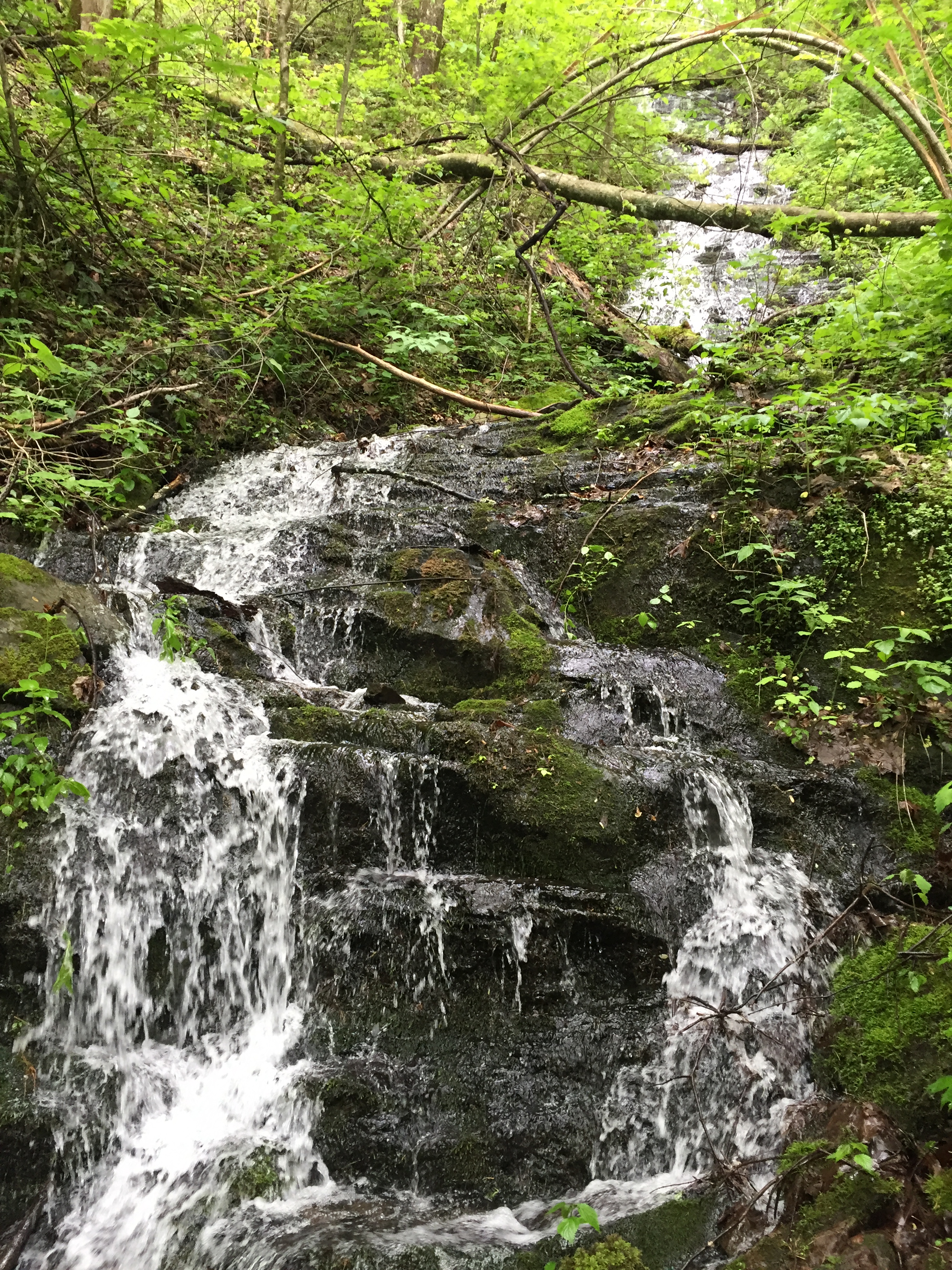
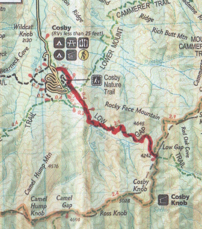
The steady climbing continued on Long Bunk Trail.  It was 4:00 when that hike began and I was still over 6 miles from the end of the day.  The Hannah Cemetery is at 0.2 miles and there were fresh flowers on a couple of the graves.  Past the cemetery, the jeep track became a single track pathway.  There are a few shallow streams to cross over the next mile but with deft stepping, the feet can remain dry.  Long Bunk Trail is rather unremarkable in its features.  It is a steady climb on good trail and it terminates on the Mt. Sterling Trail about a half mile in from the road.  I completed the 3.7 miles in an hour and a half.

This time I dropped the pack to hike the half mile out to the road, which is the third option for starting the loop.  Touching the gate, I immediately turned around started the watch to count the miles on Mt. Sterling Trail.  Much of the trail is a primitive jeep track that serviced the fire tower on the summit.  The pack was waiting for me at 0.5 miles and I donned it for the last 2.2 miles of the day.  The switchback at 0.8 miles was a slap in the face because it began the more strenuous part of the trail that would continue to the top.  The climb was steady, not severely steep or rugged but on top of 20 miles, it was miserable going.  I didn’t make any voice recordings after the switchback at 1.6 miles but I remember going a tenth of a mile, catching my breath, then repeat.  The mind plays tricks on you when you are exhausted and still have a long way to go.  Actual mileage lengthens to fill the worst depths of your imagination.  You begin to notice damp rocks in the trail and wonder if you could get enough water to make camp right in the trail.  No energy in the legs and the heart only beats so fast at this point in the day.  There is nothing to do but keep plugging with an eye toward dinner.  The 2.7 miles took a pitiful hour and a half to get done and there was rejoicing when the trail broke the top of the ridge, leading 0.4 miles to the summit.

DSC00972
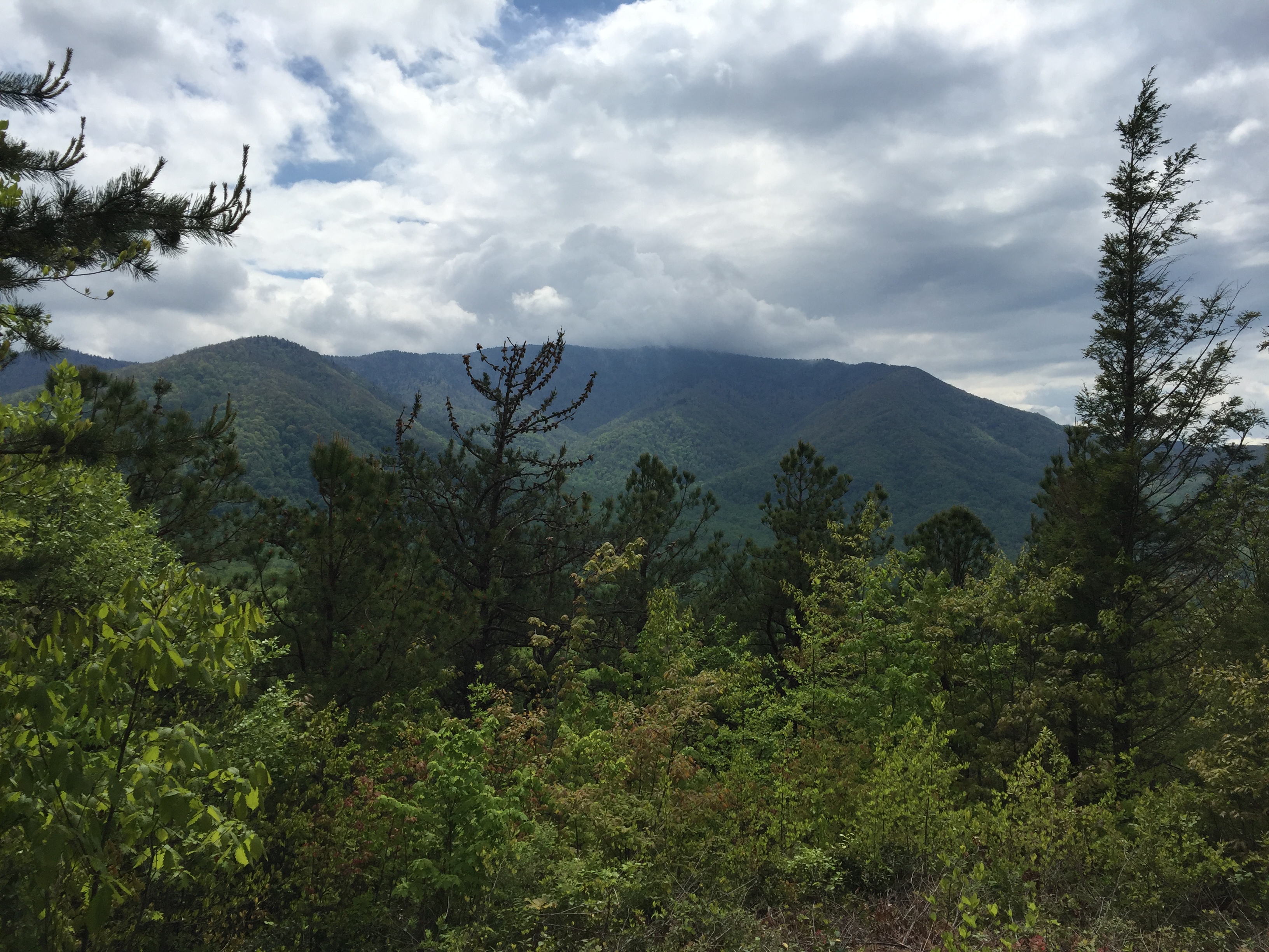
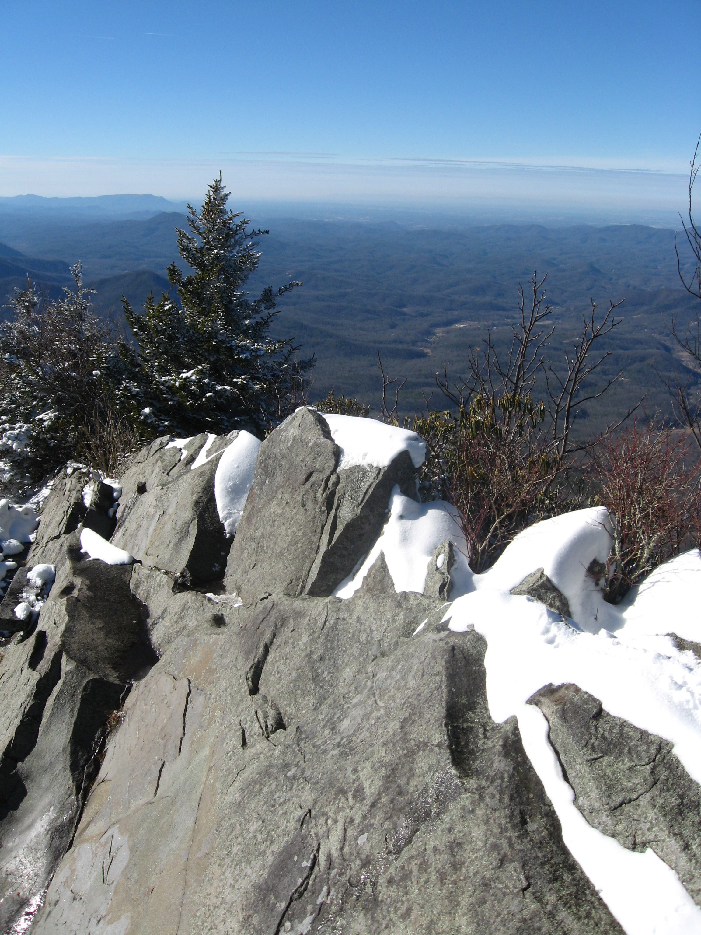
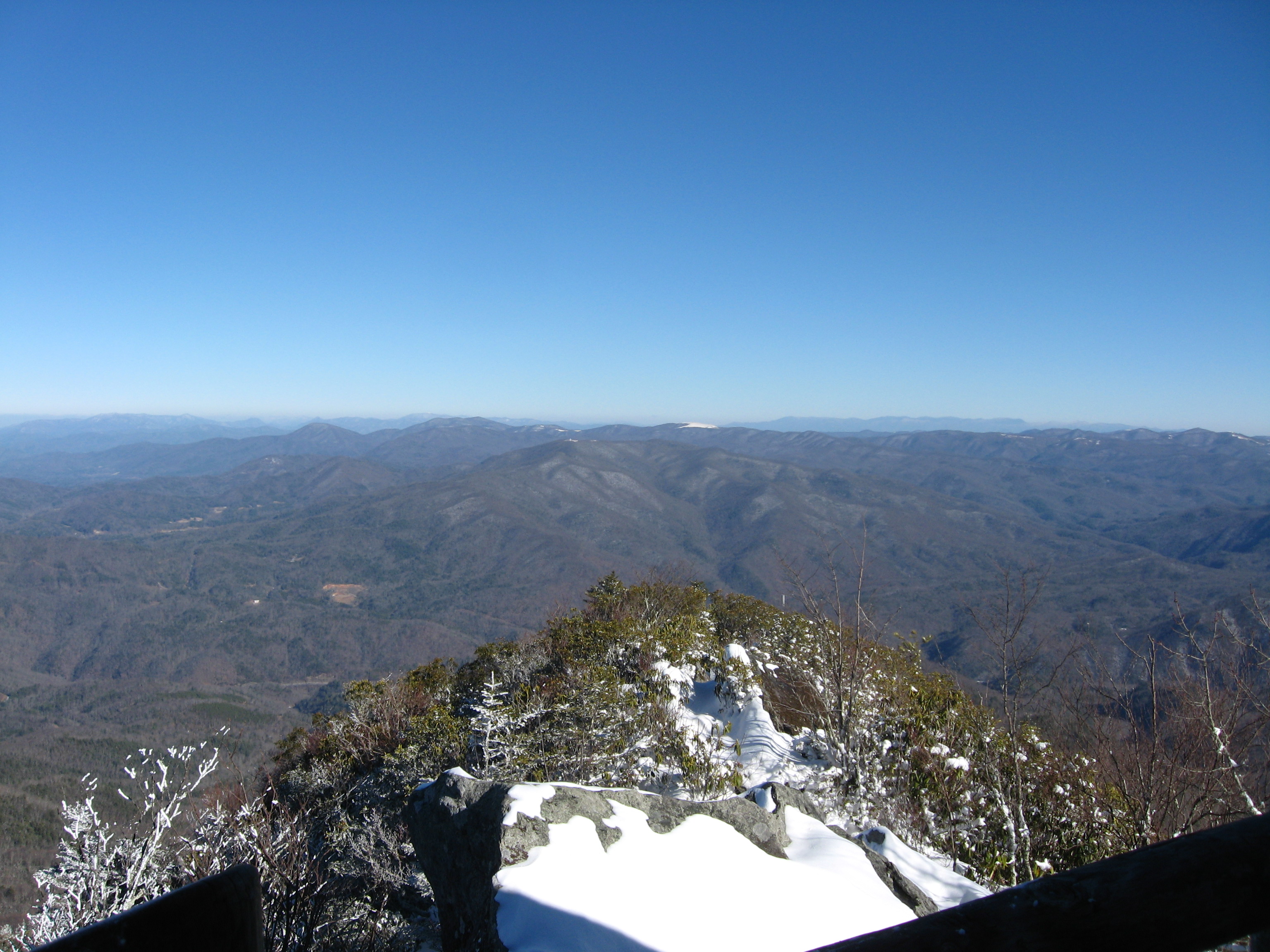
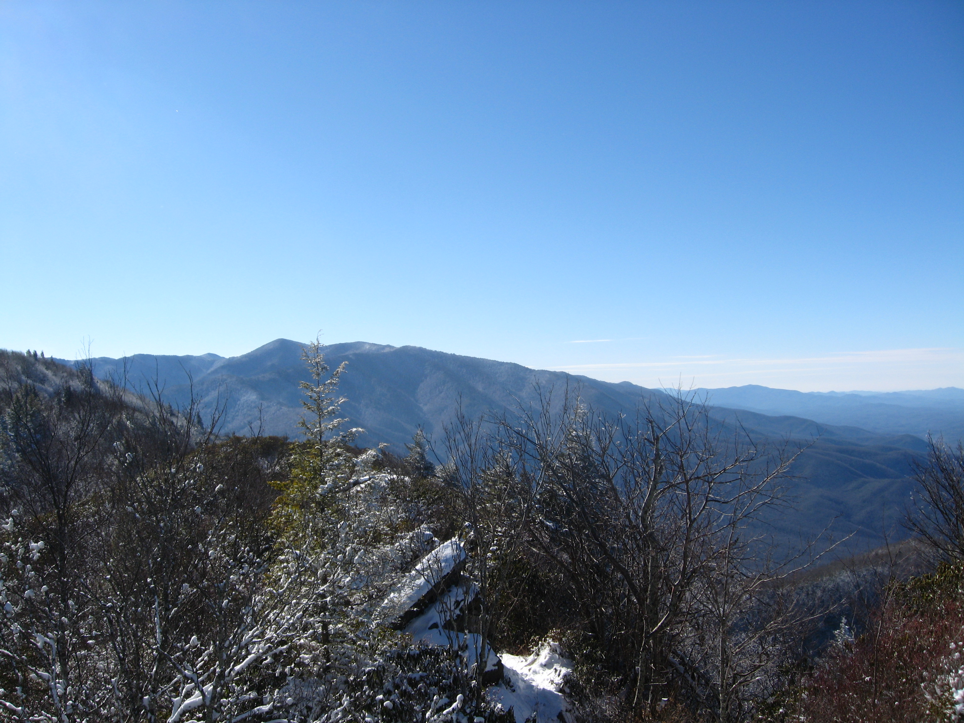
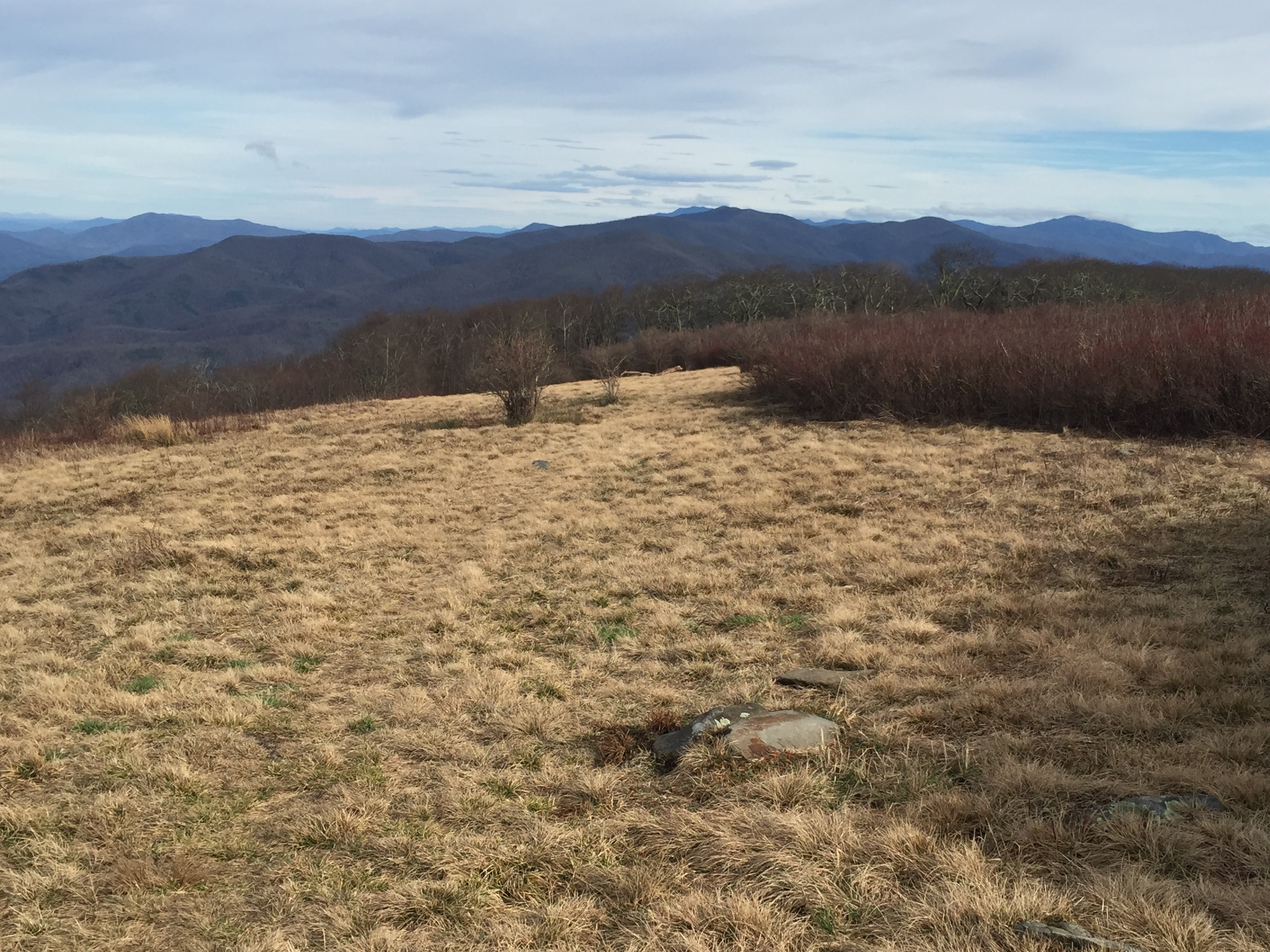
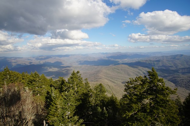
The trail ends in a clearing that is the home of a fire tower standing watch over the far northeast end of the Park.  The views are spectacular and I couldn’t wait to summon the energy to grab some pictures before sunset.  But the first order of business was to get water for the night.  I was out and also dehydrated.  The water source is almost a half mile down the Baxter Creek Trail just past the fire tower and it IS steep.  The side trail leads 700 yards to a small piped spring that, at best, offers a trickle of clean cool water.  I dropped the pack, and stripped to my skivvies because everything was soaked and I figured it would be easier to dry off by moving around.  With the water bag filled, I climbed back up to the campsite, grabbed my fleece jacket and camera and climbed the tower to the landing just below the top.  Then I sat down.

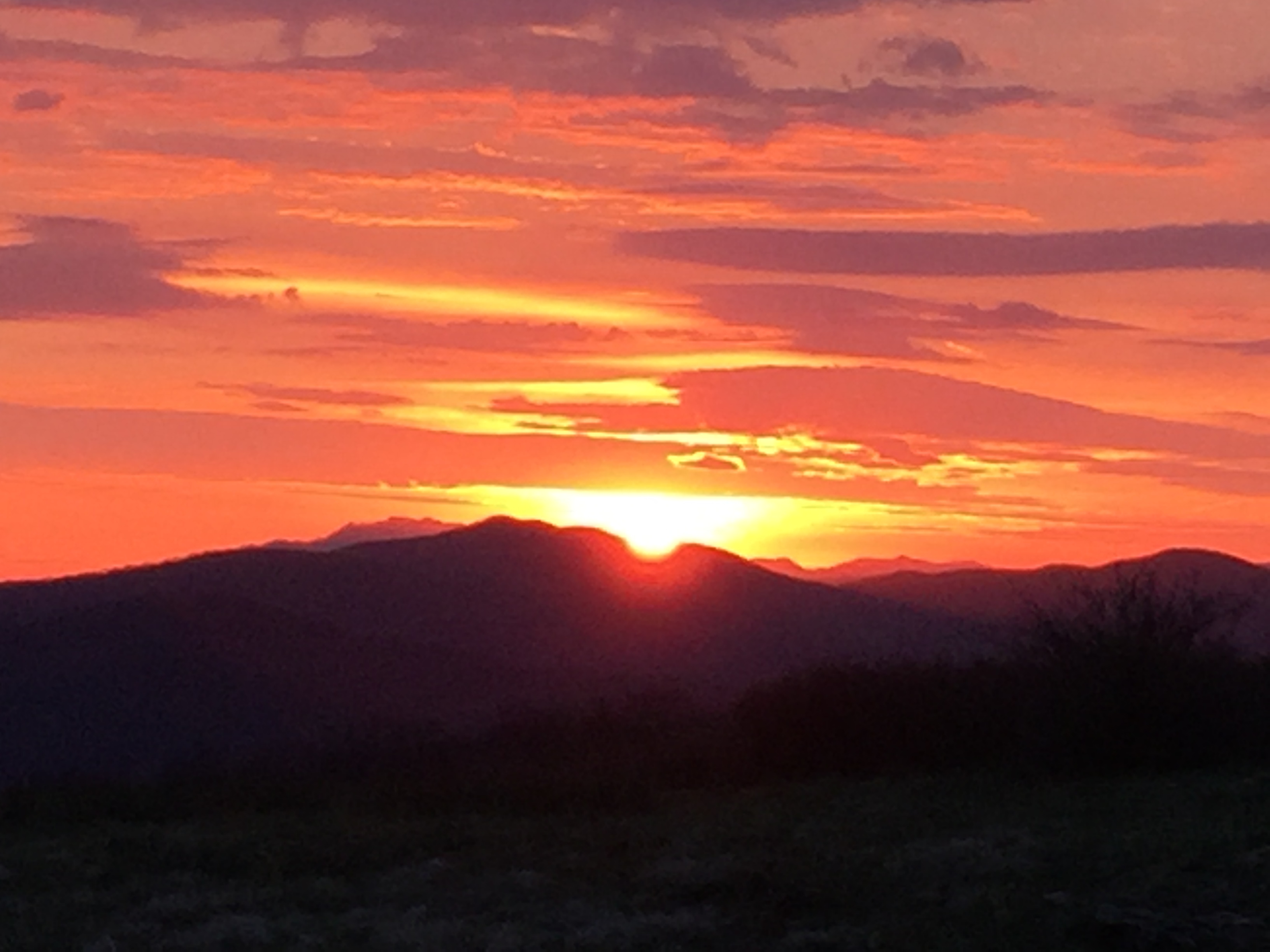
The sun hung low in the evening sky but still lit up the clouds brilliantly.  I snapped a dozen or so shots with different f-stops and wide angles, hoping to get at least one good shot to capture the moment.  The wind was picking up and I was still pretty damp with body moisture.  Chills were setting in as the sun got low.

Sunset at Mt. Sterling

DSC00986

I decided dinner was the next challenge to accomplish but before that, I hung the hammock among the evergreens that adorn the top of this beautiful ridge.  There was a bivy style tent in a spot nearby but there was no sign of another human being.  Despite the small tent, there was no pack or food bag hung on the bear cables.  I opted not to “knock on the door’ and introduce myself to the neighbor.  I was thankful for the quiet loneliness.  I had been looking forward to camping here for a long time and the peacefulness was a reward for the hard day’s work.

I got my stove ready for dinner, poured the cup of water to boil and opened the pouch to ready the ingredients.  There were two pouches; one obviously food and the other was a “heating element.”  Bewildered, I read the package to figure what exactly I had brought along for dinner.  It was a self-heating backpacking dinner.  Who knew?  There is a white package of some material, which you cover with water in the meal package and you dump in the other pouch of food, unopened of course.  The material spontaneously starts to “boil” the water, with steam and everything.  After 10 minutes, diner was warm enough to eat and it was pretty good, although one must adjust for the quality of food, accounting for camping after 22 miles of hiking uphill.  My shoes would probably have tasted pretty good at that point.

The setting sun was taking its light down with it and after a bit of clean up, I secured things for the night.  Anticipating a cool wind, I unrolled my thermal pad but I decided to try it uninflated.  The wind was picking up as I wiggled into my cocoon for the night.  I warmed up quickly and started to doze as darkness settled.  The wind rattled the fire tower and I heard the typical animal activity as I was drifting off.  Within a few minutes there were voices.,  Having ruled out a dream and being reasonably sure the voices were outside my head, it turned out to be a few late arrivals.  They must have been as exhausted as I was because after a couple tents were thrown up, they got quiet pretty quickly and we went back to the low roar of the wind to sing us to sleep.

Hammocks sleep cold.  My experiment proved to be a failure as the wind blew under and around every surface in contact with my backside.  While I wasn’t freezing, I was not warm either.  I finally inflated the thermal pad and I was immediately toasty and warm.  The final report: You gotta take some insulation with a hammock, even in the summertime.  Once I was warm, I slept soundly for the second night in a row.

I awoke early and set up for breakfast.  The owner of the bivy tent could still not be seen but I did meet one of my late arriving neighbors as I boiled water for my oatmeal and coffee.  The three of them had come up Baxter Creek Trail, which must have been a killer that late at night.  I offered the balance of my water so he wouldn’t have to negotiate the walk to the spring.  Packing up a hammock goes quickly and I was on the trail a little after 7:30 am.  Mt. Sterling Ridge Trail to Pretty Hollow Gap and out the trail named for the gap.  My arduous effort the day before would reward me with a 7 and a half mile hike back to the trailhead.

The details of this part of the hike are pretty sketchy.  I had brought a battery charging device for my watch but I failed to include the proper cable.  Furthermore, my phone battery was all but dead as well.  The features and fallacies of technology are a topic for another post, but here, let me say that it is amazing how much detail one forgets when not archiving it somehow.  Mt. Sterling Ridge is a steady downhill hike from its start at the Mt. Sterling Trail, following the ridge as it descends into Pretty Hollow Gap where there is a crossroad of trails.  To the right is Swallow Fork Trail, which leads down to Walnut Bottom, one of my favorite camping spots in the Park.  My path took me to the left down Pretty Hollow Gap Trail, which looses about 2,000 feet along its 5.6 miles.  In my anxiousness to finish, coupled with all my technology being dead, I remember very little of that hike except that I got to the bottom before 10:00.

The final tally was 38.9 miles in less than two full days of hiking.  I can’t speak for high altitude but I think I am in reasonably good shape for the JMT in a month.

HikerHead 2

Strider Out!

Newton Bald Trail

Date: March 4, 2018

Miles: 5.5        Elevation Gain: 2982 ft.         Elev./Mi: 542        Grade: 10%

Difficulty:       Hiking Time: 2:03      Pace: 2.2 mph       Avg. Temp.: 52

Newton Bald TrailNewton Bald Elevation

DSC01007

Meigs Falls

Springtime was on a preseason tour the first weekend of March and stopped for a couple days in the Smokies.  One of the secret blessings of being a 900 Miler is you get to drive the though our beautiful park early on a weekend morning when the rest of the world is wondering why none of the breakfast places in Gatlinburg open before 9:00 am.  The Little River was proudly sporting Class II rapids as the kayakers were gathering in the parking lot at the Townsend Y, donning winter wet-suits.  Meigs Falls were in full glory and the fly fishermen were congregating near the bridge over the Oconaluftee on the Kephart Prong Trail.  My target for the day: Newton Bald Trail.  Newton Bald could be put together with the Mingus Creek Trail for a pseudo loop but you have to get from near the park entrance back to Smokemont or just walk it.  In my case it was an orphan, having completed Mingus Creek so I decided on an out and back for the 5.5 miles.

The first thing one should know about Newton Bald Trail is the fact that Newton Bald is not.  The Wise Guide mentions that it used to be a bald years ago before the park but as the Brown Book says, there are no views except through the winter trees.  The elevation profile in the Brown Book shows a scary climb at a 45 degree angle and it is a 10% grade gaining nearly 3,000 feet at 542 ft. per mile.  That said, I found the climb steady but not particularly strenuous.

The temperature had just passed 40 degrees as I started the flat section along Newfound Gap Road.  The easy flat hiking was short lived as the trail bent left and started the 4 1/2 mile climb at 0.1 miles.  The Newton Bald horse loop joins in a couple hundred yards in a wide gravel path before it turns left and the trail heads straight in a single track as the steady climb begins in earnest.  The early climb is through rhododendron and mixed hardwoods.  The first discernible landmark is the first stream crossing at about 1.2 miles.  There are a few bends in the trail along the way, some involving small streams in the springtime.

On the one hand, the Newton Bald Trail is rather unremarkable with no views, no waterfalls and it is up hill mostly the whole way.  Perhaps it was the great weather or joyful ride through the park putting me in a great mood, but I would call the hike rather pleasurable, despite the steady climb.  The trail is well graded through forest that was clear of undergrowth and there are really no places where I would call the trail rugged; just a steady walk over a carpet of leaves.  The streams are all rock hoppers and fortunately, only a couple small blow downs at this point in the season.

The steady climb takes a break at about 4.1 miles for a hundred yards or so and continues up over Newton Bald at about 4.7 miles.  Newton Bald is covered with mixed hardwoods.  The guidebooks mention grasses and flowers evident in the warmer months but in winter, one is left wondering why the name “Bald” is involved, although shortening it to “Newtons” doesn’t make any sense at all. The trail levels out all the way to Campsite #52 at 5.3 miles and beyond to the intersection with the Thomas Divide Trail at 5.5 miles.  I made the 5.5 miles in 2:03 for a pace of  2.19 miles per hour.

Lunch and some mind out of time back at the campsite.  The stillness was sublime with a hint of birdsong once in a while and the occasional low rumble of a jet engine leaving the McGee Tyson airspace.  I wouldn’t call my mind out of time a nap because I really didn’t dose off but I did loose track of time in the warm sunshine listening to the faint, quiet sounds around me.  Although it was warm and springlike, the wild world was still asleep and the earth felt that way.

After an hour, or a moment, I’m not really sure, I was ready to head back.  I am a pretty fast hiker, especially with well over 5 decades in my knees but the descents are never easy.  But that is the beauty of Newton Bald trail.  The steady decrease in elevation and the absence of stumbling rocks and roots made for a fast retreat.  I made it back to the trailhead in 1:37 for a 3.4 mile per hour pace and happy knees in the end.

Data Book:

Newton Bald Databook

Be well, do good, walk humbly!

HikerHead 2


Strider Out…

Lower Mount Cammerer Trail

Date: May 6, 2016

Miles: 7.4 miles       Elevation Gain: 394 ft.         Elev./Mi: 53        Grade: 1%

Difficulty: Class 1    Hiking Time: 2:10      Pace: 3.4 mph       Avg. Temp.: 59

Lower Mount Cammerer Trail Lower Mount Cammerer Trail Elevation

Lower Mount Cammerer Trail, along with Low Gap Trail II, connects the Appalachian Trail to Cosby Campground and the two trails make up part of a very popular loop hike that includes the fire tower atop Mount Cammerrer.  The trail is fairly rich in features that includes Campsite #35, Sutton Ridge Overlook and a number of stream crossings.  The main trailhead is at Cosby Campground at an intersection with Low Gap Traill II near campsite B93.  Although the guidebooks portray the trail from this starting point, this hike was completed starting from the Appalachian Trail.

Lower Mount Cammmerer Trail leaves the AT at 3,566 feet and begins a fairly level stretch over a mile and a half.  The path meanders in and out of ridges and ravines, often accompanied by stream crossings.  The first mile crosses streams four times.  At 1.5 miles, there is a side trail to a very small cemetery where the markers are mostly tiny rock slabs, only one of which bears any wording of its inhabitant; a two year old child who died in 1912.  Not far past this landmark,

Cascade at Riding Fork

Cascade at Riding Fork

the trail starts its steady decent for the next four miles.  The trail is well graded single track through mixed hardwoods and the stream crossings continue.  At 3.1 miles, the trail crosses Rowdy Creek, requiring a fording of the creek.  The feet get wet again at 3.8 miles crossing Robinson Creek.  Gilliland Fork Campsite #35 appears at 4.1 miles.  The site consists of a number of satellite sites near the creek at 4.2 miles.  The tents sites are more level near the creek crossing.  At 5.3 miles the trail enters a pine forest.  At 5.5 miles, there is another stream crossing that can be negotiated by hopping the rocks, followed by a small but pretty cascade and stream crossing Riding Fork at 5.8 miles.


View from Sutton Overlook

View from Sutton Overlook

The side trail to Sutton Overlook arrives at 6.0 miles.  This trail is only 200 yards or so but it is fairly steep.  The effort is worth it as the path ends on a ridge point with outstanding views to the north and west, including Maddron Bald.  There is a footlog across Toms Creek at 6.4 miles and a wet crossing through one of its branches at 6.5 miles.  At 6.7 miles, the trail becomes a gravel road at a turnaround and continues a gentle descent to the trailhead.  Low Gap Trail intersects at 7.3 miles and there is a footlog over Cosby Creek just beyond.  AT IMG_27887.4 miles, the trailhead at Cosby Campground appears, ending an enjoyable hike on a well graded pathway.


Data Book:

Lower Mount Cammerer Data Book

HikerHead 2  Shalom…


Mount Cammerer Trail

Date:    May 6, 2016

Miles:  0.6 miles           Elevation Gain:  118 ft.    Elev./Mi:  196         Grade:     4%          

Difficulty:  Class 1      Hiking Time: 0:14       Pace:  2.5  mph       Avg. Temp.:   46

Mount Cammerer Trail Mount Cammerer Elevation

Mount Cammerer Trail is the access trail to Mt. Cammerer Tower from the Appalachian Trail.  The mountain, trail and the tower are named for Arno Cammerer who was the director of the National Park Service at the time the Smokies were designated as a national park.  There are no camping facilities or water along this trail and while camping in the tower occurs, the Park Service discourages it by patrolling the area frequently

The trail is generally accompanied by laurel and rhododendron and reaches a point where it becomes brushy like an overgrown bald.  The views are spectacular, especially when viewed from atop many of the rock outcroppings along the way.

The trail terminates at the tower which was constructed of stone and local timber in the 1930’s by the CCC.  It is octagonal in shape and offers sheltered views 360 degrees.

IMG_0978 IMG_0985

IMG_0981 IMG_0984

Data Book:

Mount Cammerer Data Book

HikerHead 2  Shalom…

Low Gap Trail II

Date:    May 6, 2016

Miles:  2.9 miles           Elevation Gain:  1,916 ft.↑   Elev./Mi:  660    Grade:     13%          

Difficulty:  Class 5      Hiking Time: 1:03       Pace:  2.7  mph       Avg. Temp.:   57

Low Gap Trail II Low Gap Trail II Elevation

Older guidebooks speak of Low Gap Trail as one trail, with a Tennessee side and a North Carolina side.  Low Gap Trail II provides access to the Appalachian Trail from Cosby Campground.  For this reason, it is a fairly popular trail as it makes for a good loop hike to Mt. Cammerer.  At the AT, it connects with Low Gap I, which terminates at Walnut Bottom and CS# 37, and it is one of the more idyllic campsites in the park.  Low Gap II is also one of the more steeper hikes in the park at 13% grade.  The trailhead is at the hiker parking lot just before the check-in shack for the campground.  There are a number of trails around Cosby Campground with its several side trails but also, Cosby is the general trailhead for Lower Cammerer and Snake Den Ridge Trails as well. With reasonable attentiveness, the hiker should be able to stay on their intended path.

Cosby Creek on Low Gap Trail II

Cosby Creek on Low Gap Trail II

The first 0.4 mile or so is consumed with negotiating the maze of side trails.  At 0.2  and 0.3 miles there are creek crossings on footlogs.  At 0.4 miles is the intersection with Lower Mt. Cammerer Trail.  This intersection is quite confusing because Low Gap II seems to exit to the right.  Take care to follow the signs here.  The confusion continues at 0.9 miles as the Cosby Horse trail enters from the right.  Some guidebooks indicate this is an alternate Low Gap Trail and signs may indicate that.  At this point, the climbing begins in earnest and continues the rest of the way up.  At 1.2 miles, there is a series of switchbacks in rapid succession before the trail straightens out and continues its steady ascent.  The trail crosses Cosby Creek at its headwaters at 2.5 miles and finally,a t 2.9 miles, this step climb is over at the intersection with the Appalachian Trail.  Low Gap Trail I heads down the ridge 2.5 miles to Walnut Bottom.  To the right on the AT is Cosby Knob Shelter at 0.8 miles and to the left is the Mt. Cammerer Trail at 2.1 miles.

Data Book:

Low Gap II Data Book

HikerHead 2  Strider out…

Gregory Bald Trail

Date:    April 29, 2016

Miles:  7.4 miles           Elevation Gain:  2,516 ft.↑   Elev./Mi:  340    Grade:     6%          

Difficulty:  Class 5      Hiking Time: 2:54       Pace:  2.7  mph       Avg. Temp.:   72

Gregory Ridge Trail Gregory Bald Trail Elevation

Gregory Bald Trail is a signature hike of the Smokies and although it is quite popular with hikers, it does not see the traffic of Alum Cave Trail.  What makes it special is its access to Gregory Bald.  Like Mt LeConte, there are several ways to get to Gregory Bald and Gregory Bald Trail is perhaps the most direct and least strenuous overall but that is relative.  There is not a non-strenuous approach to Gregory Bald.  The main downside is that the trailhead is in Sams Gap on Parson Branch Road, a maintained gravel road that leads oneway out of the southwest corner of Cades Cove.  Parson Branch Road is closed in the winter so accessing the trailhead requires a bit of planning.  At the time of this writing, the road was still closed well into June as the result of multiple blowdowns.  Once you reach Sheep Pen Gap and Campsite #13, the trail follows the Tennessee/North Carolina state line to its terminus with the Appalachian Trail  at Doe Knob.  One guidebook mentioned that Gregory Bald Trail was the original route of the AT as it exited the Park but later was changed to drop down into Fontana in 1948.

IMG_2717Sams Gap is a large open space with plenty of parking but remember, you cannot return to Cades Cove.  You must exit the park at US 129 Twentymile.  Gregory Bald leaves the gap on a fairly level walk for the first half mile.  A small stream crossing at 0.6 miles initiates a steady uphill climb through pines and other evergreens as it ascends the south side of Hannah Mountain.  Along this section you may see a beautiful flowering tree known as the Mountain Magnolia, which flowers in IMG_2718April/May.  At about 2.3 miles, the climb levels for a short bit, long enough to catch some breath left behind on the climb.  But catch it well as the ascent continues fairly steeply in this section, gaining 635 feet per mile (12%) until you reach Sheep Pen Gap.  At 3.2 miles, you reach Panther Gap and by now the pines have given way to mixed hardwood forest.  Leaving Panther Gap, a rhododendron tunnel ushers you into the last mile of steep climbing.  At 3.9 miles is the spring on the left and water source for Campsite #13.  Be prepared for a muddy, wallow as hikers, horses and feral pigs use this spot.  You may have to climb up the side of the hill a bit to find a suitable place to fill water containers.

Sheep Pen Gap Campsite 13At 4.1 miles, your climbing is done as you enter Sheep Pen Gap and Campsite #13.  During warmer seasons, it is rare to find the site empty.  It’s wide grassy spaces and level tent sites make it one of the more beautiful and popular sites in the park.  Wolf Ridge Trail meets Gregory Bald Trail at Sheep Den Gap and is a pathway less than a mile to Parson Bald.  If you choose to camp at CS #13, you choose well as you then have the opportunity to hike 10 minutes up to Gregory Bald to catch sunsets and sunrises.

IMG_1580At 4.5 miles is a Sacred Place.  Gregory Bald is still very much a bald covered with grasses, azaleas, which bloom in June-July and wild blueberries which are ripe in late August, but the bears and deer typically beat the humans to that feast.  There is a very special Pine tree at the summit near the USGS Benchmark.  This tree provides a wind break on blustery days and shade for napping.  Its branches are low and spread out widely, more reminiscent of a Water Oak and the needles carpet the IMG_1583ground for the weary saunterer.  This tree person is quite worthy of a name although none comes to mind that are worthy of its stately majesty.  Gregory Bald looks out over the western end of Cades Cove and further to the west is the city of Maryville whose lights glow warmly in the nighttime horizon.  The Bald is large enough to explore for a couple hours but its real attribute is its stillness and its welcome for contemplation.


IMG_1577

IMG_2727

A Gregory Bald Sunrise

Sunrise from Gregory Bald

Sunrise from Gregory Bald

IMG_2734


At some point you realize this moment of eternity must pass and you move along.  As you hike east, the Bald quickly disappears at about 4.8 miles and descends rather steeply to Rich Gap and the intersection with Gregory Ridge Trail at 5.3 miles.  There is side trail or manway that leads 600 yd. to the right to Moore Spring.  The trail sign mentions that Long Hungry Ridge Trail is a mile further up the trail but after a couple minutes, you realize it’s a misprint as the same trail exits to the right at 5.4 miles  There is a short but steep climb before you descend for 2 miles along the Tennessee State Line to Doe Knob and the Appalachian Trail.

Data Book:

Gregory Bald Data Book

HikerHead 2  Strider Out…

Hannah Mountain Trail

Date:    April 29, 2016

Miles:  9.5 miles           Elevation Gain:  2,149 ft.↑   Elev./Mi:  226.2    Grade:     4%          

Difficulty:  Class 3      Hiking Time: 3:21       Pace:  2.8  mph         Avg. Temp.:   81

Hannah Montain Trail

Hannah Mountain - Abrams Creek to Rabbit Creek Trail

Hannah Mountain – Abrams Creek to Rabbit Creek Trail

Hannah Mountain Elevation #2

Hannah Mountain – Rabbit Creek Trail to Sams Gap

IMG_2556 IMG_2555Hannah Mountain Trail is one that does not fit easily into a day hike loop.  Its trailheads are remote with one crossing Abrams Creek at the end of Abrams Falls Trail, and the other is in Sams Gap on the one way Parson Branch Road leading out of Cades Cove.  Plan to carry plenty of water as there is little of it once you leave the trailhead at Abrams Creek.  There are two campsites along this path, CS#16 at Scott Gap and CS #14 at Flint Gap.

The trail opens in exciting fashion with a ford of Abrams Creek.  In the early spring, this crossing can be deep and treacherous due to cold high water.  Even in low water, it is swift and waste deep but with reasonable care, it can be forded safely.  There is a short, steep climb away from the creek that quickly settles into a steady climb for the first couple miles.  At 1.7 miles the trail crosses Scott Gap Branch before arriving in Scott Gap and the intersection with Rabbit Creek Trail.  There is a side trail from the intersection leading to Campsite #16, which is the former site of a shelter.  All that remains of the shelter is its concrete foundations but the site is a reasonable choice for camping.

IMG_2546From there, the trail ascends steadily for a mile and a quarter, cresting at Polecat Ridge at 3.2 miles, then rolling along until you reach the small Flint Gap and Campsite #14 at 5.1 miles. CS#14 is rather disappointing as a campsite as there are few level places for tents and the site is quite literally on the trail.  There is a small stream crossing on Hannah Branch at 5.4 miles, which is the likely water source for CS #14.  The trail climbs again for a mile or so until it levels off around 6.4 miles.  All along this section the flora alternates between mixed hardwoods, some pines and then spots of laurel and rhododendron.  The trail is fairly level as to the end as it rolls along the ridge of Hannah Mountain.  The trial ends at Sams Gap where Parson Branch Road crosses on its way to US 129.

IMG_2716

Parson Branch Road at Sams Gap

IMG_2715

Hannah Mountain Trailhead at Sams Gap

Data Book:

Hannah Mountain Data Book

HikerHead 2  Strider Out…


Rabbit Creek Trail

Date:    April 29, 2016

Miles:  7.8 miles           Elevation Gain:  1,582 ft.↑   Elev./Mi:  202.7    Grade:     4%          

Difficulty:  Class 3      Hiking Time: 2:42       Pace:  2.9  mph         Avg. Temp.:   75

Rabbit Creek Trail

Trailhead to Scott Gap

Trailhead to Scott Gap

Scott Gap to Abrams Creek

Scott Gap to Abrams Creek


IMG_2690

Rabbit Creek is an overall delightful hiking experience with several highlights and options.  It makes for a fine loop hike that includes Abrams Fall Trail.  There is ample water on the route and there are two campsites, CS #15 and CS #16.  It is a challenge to hike the entire length of its 7.8 miles in one trip unless you opt for a 15 mile Yo-yo.  This is due to the trailheads being prohibitively far apart; one in Cades Cove and the other many driving miles away in Abrams Creek Campground.

IMG_2691The trail begins at the Abrams Falls Trail intersection at the parking area off Cades Cove Loop Road.  Within 100 yards, you must ford Mill Creek near it’s confluence with Abrams Creek.  It is a shallow ford about 35 yards wide.  The trail is an old mountain road and ascends steadily over 2.5 miles up Boring Ridge through a pine forest.  At 1.0 miles you cross More Licker Branch and continue climbing steadily until the trail apexes on Andy McCully Ridge at 2.0 miles.  After a brief

Campsite #15

Campsite #15

level walk the trial begins a steady descent until you reach Campsite #15 – Rabbit Creek at 4.1 miles.  Rabbit Creek, the trails namesake is just beyond the site at 4.2 miles.  The Rabbit Creek crossing is wet and can be difficult in high water.  At 5.1 miles, you reach Scott Gap where the trail intersects with the Hannah Mountain Trail which leads 1.9 miles to the right and intersects with Abrams Falls Trail.  Campsite #16 – Scott Gap is down a side trail at this intersection.  It is the site of a former shelter.  From Scott Gap, the trail climbs slightly for a mile to crest Pine Mountain and then descends steadily to Abrams Creek at 7.6 miles.  Ordinarily there is a footlog across Abrams Creek but in times of high water, the bridge becomes disconnected from it’s mornings as was the case in this hike.  Consequently, the hiker must ford the creek before reaching the trailhead at 7.8 miles, making Rabbit Creek one of the few trails with a wet crossing at either end.

IMG_2534

Footlog on the side of Abrams Creek

Data Book:

Rabbit Creek Data Book

HikerHead 2  Strider Out…

Wet Bottom Trail

Date:    April 29, 2016

Miles:  1.0 miles           Elevation Gain:  20 ft.↑        Elev./Mi:  20        Grade:     0%          

Difficulty:  Class 1      Hiking Time: 0:20       Pace:  2.9  mph         Avg. Temp.:   75

Wet Bottom Trail Wet Bottom Elevation

Wet Bottom Trail is aptly named as it passes across the Abrams Creek flood plain.  It is a connector between Cooper Road Trail and the intersections with Rabbit Creek and Abrams Falls trails.  Due to prevalent horse traffic in the summer months, the trail can be rather muddy in rainy times.  But if you catch it on a dry day, it is a pleasant alternative to hiking the Cades Cove Loop road.  For 900 milers, it is best to integrate this trail with several loop options, principally the Cooper Road to Hatcher Mountain to Abrams Falls loop; enabling you to park either at the Abrams Falls Parking area or at the small parking area at the trailhead for Cooper Road Trail

IMG_2685Wet Bottom starts at the intersection on Cooper Road Trail.  It descends ever so slightly through a recent controlled burn area and meets up with Abrams Creek.  At. 0.2 miles, you pass a red barn built by John Oliver in the early 1900’s.  At 0.5 miles the trail intersects with a side trail to the John Oliver Cabin.  Finally, at 0.9 miles you reach Abrams Creek.  You can ford the creek or you can choose to take the parallel trail to the connector from Abrams Falls trailhead to Oliver’s Cabin.  Keeping your feet dry may be a wise goal but if you continue on to Rabbit Creek Trail, your efforts are in vain.  Wet Bottom ends at the Abrams Falls Trail parking area, which also serves as the trailhead for Rabbit Creek Trail.

IMG_2688 IMG_2689

Data Book:

Wet Bottom Data Book copy

HikerHead 2 Strider Out…

Cooper Creek Trail

Date:    April 27, 2016

Miles:  0.5 miles           Elevation Gain:  75 ft.↑        Elev./Mi:  150        Grade:     3%          

Difficulty:  Class 1      Hiking Time: 0:10       Pace:  3.0  mph         Avg. Temp.:   78        

Section:  Oconaluftee

Cooper Creek TrailThe trailhead for Cooper Creek Trail is on Cooper Creek Road, 3 miles from US Hwy. 19 between Cherokee and Bryson City, NC.  The trail is a connector from Cooper Creek Road to Deeplow Gap Trail.  There is no public parking.  The guidebooks suggest getting permission to park on private property.  For the 900 Miler, you are best to hike this small section when you cover Deeplow Gap Trail.  Access is not straightforward and it’s a long way to go for a half mile of hiking.  Plus, it only take about 10 minutes total.

Cooper Creek Trail is one of a handful of trails in the park that leads one to wonder why it is an official trail at all.  It’s purpose is to provide access much like the way many trailheads lead from campgrounds or picnic areas.  But because it’s an easy hike and convenient if captured along with Deploy Gap, the level of annoyance is minimal.  The trail is a gravel road bed.  At about 300 yds, you will see a clearing on private property across the creek. At 0.2 miles the creek and the trail literally merge for 100 yards or so.  It is possible to bypass wet feet on the left bank but bear in mind, the creek is the park boundary so you are on private property at that point.  At 0.5 miles you cross the Cooper Creek on a footlog and the Deeplow Gap trail is just beyond.

Data Book:

Cooper Creek Data Book

HikerHead 2  Strider Out…