Date: April 29, 2016
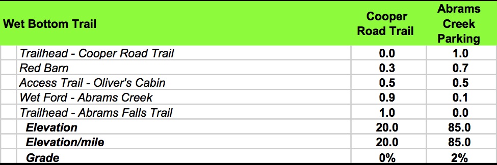
Miles: 1.0 miles Elevation Gain: 20 ft.↑ Elev./Mi: 20 Grade: 0%
Difficulty: Class 1 Hiking Time: 0:20 Pace: 2.9 mph Avg. Temp.: 75


Wet Bottom Trail is aptly named as it passes across the Abrams Creek flood plain. It is a connector between Cooper Road Trail and the intersections with Rabbit Creek and Abrams Falls trails. Due to prevalent horse traffic in the summer months, the trail can be rather muddy in rainy times. But if you catch it on a dry day, it is a pleasant alternative to hiking the Cades Cove Loop road. For 900 milers, it is best to integrate this trail with several loop options, principally the Cooper Road to Hatcher Mountain to Abrams Falls loop; enabling you to park either at the Abrams Falls Parking area or at the small parking area at the trailhead for Cooper Road Trail
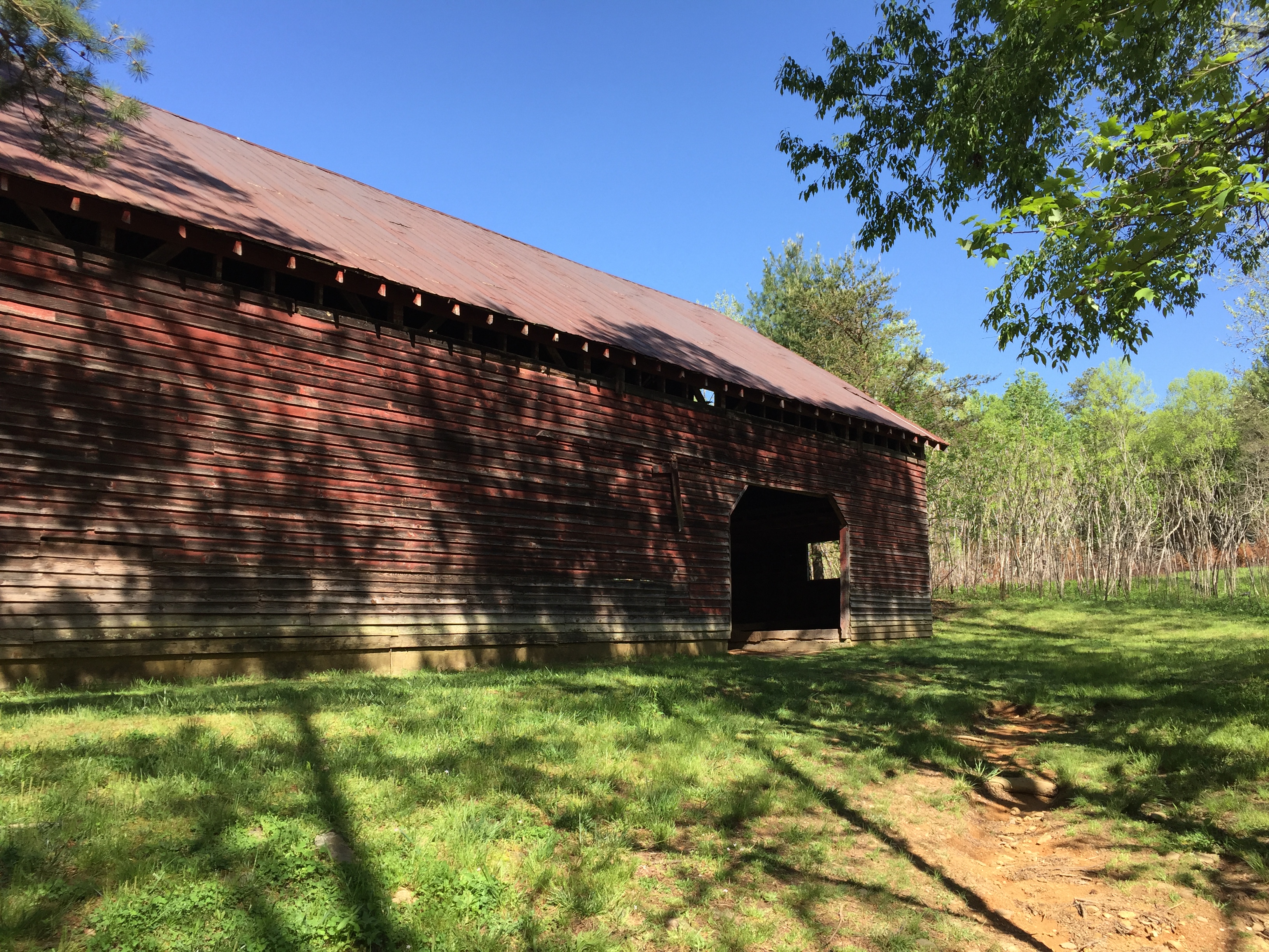
 Wet Bottom starts at the intersection on Cooper Road Trail. It descends ever so slightly through a recent controlled burn area and meets up with Abrams Creek. At. 0.2 miles, you pass a red barn built by John Oliver in the early 1900’s. At 0.5 miles the trail intersects with a side trail to the John Oliver Cabin. Finally, at 0.9 miles you reach Abrams Creek. You can ford the creek or you can choose to take the parallel trail to the connector from Abrams Falls trailhead to Oliver’s Cabin. Keeping your feet dry may be a wise goal but if you continue on to Rabbit Creek Trail, your efforts are in vain. Wet Bottom ends at the Abrams Falls Trail parking area, which also serves as the trailhead for Rabbit Creek Trail.

Data Book: