
Date: 02.26.2016
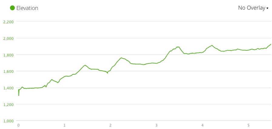
Miles: 4.2 miles Elevation Gain: 551↑ Elev./Mi: 131 Grade: 2%
Difficulty: Class 1 Hiking Time: 1:29 Pace: 2.8 mph Avg. Temp.: 55
Section: Cades Cove

 Abrams Falls Trail is a marquee trail of the Great Smoky Mountain National Park. It is very approachable for most any hiker and it features Abrams Falls, which is one of the most spectacular sights in the Smokies. The trailhead is at a parking area off Cades Cove Loop Road. The Brown Guidebook states that Abrams Falls was named for Cherokee Chief Abram. There are no campsites on Abrams Falls Trail and there are no substantial water crossings.
Abrams Creek at Hannah Mountain Trail
Most hikers will take this trail from the trailhead at the parking area and return as an out-and-back. But there are a couple loop opportunities that add depth and variety to the hike that are well worth considering. This particular hike was documented in a loop hike that started at the Cooper Road trailhead just before the parking area for Abrams Falls. This loop went from Cooper Road Trail to Hatcher Mountain Trail to the far end of Abrams Falls Trail which is how this hike is documented. Another great loop is to take Abrams Falls to Hannah Mountain (fording Abrams Creek) to Rabbit Creek and back up to the Abrams Falls trailhead. Note that the ford at Abrams Creek is normally passable in knee deep current but in times of high flow and swift current, the ford is too dangerous to consider.
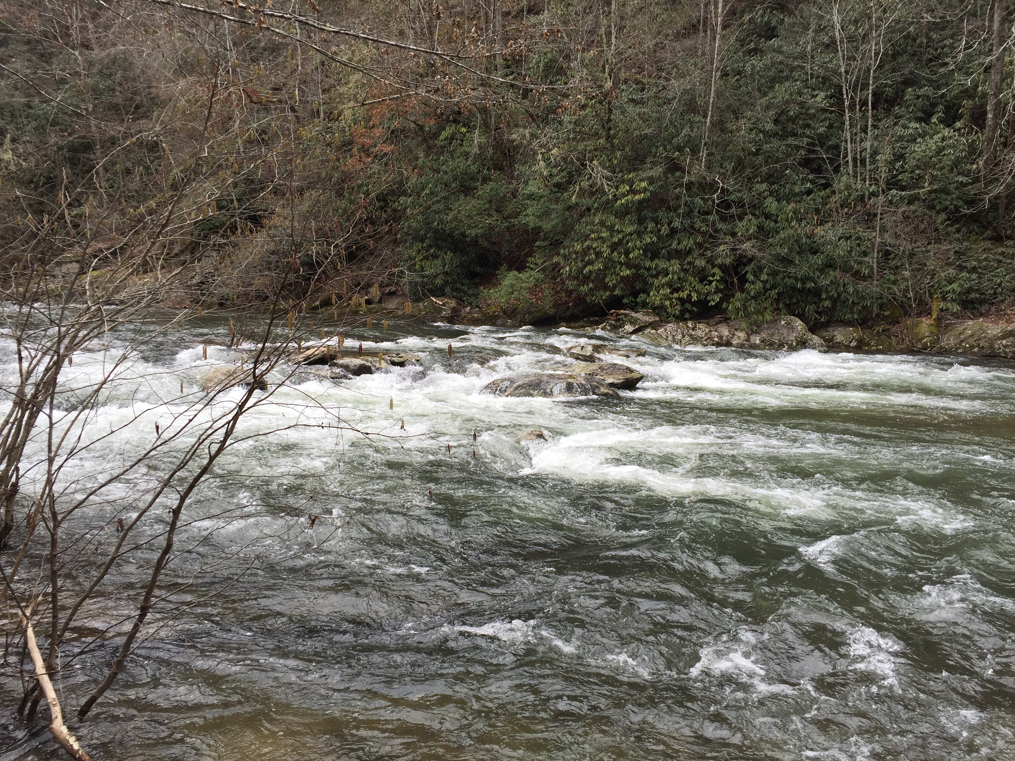
 The end of Abrams Falls is at the junction with Hatcher Mountain Trail and Hannah Mountain Trail at a beautiful place on Abrams Creek where you must ford the Creek to continue on Hannah Mountain Trail. The trail starts out pretty level and continues for a half mile until it begins a gentle rise in elevation. The trail follows Abrams Creek all the way to the falls proving company and a symphony of river music. At about 0.8 miles there is a small creek crossing. As you reach 1.3 miles, the trail moves away from the Creek causing the sound of the river music to change keys as though a different movement of the symphony began. By this time the trail rises significantly above the Creek with a great view of the cascades down below.
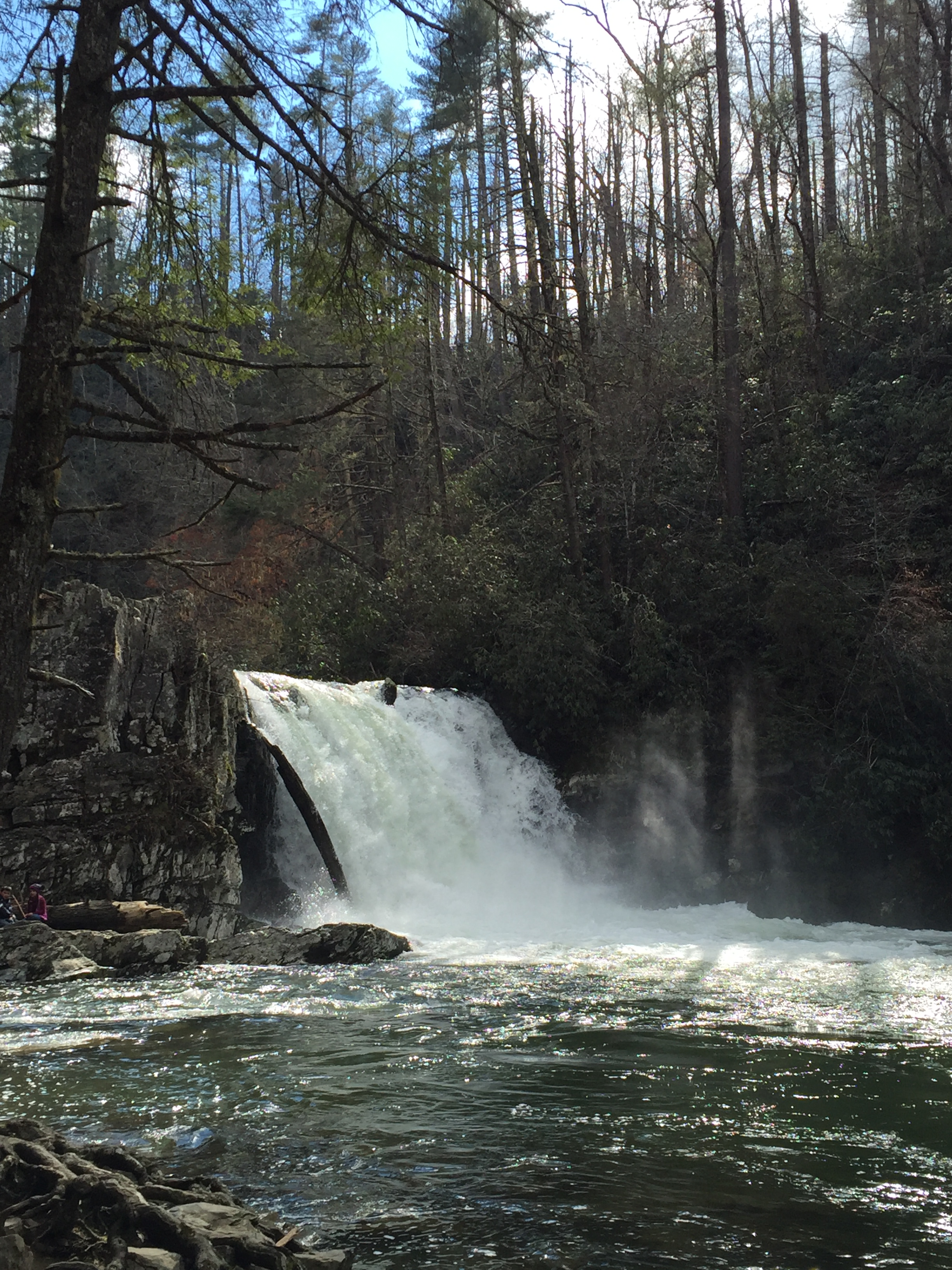
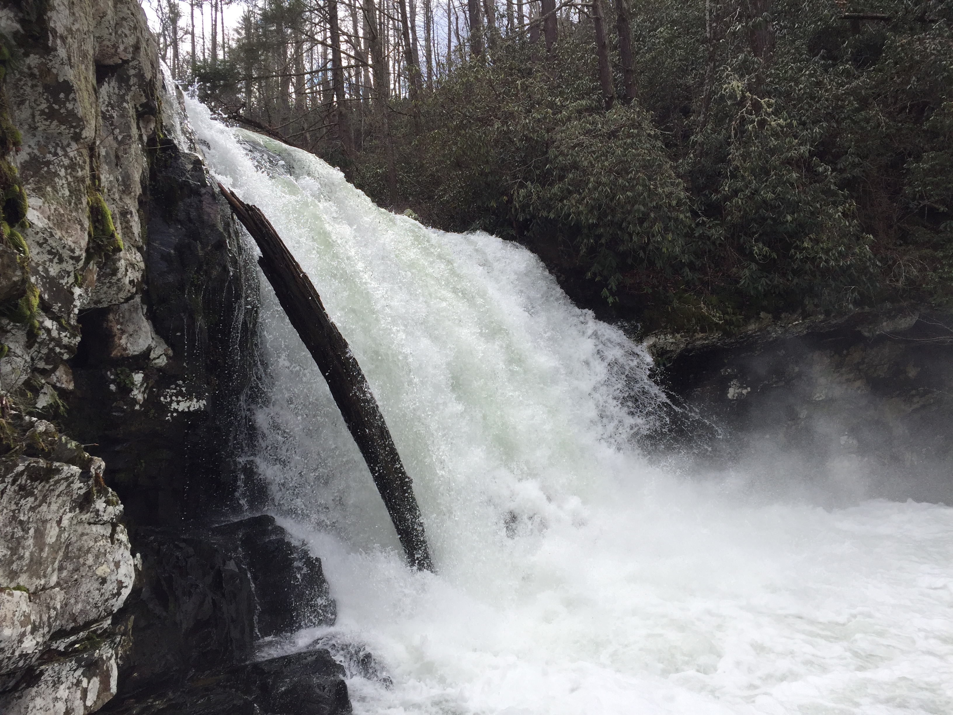
 At 1.5 miles, the falls come into view through the wintertime foliage. At 1.7 miles, you cross the foot bridge, which is a door of sorts to the inner sanctuary that is Abrams Falls. This particular day, the Falls is flowing more than normal due to heavy rains in the past few days. There are few visitors here giving a little solitude to the experience. On a summer weekend, you will encounter dozens of visitors, many of which will risk a dip in the pool that receives the Falls. I captured more of my personal experience in my entry for the loop hike.

After a good break, I continued up the trail toward the trail head. The elevation continues to rise gently and the trail widens. At 3.3 miles the trail starts to distance itself from the creek by veering away from the gorge. At 4.1 miles you reach the bridge that leads across Mill Creek to the Trailhead just beyond.
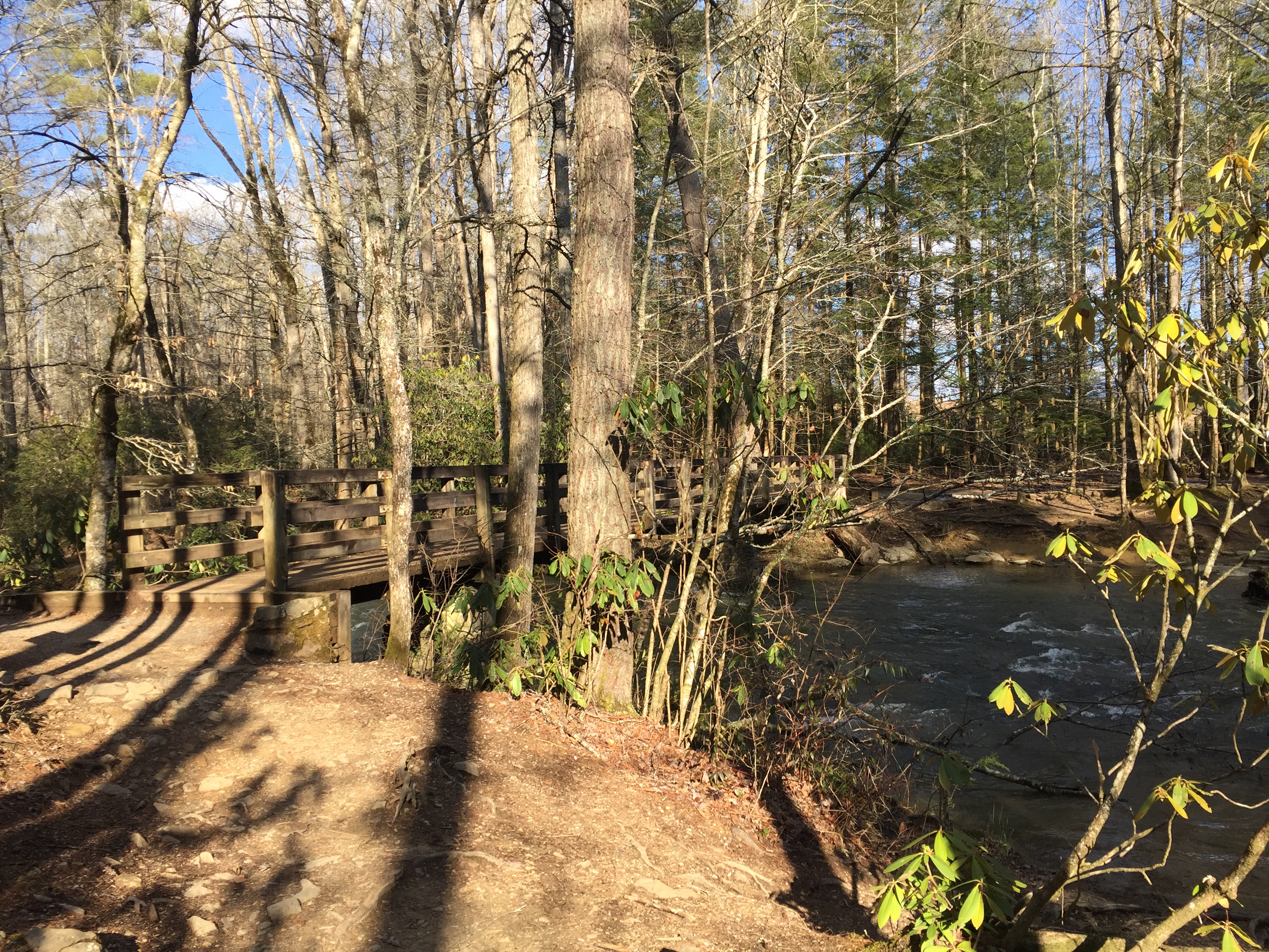
Bridge at the trailhead


Pingback: Abrams Falls Loop Hike | Hiking the Great Smoky Mountain National Park