Boulevard Trail
Miles: 8.8 Elevation: 3724 ↑ Grade: 8%
Hiking Time: 3:15 Pace: 2.8 mph Avg. Temp.: 60
Map Miles Completed: 8.8 Total Map Miles: 36.5 Total Miles Hiked: 36.5

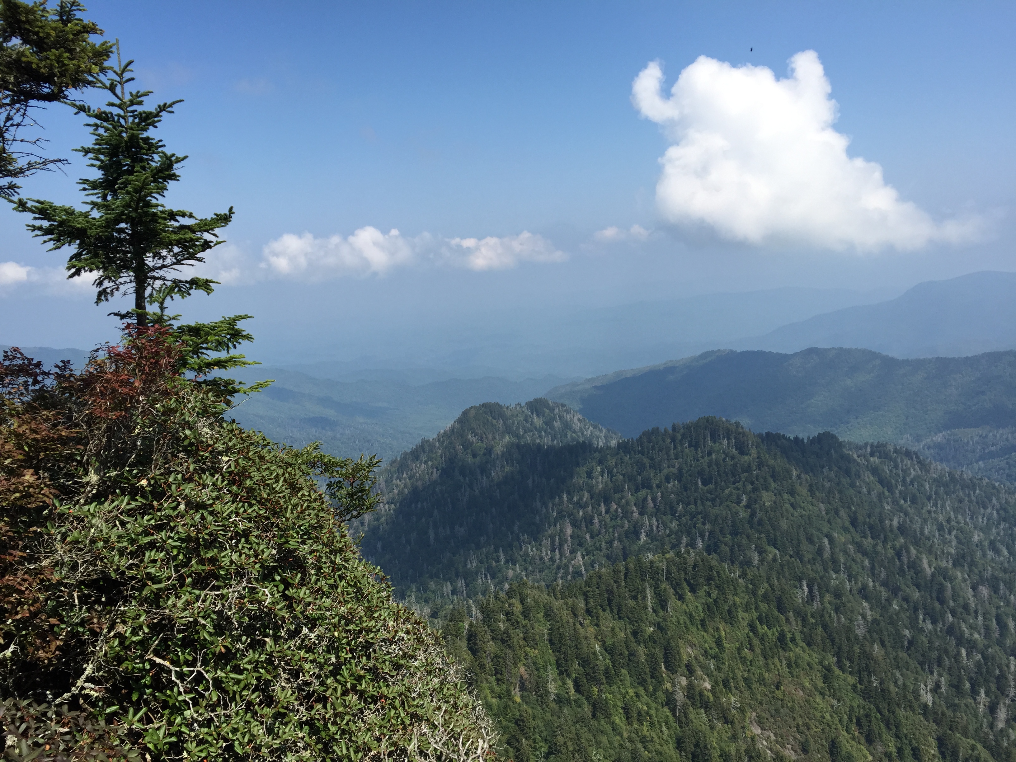
Newfound Gap at the beginning of the end
9:00 is a better start time than midnight. man i’m freezing. it’s not that cold but i’m shivering. pull out the fleece. it’ll come off in 15 minutes but right now, i’m freezing. let’s get this picture over with and get moving. watch that guy in the broken down pickup truck. looks a little suspicious. oh, good, he’s leaving. so glad that truck cranked.
“Brian, you ready to go? I’d need to hit the head right quick.”
“Yep. I’m ready to warm up so let’s move.”
it’s amazing but I don’t feel that bad after hiking almost 30 miles. advil helped a lot. i should have eaten more dinner. it’s all good cause i have plenty of trail food.
Shawn: “Make sure to thank Tina for me. She really helped us out by shuttling us up here.”
Brian: “You bet. I think we made the right decision on the routing. It took a total of 30 minutes to transport, eat and load up for the next segment. Last time it took 1:45 to go around to Greenbriar.”
“We’re going to break 5:30 am all to pieces. Heck, we’re going to break 4:00. Do you think we can hit 3:30? That would take 3 hours off our time.”
“I feel pretty good right now. I think it’s a good chance we can. look, there’s the AT blaze.”
“It’ll take you all the way to Maine…”
“wow, pretty quick time to the Boulevard Trail. that was a fast 3 miles. crazy that the Jump Off is not on the official map. even more crazy that trails like the horse trail around Smokemont are. a mile of mud and horse poop. it’s just as well, there wouldn’t be much to see tonight.”
“We’re going down now. A lot! I’ve already climbed this elevation! I don;t want to do it again. Do you know how much we descend?”
“I think it’s about 1,000 overall. We head down until about 6 miles in. Then we have to climb back up to the ridge.”
gotta be really careful. legs are tired. every time i stumble, i head for the edge of the trail. Trees and rocks. my head. broken ankle. can’t see much. nice and cool though. the night is clear. thought there’d be more stars than this.
“There’s a sign.”
I think it’s for Myrtle Point. Yep that’s it…”
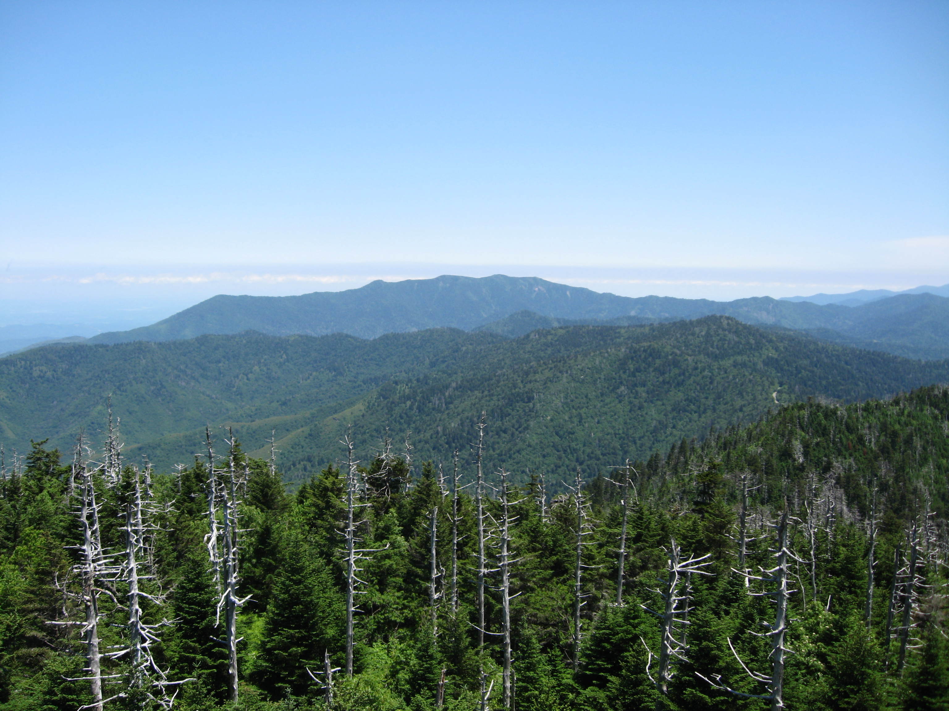
High Point is just ahead. I wonder if I can get a picture of it…”
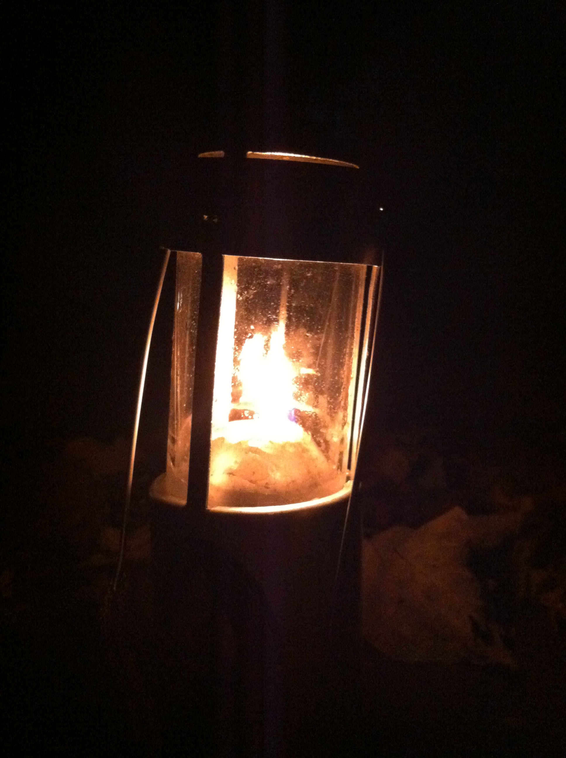
there’s the shelter, those guys we met at the Alum Cave trail said they were staying there. It’s midnight. we should wake them up and ask how far it is to Rainbow Falls. we should probably be quiet…

Rock Pile at High Point at midnight
Trillium Gap/Brushy Mtn. Trail
Miles: 9.1 Elevation: 4,564↓ Grade: 9.5%
Hiking Time: 3:50 Pace: 2.4 mph Avg. Temp.: 60
Map Miles Completed: 5.4 Total Map Miles: 41.9 Total Miles Hiked: 45.6
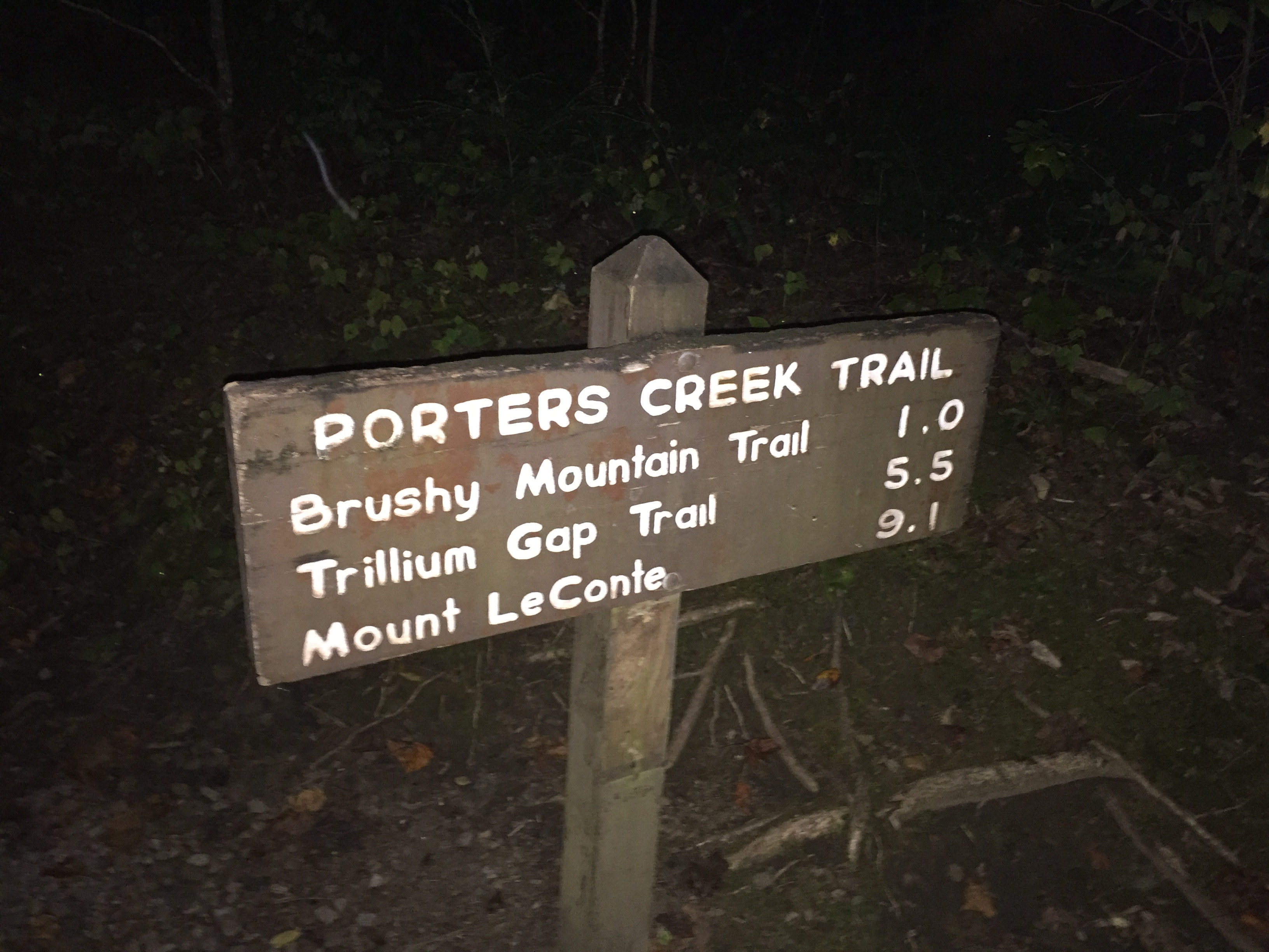
9.61 miles. i wish we could have figured out how to skip the Trillium Gap trail and just do the Brushy Mtn. trail. we’ve already done it anyway. i don’t know why we’re counting Brushy Mtn. anyway. technically, it doesn’t go all the way to the top.
“Hey Brian, did Dave Worth hike all 6 trails?”
“Yep.”
dang it! i guess we gotta do it. it’s not like we can hitch around it now at 1:00 in the morning. 9.78 miles. man, we’re going slow. i’m not sure having this GPS watch is such a great thing. i keep looking down and we’ve only covered a tenth of a mile. maybe it’s better not to know. that way you’re surprised when you’re done. we finished Alum Cave sooner than i thought. 9.81 miles. that’s the fourth time the “low battery” warning came up. i don’t remember the rocks being so big the last time. how can they make the llamas walk on this stuff? 9.83 miles. CRAP! we’re going slow. my legs hurt. my butt hurts. EVERYTHING hurts. these big step things they put in the trail don’t help a bit. 9.98 miles. GREAT!
“10 miles in Brian. We’ve descended about 1,200 feet”
Low battery again.
“Hey Brian, my watch isn’t going to last much longer”
“Mine’s dead too. Hopefully it saved the data. Be a shame to lose the whole day.”
great! spend $300 on a fancy watch that can tell you how many steps you take and it can’t last a whole day.

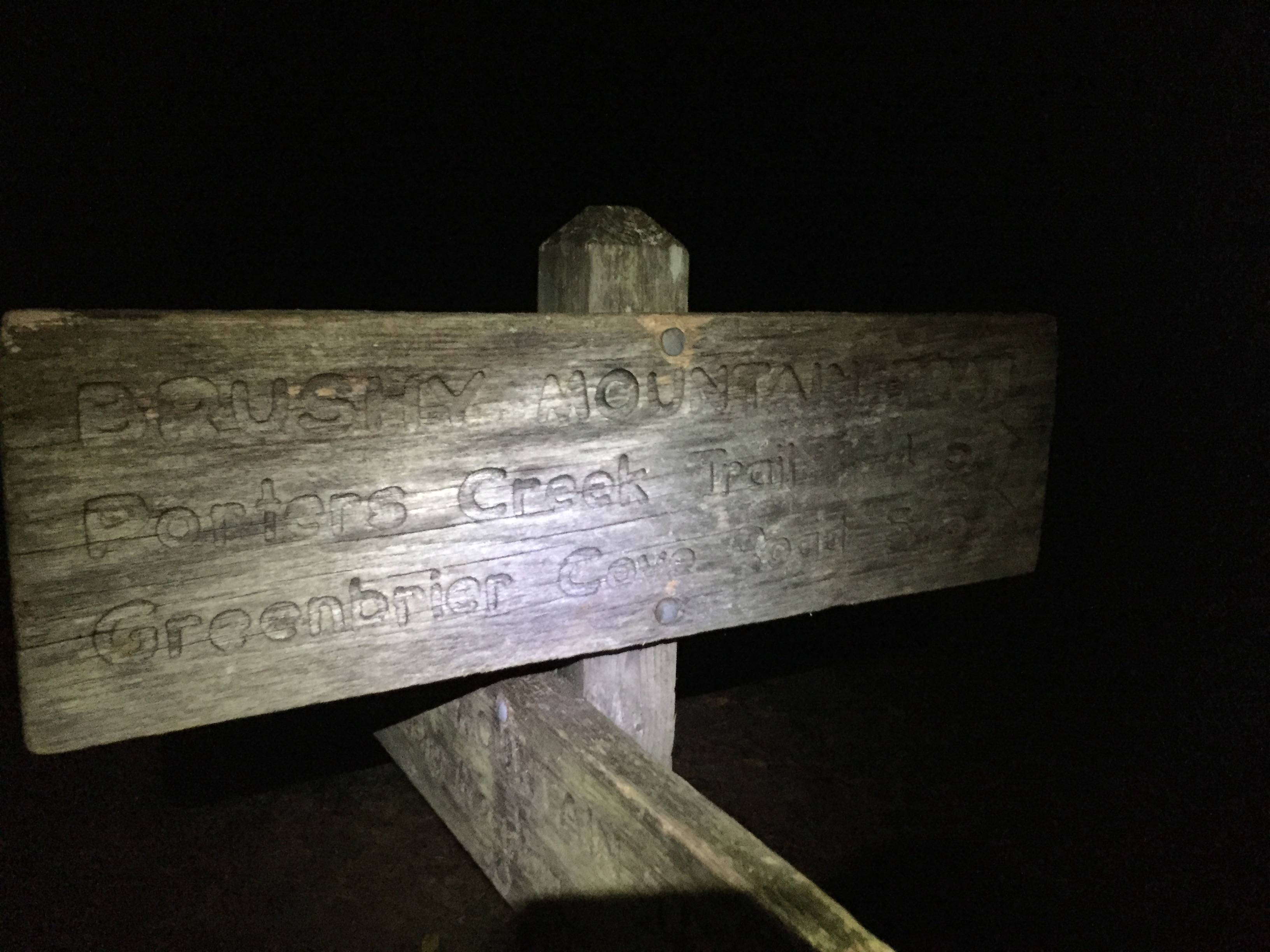
Brushy Mtn. Trail Junction
FINALLY! Brushy Mt. trail. i love seeing those signs. 4.5 miles to Porters Creek. i can make this. i hope we’re done with the rocks. Brushy Mtn. trail is one of those old logging road beds right? i don’t remember.
Brian: “We did the right thing hiking the spur trail to the summit this afternoon. I’m so glad we don’t have to do it in the dark.
Me: “It, would have been pointless. We wouldn’t see much except the city lights would be cool”
the rocks are still here and now there’s overgrowth. at least there hasn’t been any blow downs to climb over. WAIT! don’t say that, we still have 4 miles to go. don’t kill the mojo! i thought the cicada’s or whatever these things are would be gone by now. i guess it’s better than dead quiet. i thought we would hear an owl or something. at least there’s no motorcycles in the distance. no bears today. wonder what happens if we hear that loud huffing sound. 12.6 miles.
“Hey Brian, 4 miles to go and we’ve descended about 2,200 feet.”
“It’s 4 miles to Porter’s Creek. We still have the gravel road. It’s another mile.”
“Are you sure??!!!
“I’m sure”
CRAPPPPP!!!! now i’m playing mind games on myself. 5 miles to go and it hurts every step.
“Brian, how are you feeling?”
“OK”
he’s lying. my whole body hurts. we’re both slowing down. i felt so good at Newfound Gap, even going uphill. should have eaten something but my stomach hurts. drink some water. 10.13 miles. “low battery” AGAIN! i gotta sit down a second. i’ll let Brian hike on ahead and i’ll catch up. i could fall asleep right now. just a little nap. it wouldn’t hurt our time that much. WHAT AM I SAYING???!!!! get up slacker. OOOOOO my legs hurt. great, Brian waited on me.
“Hey Brian. I’m dead!
“You mean you or your watch?”
“Both”
now what am i going to do? i can’t tell our progress. that’s it. it’s way better to know and keep looking. now all i can do is suffer. got nothing left to talk about. can’t see anything. those cricket things won’t shut up! my headlamp is a lot brighter than Brian’s. i should lead for a while but i need him to pace me now. i could count steps. no, that’s just stupid. i could pull out my phone and check the time but then i’d have to hold it. i could ask Brian to check the time, he’s got that belt pocket. nah, just grind it out. working through the pain sounded honorable at high school football practice but it just sounds stupid now. at least the trail’s finally smoothed out. it’s really flat here. we gotta be close to the road. there’s a switchback. switchbacks are good. change of direction. something’s different.
Brian: “It’s the gravel road”
Me: “Finally. Do you think we can pick up the pace?
Brian: “I don’t have much left.”
Me: “Me either. We’re almost there.”
i REALLY hope we were supposed to turn left. Brian seems sure. i should ask. no i trust him. i REALLY hope he’s right. maybe he’s almost delirious like me. are you crazy if you know you’re going crazy? wait, that’s a catch 22. i can’t be crazy because i’m thinking about being crazy. i wonder where the other end of this goes. what would we do if we turned the wrong way? nah, Brian knows. i should ask. no i trust him. I REALLY hope he’s right. we’re moving faster. that’s good. chocolate milk is waiting in the truck. cold chocolate milk. i REALLY love chocolate milk.
“There’s some sort of light ahead! Was there a street light at the trail head?”
“Don’t think so.”

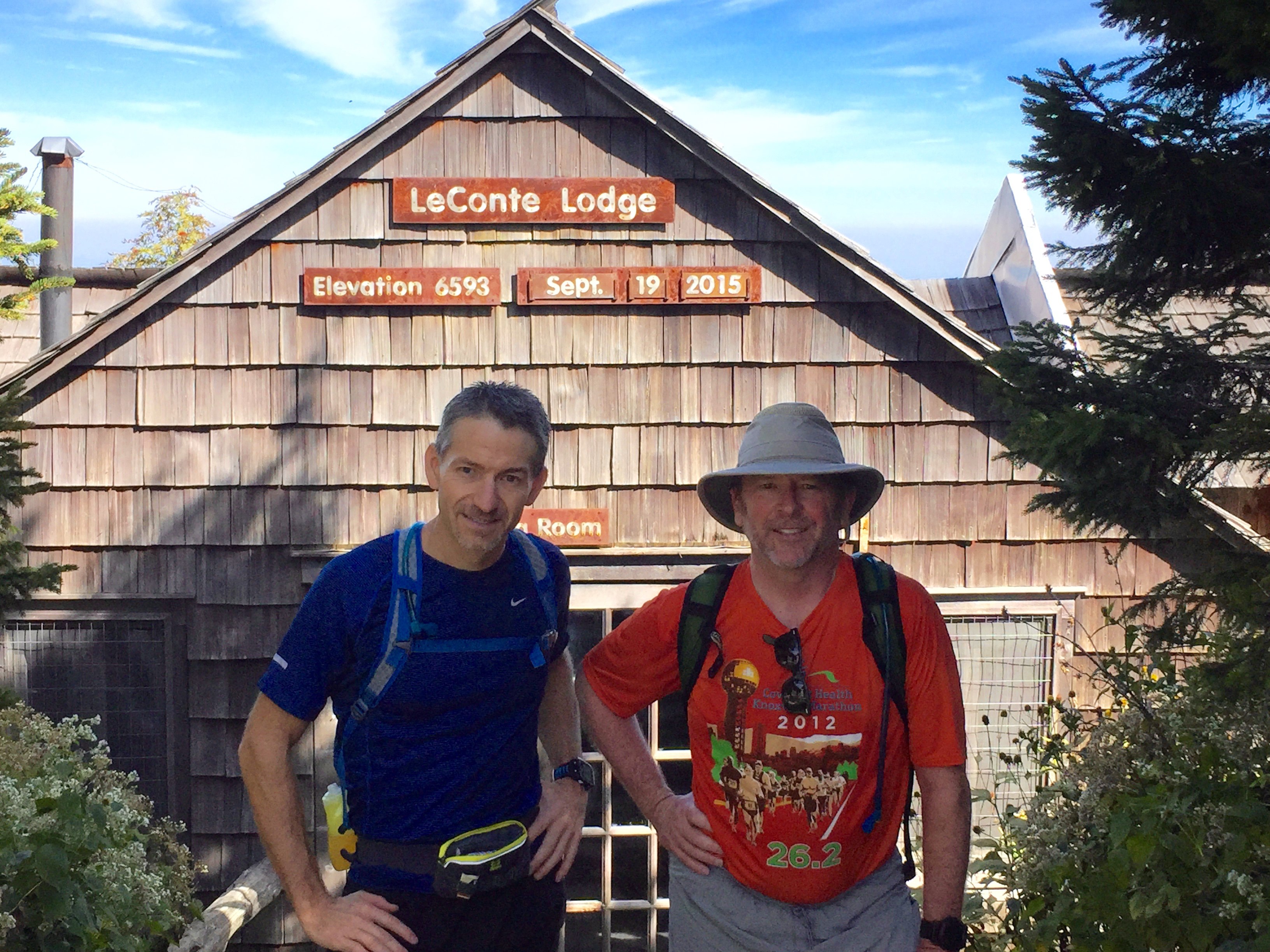
LeConte24 – 2015: THE END!
“Wait, it’s the reflectors on the gate. WE”RE DONE!!!”
“4:05 am. We cut an hour and a half off our planned time, which was two hours off our first time. 19 1/2 hours. Plus we added the Brushy Mtn. summit. WE DID IT!!!!”


 7.4 miles, the trailhead at Cosby Campground appears, ending an enjoyable hike on a well graded pathway.
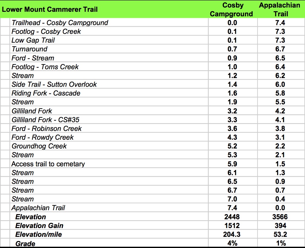
 Shalom…