
Date: October 18, 2025
Miles: 19.3 miles Elevation Gain: 2,482 ft. Elev./Mi: 129 Grade: 7%
Difficulty: Class 3.7 Hiking Time: 7:44 Pace: 24:07/mi. Avg. Temp.: 79
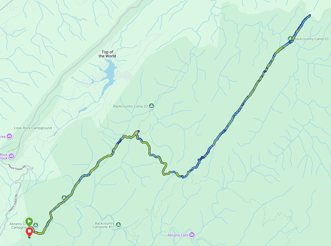
Trailhead: Abrams Creek
Trails: Cooper Road, Beard Cane

Out and back hikes are annoying. Especially when it’s a 19 miler and you hike the same 9.5 miles twice. Even more so when 5 of those miles were already hiked… twice. In the end, I hiked 19 miles to complete 4.2 map miles. And it won’t be the only time. Such is the part of the challenge. The 900 miler (which is really 800 miles) involves hiking much more than that.
Beard Cane trail doesn’t lend itself to a loop and there is no other trailhead convenient to cutting that mileage unless you park at the trailhead for the Goldmine Trail. That would take about 5 miles off the round trip.
I got an unusual late start. Usually I have everything packed up and planned the night before but today, I got up, had coffee and put together my day. I made it to the trailhead around 9:00 and met an old friend, Pete Nelson, from Boy Scouts who was taking a few of his scouts to Camp Site 17 for a bi monthly checkup/cleanup. The Campground was again, nearly full, this time with a couple scout troops in the mix.
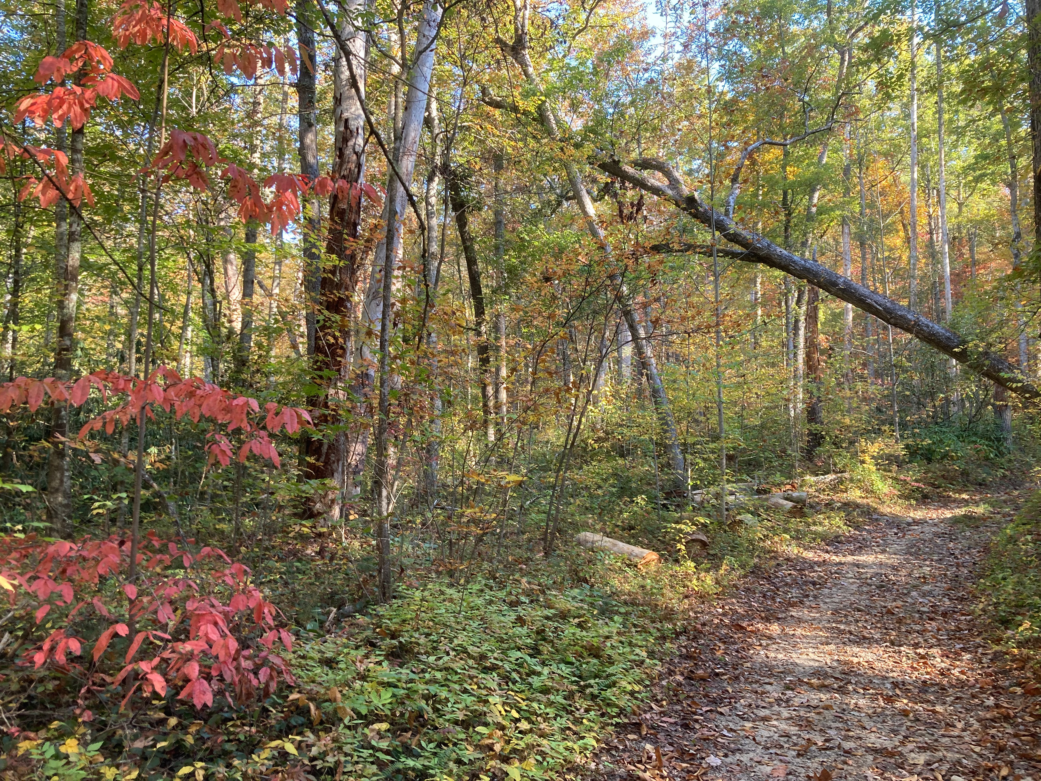
After a quick Four Corners prayer at the trailhead to Cooper Road Trail, I was off. The sun was up and the weather was great.As I passed by CS #2, there was a small group packing up. Not far after that I quite startled a couple hiking as I waited too long to scruff the trail letting them know I was there.
At 3.1 miles, the Gold Mine trail exits Northwest 0.8 miles to the Park Boundary at Top of The World.
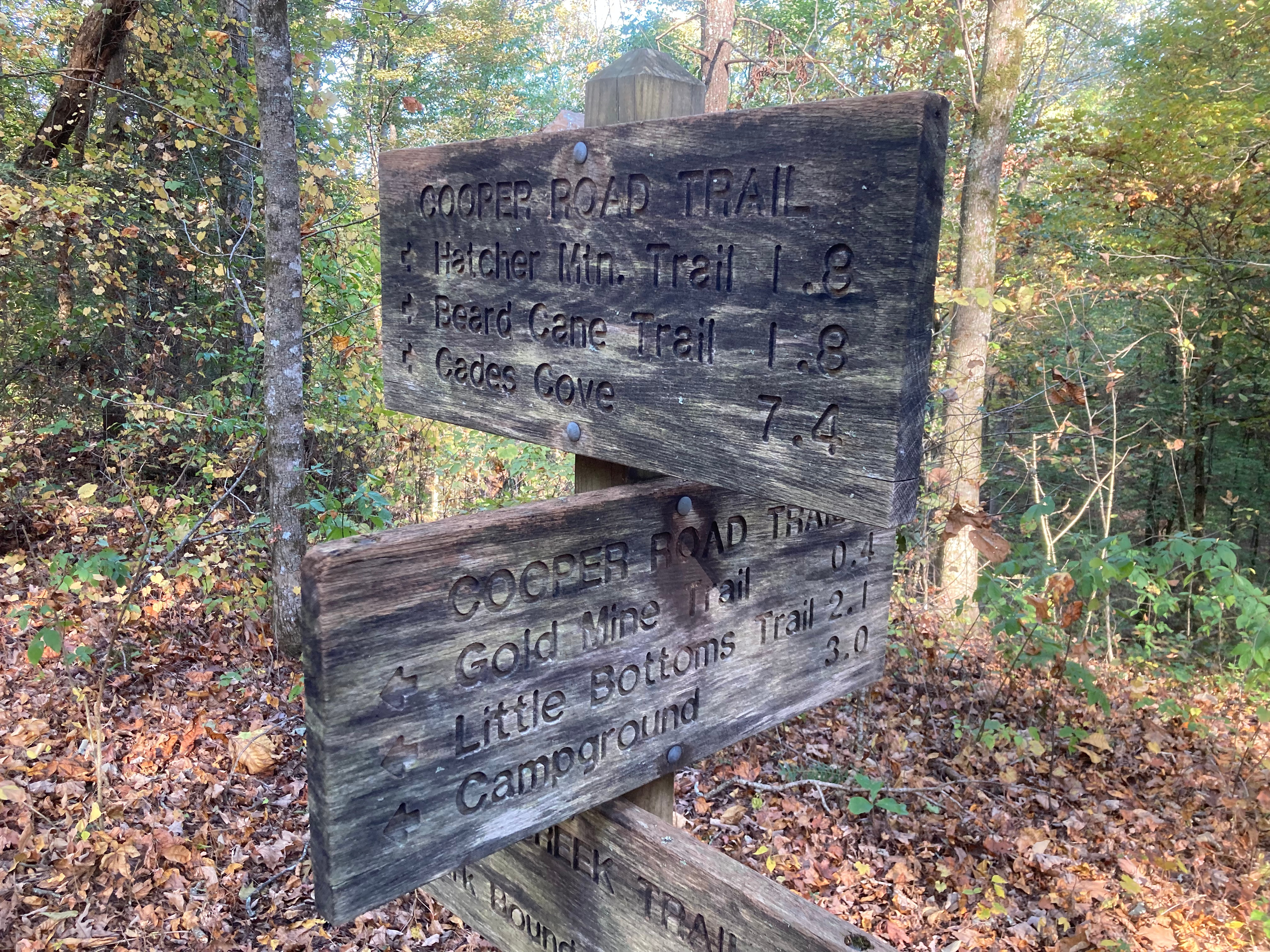
About a half mile down, is the intersection with the Cane Creek Trail which continues straight to the NNE. Cooper Road takes a hard right turn SW. The Beard Cane Trail is about 1.8 miles further down. The hiking is all on double track jeep roads, although they are closed to motor traffic. There is a steady climb but not strenuous at all. Once you leave the Abrams Creek area, water gets harder to find.
5.1 miles into the hike, is a major intersection. Hatcher Mountain Trail leads SSW about 2.6 miles to the Abrams Falls Trail. Cooper Road Trail continues east 5.5 miles to Cades Cove. I am turning left on Beard Cane Trail heading NE for 4.2 miles to Ace Gap.

Beard Cane Trail is fairly remote and so being, gets less maintenance than it’s more popular companions. In practical terms, that means over grown and blowdowns and Beard Cane did not fail to live up to that expectation. While none were particularly impassable, there we plenty leading me to add a point in the difficulty rating for barriers. Beard Cane Creek makes it presence know with very frequent crossings, none of which required fords and all of them were passable in the low water conditions of Late October by careful rock hopping.
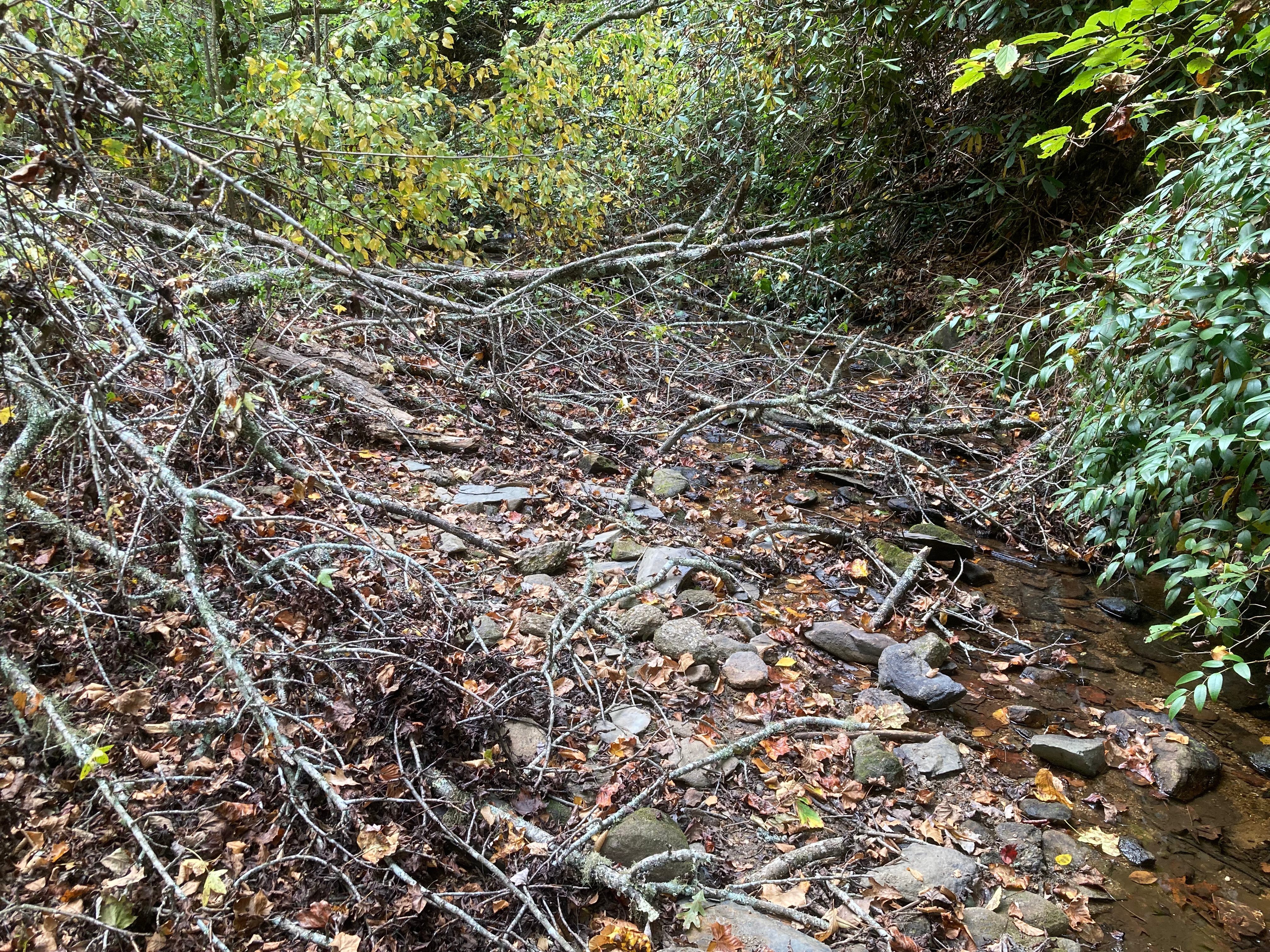

At 6 and a half miles in, the stream and the trail become one with about 3 yards of rock hoping. I imagine in the spring, this would be a wet crossing. At 8 miles there was a confluence of creek crossing with blowdowns.
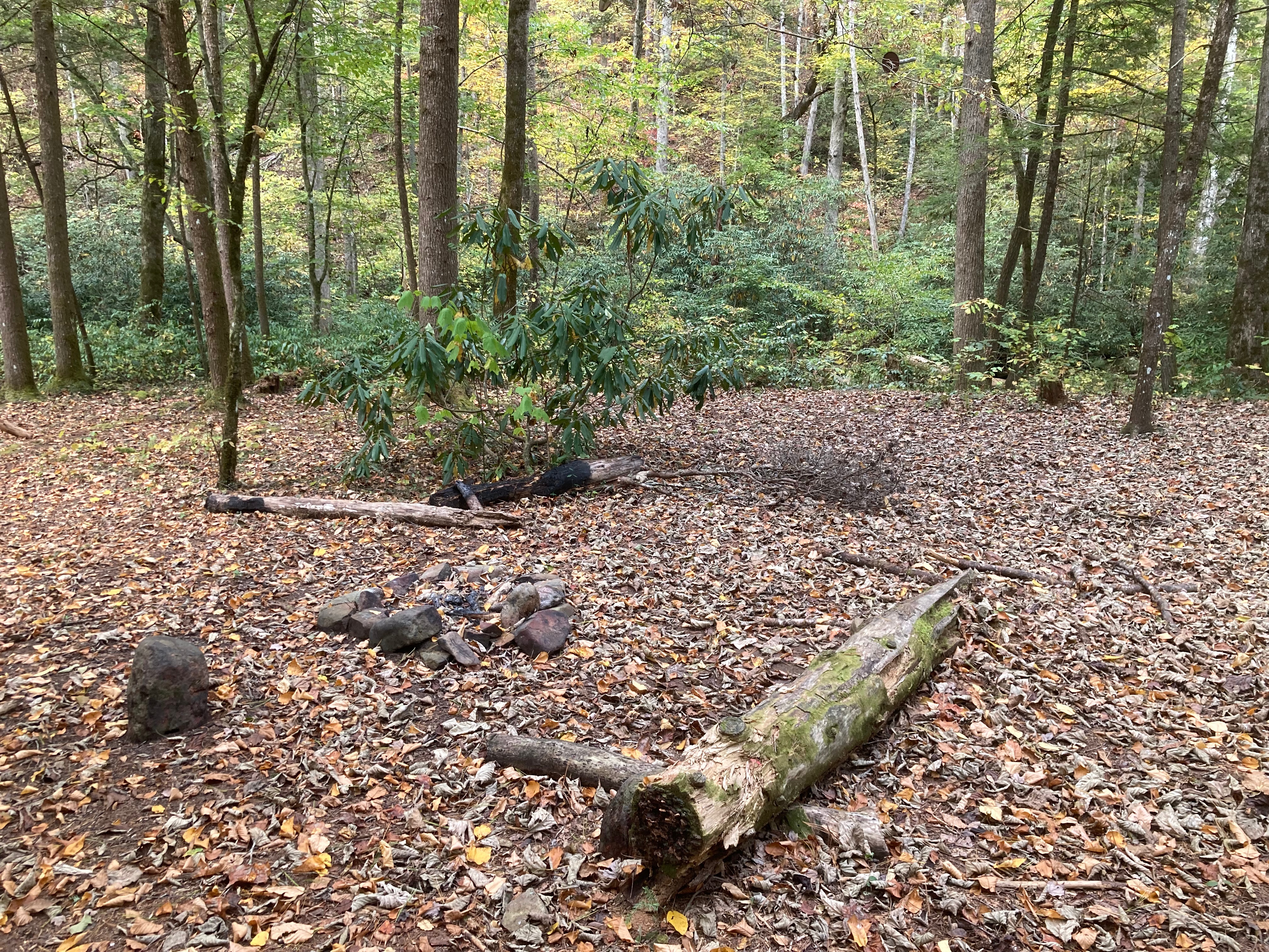
The last mile and a half of Beard Cane Trail flattens out and the hiking is more pleasurable. CS #3 is at 8.7 miles in. There are the usiual amenities, fire ring, bear cables. There are nice covered flat spaces for a few tents and the water is the creek behind the campsite.
Just past the campsite, the trail steepens substantially. It gains about 392 feet in .6 miles which would be about 660 ft./mile. A good steady climb.
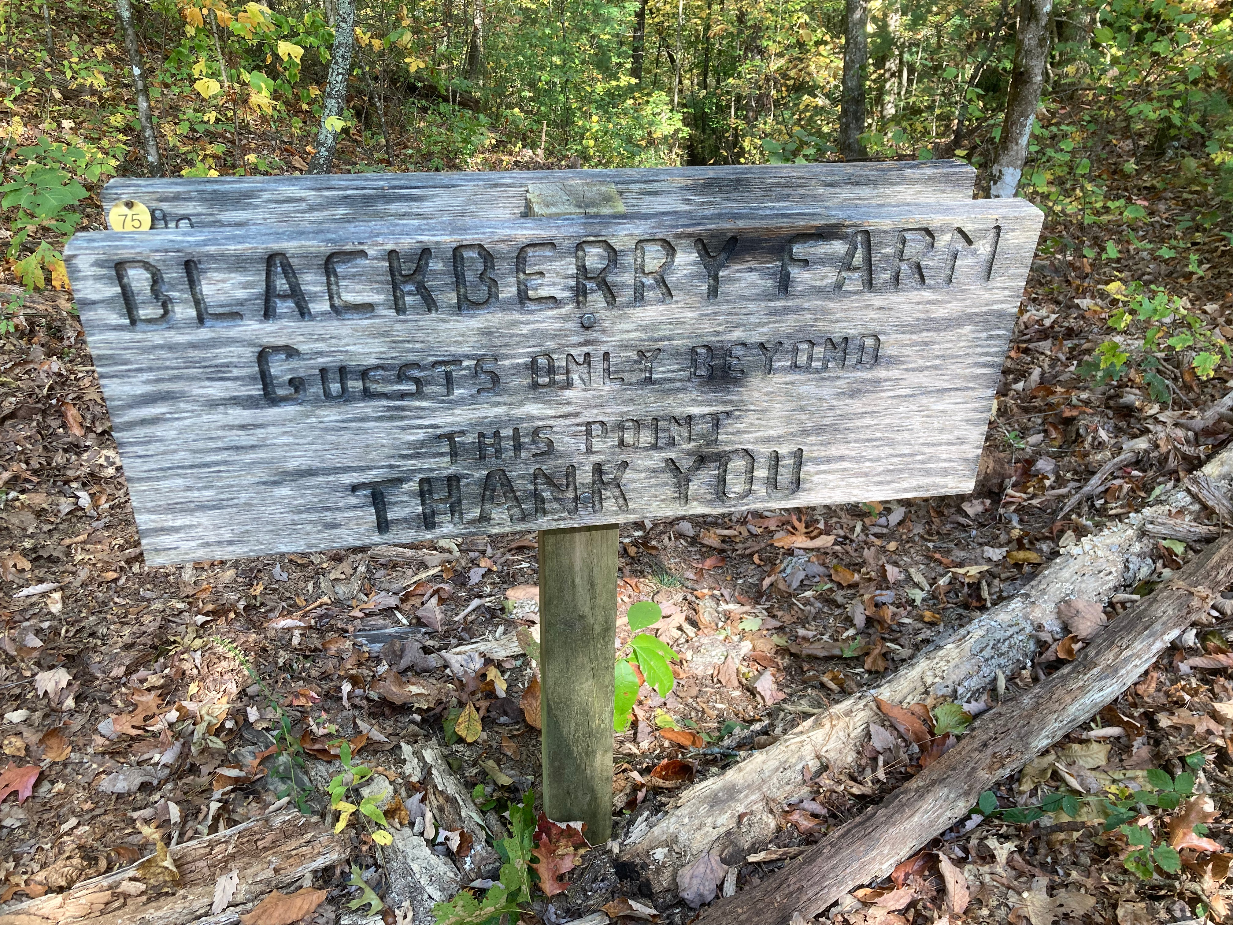
At 9.6 miles into the hike, I arrived at Ace Gap, where the Ace Gap Trail leads SE 5.6 miles to Rich Mountain Road. This intersection is at the park boundary with a substantial sign indicating that and saying the property ahead is that of Blackberry Farm and only open to its guests.
The is a trail leading NW with a sign for Blair Gap Trail leading 0.8 miles to the Boundary Trail. Neither of these are on any maps, paper or digital that I have but it raises the possibility perhaps of a short cut over to Cane Creek Trail. A little googling reveals Blair Gap Trail is an unmaintained trail along the park boundary from the CCC days, as well as the Boundary Trail. For the brave bushwacker, there may be a line leading to Cane Creek trail.

So all that’s left is to repeat what I just did in reverse. 4.1 hours in. Probably another 4 hours back, but it’s mostly down hill. The biggest task I had in the return is to locate CS #11. I missed it on the way in. Alas, I failed to find it on the way back. It is still listed among the backcountry campsites for the park but there must have been some blowdown obscuring the site.
I made it back to finish 19.3 miles in 7:44. A long day but not too bad, given the help of vitamin I and some Tylenol.
Difficulty Rating:
Length: 5 Elevation: 2 Barriers: 3 Average: 3.7
