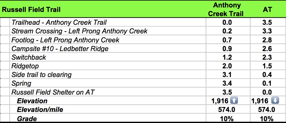
Date: May 26, 2016
Miles: 3.5 miles Elevation Gain: 1,916↑ Elev./Mi: 574 Grade: 10%
Difficulty: Class 5 Hiking Time: 1:26 Pace: 2.8 mph Avg. Temp.: 65
Section: Cades Cove


 Russell Field Trail is a connector trail from Anthony Creek Trail to the AT at Russell Field Shelter. It provides a direct link to Cades Cove from the AT. The trailhead is at 1.6 miles up Anthony Creek Trail from the Cades Cove Picnic Area. The intersection is just pat where Anthony Creek and Left Prong Anthony Creek merge at a fork to form the headwaters of Abrams Creek. At 0.25 miles is a crossing of Left Prong Anthony Creek. The trail climbs steadily on single track and follows the Loft Prong to 0.7 miles at a creek crossing on a footlog, then another rock hopper at 0.8 miles. Campsite #10, Leadbetter Ridge appears at 0.9 miles. The

Campsite #10
site is just off the trail with quite a bit of impact. On this day there was much litter left around the campfire. The grade increases past the campsite through mixed hardwoods and hemlocks, some of which are old growth stands of trees. AT 1.2 miles is a switchback turing into rhododendron. The trail has left the company of Left Prong by this time and opens up a bit with views of Rich Mountain across Cades Cove. AT 1.4 miles, the trail grade really increases as it become more rocky. At 1.9 miles more views appear through the trees into the Cove. At 2.0 miles you reach the top of a rolling ridge with plenty of laurel and rhododendron which blooms beautifully in early June. At 2.4 miles, you are still on the top of the ridge but the climbing resumes. At 2.7 miles you pass through mixed hardwood with very little undergrowth and open. The rhododendron returns at 3.0 miles. AT 3.1
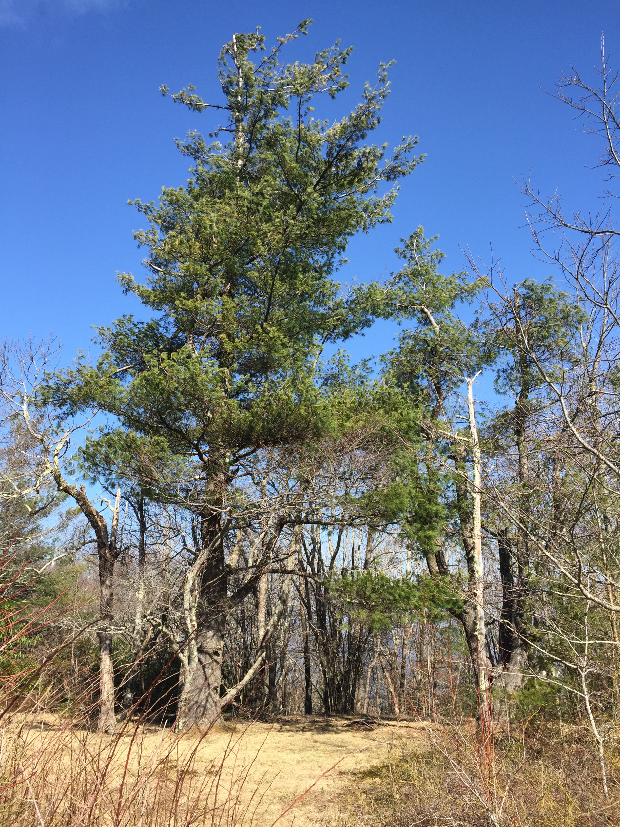
Pine Tree Sentinel In Clearing Near Spence Field
miles, there is a side trail leading to a clearing where there is evidence of previous unofficial camping. There is a majestic pine tree serving as a sentinel over this lovely space and it is easy to understand why humans would want to spend time here. The trail continues fairly level for the last several hundred yards to Russell Field Shelter. You rock hop a spring at 3.4 miles, which is the water source for the Shelter and at 3.5 miles, Russell Field Trail ends on the AT.
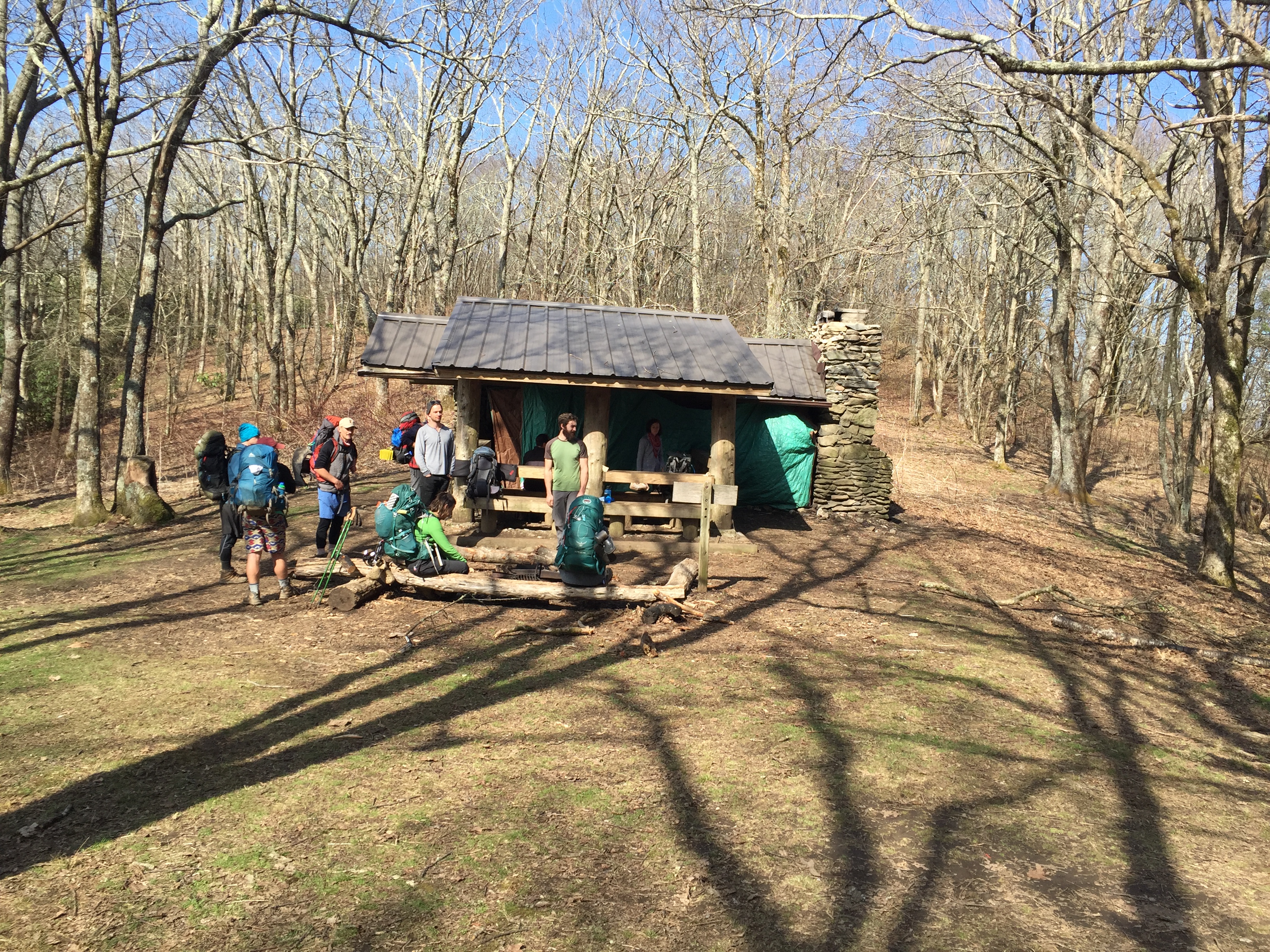
Russell Field Shelter

Rhododendron Tunnel on Russell Field Trail
Data Book: