Date: February 23, 2018
Miles: 17.2 miles Elevation Gain: 4029 ft. Elev./Mi: 363 Grade: 7%
Difficulty: Class 3 Hiking Time: 7:52 Pace: 2.8 mph Avg. Temp.: 76
 The forecast for Friday was 76 degrees, 10% chance of rain and 59% humidity. It was for FEBRUARY 23!!! I have no illusions that winter won’t try one more kick but this day was made for hiking and there were no meetings scheduled. I got a really late start, which for me is unusual. Normally I am on the road by 7:00 and on the trail no later than 9:00 but that day I slept in and hit Big Creek around 10:30. I really love the east side of the park. It is more remote and less visited. The big attraction for Big Creek is Midnight Hole for its swimming but there would be none of that in February. That said, the parking lot had about 15 cars despite the facilities being locked up tight. There was not even a trash can to be found.
The route for the day was Big Creek Trail to Swallow Fork Trail to Mount Sterling Ridge, Mount Sterling Trail to the tower and back down Baxter Creek. I chose that order because I figured the 4,00 ft climb would be easier spread over 11 mile than the 6.2 up Baxter Creek. I was right!
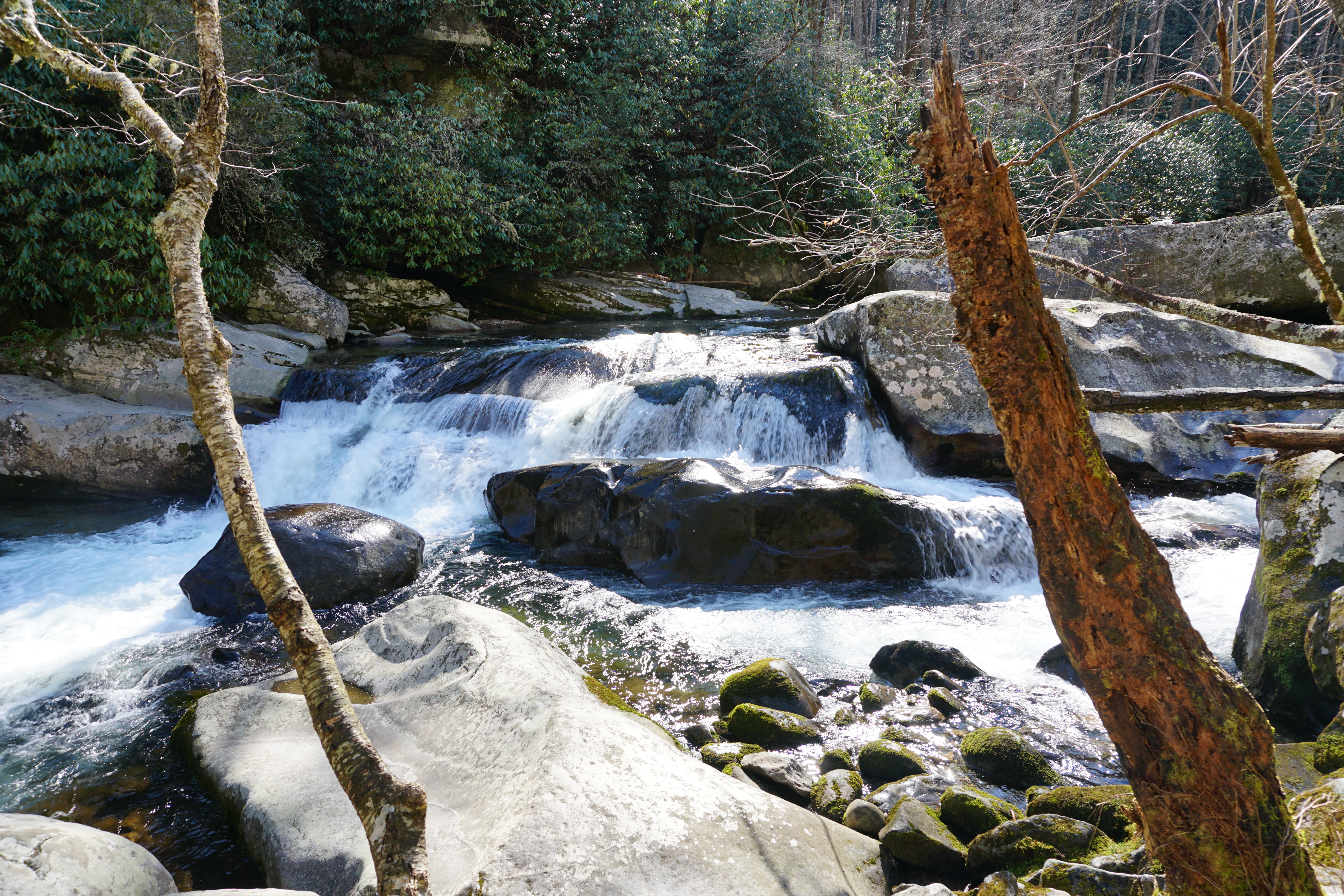
Cascade on Big Creek
Mouse Hole

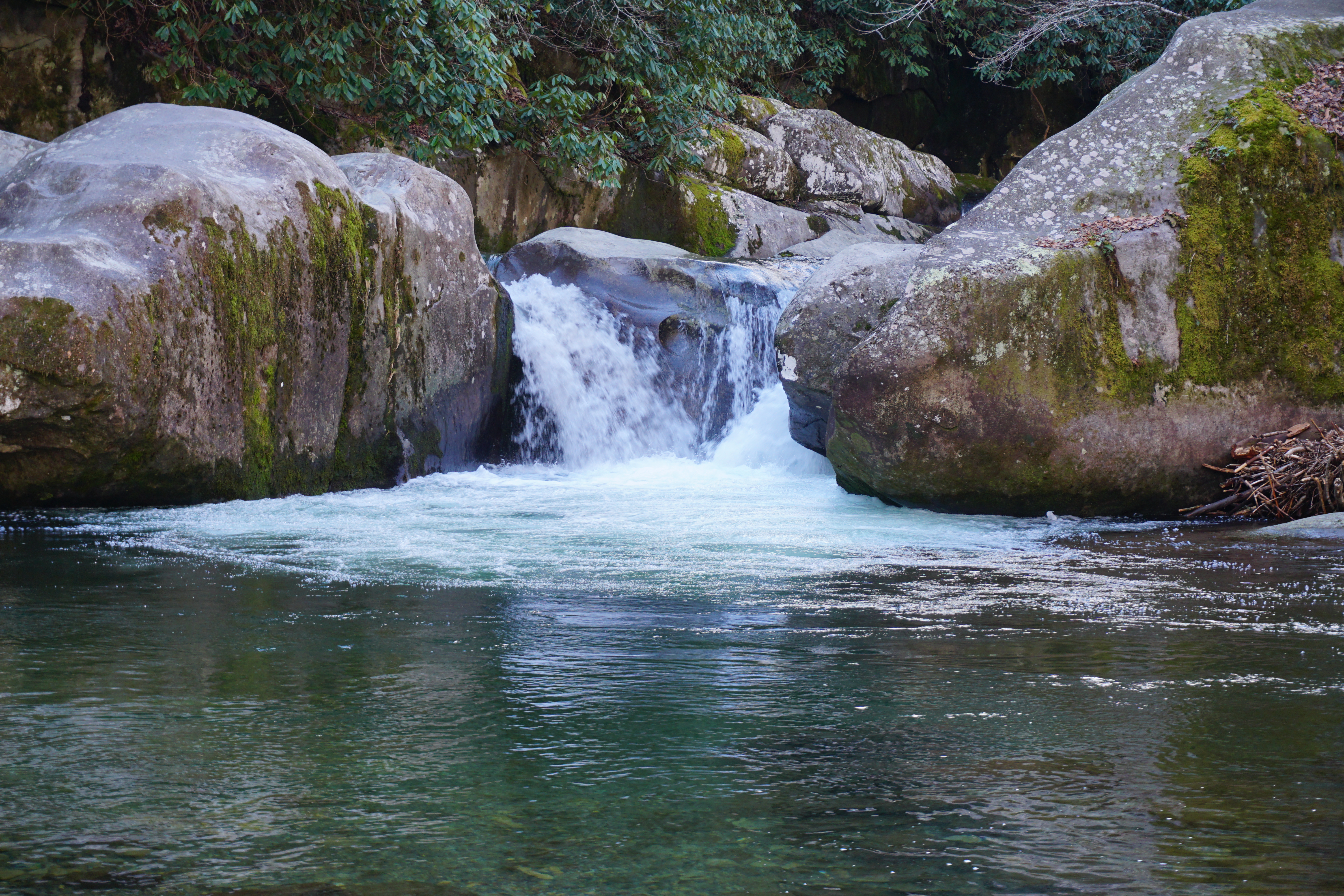
Mouse Creek Falls
The Big Creek Trail has to be one of my favorites. It follows its namesake all the way to Walnut Bottom, which is one of my favorite camping areas. The hiking is easy and the creek offers one who saunters its surprises and gifts. the trail is a wide gravel path its entire length and the 4.7% grade is quite friendly as ascents go in the Smokies. The views of the creek all along the path are spectacular. There are many opportunities to take in a cascade. Midnight Hole is at 1.4 miles. This is a popular swimming hole in the summer attracting visitors sporting swim suits and flip flops in sharp contrast to those in hiker garb. But Today, there were only a couple other hikers taking in the morning and I had Midnight Hole to my self for a few “peopleless” pictures. The lovely Mouse Creek falls is a mere half mile ahead and is a great place to pause and enjoy a concert of water music. The sun was high over the falls reflecting back a wash of white light but a couple suitable pictures were captured. Big Creek continues on another lovely 3.2 miles to Walnut Bottom and Campsite #37.
I have a really fond memory of a night spent in CS#37 back in July of 2016. As I drifted off to sleep, I awoke later in the night to this bright flashing of light coming through the tarp of my hammock fly. Wondering why there might be a vehicle this far up the trail spurred me to exit my cocoon and to my utter surprise and amazement, it turned out to be the synchronous fireflies the Smokies are world famous for. There were no crowds, no shuttles to Elkmont, no noisy people, no traffic. Just thousands of fireflies that somehow manage to blink in unison for several seconds before the rhythm breaks down. And then someone gets it going again and they all chime in. I wish the bands I have played in were this tight.
There is a wide bridge over the creek in Walnut Bottom. I enjoyed my lunch near the bridge down at the side of the creek.
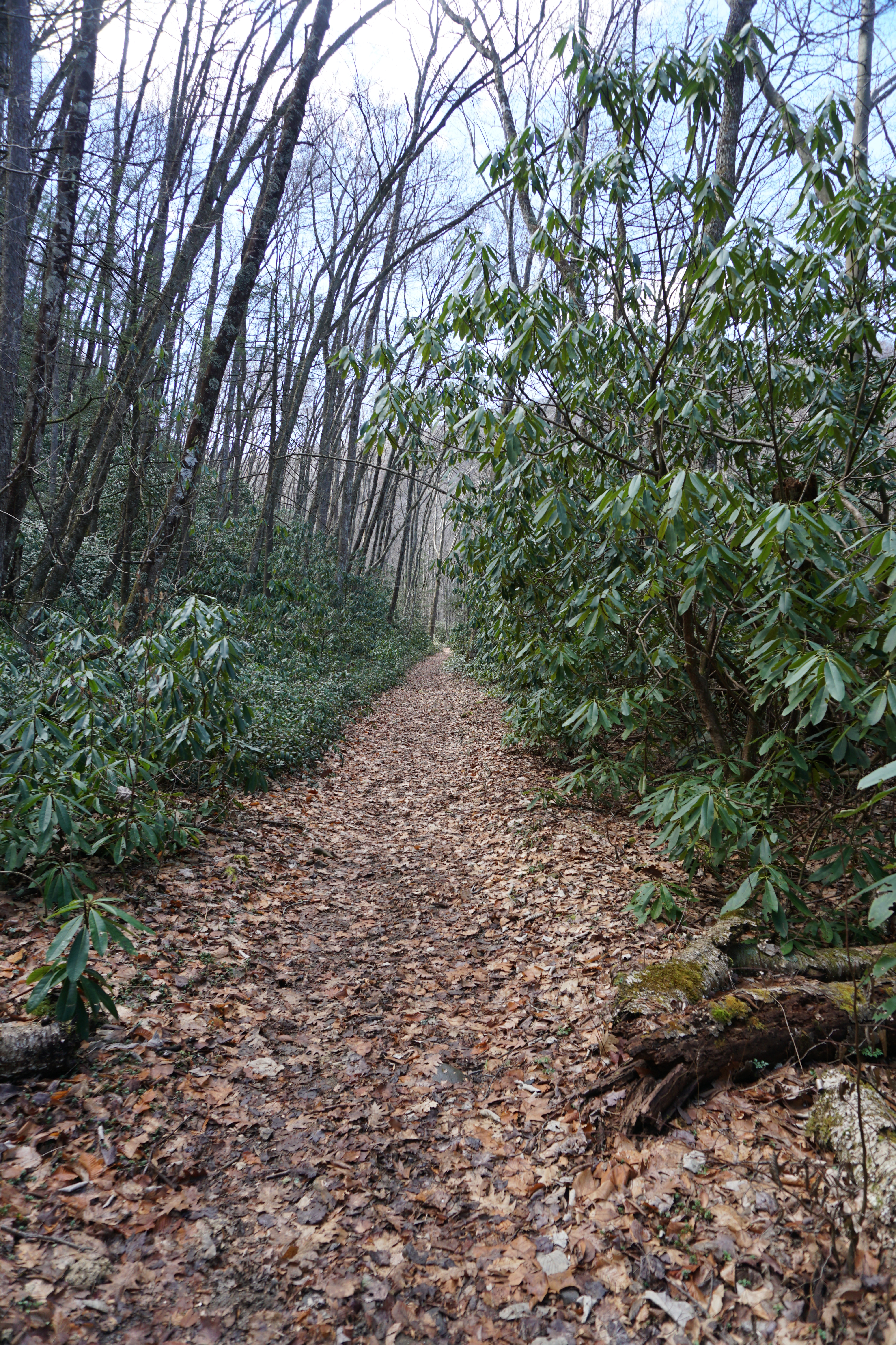 Swallow Fork Trail leaves Walnut Bottom and heads 4 miles up to Pretty Hollow Gap on the Mount Sterling Ridge Trail. The climb is no longer easy at this point gaining 2,200 feet in 4 miles at a 10% grade. There are 4 stream crossings starting with a footlog over Swallow Fork on the route, none of which involved a wet ford. The climbing is mostly steady. The trail is pretty brushy in places but clears up about a mile in becoming a nicely graded single track. There is much winter greenery including moss along the fallen trees and rhododendron. At around 2.7 miles, the climbing turns from steady to strenuous, which is a wake-up call for legs that have had a long winter off. The trail leaves the company of the Fork at about 3 miles and turns up the ridge. The stillness surrounds you with an occasional bridsong for entertainment as you continue the climb. At 4 miles, you enter Pretty Hollow Gap where I enjoyed a brief nap in the warm February Sun. The gap has some briar growth in the summer but there is still plenty of cool grass to stretch out upon for a welcome break after all the climbing.
The Mount Sterling Ridge Trail runs through Pretty Hollow Gap and my route turned left heading along the ridge to Sterling Mountain. The ridge is blessed with conifers along the top. The first 0.4 miles is uphill, then levels off for a half mile and then heads steady up to the Mount Sterling Trail. The route heads northeast a quarter mile to the tower and Campsite #38.
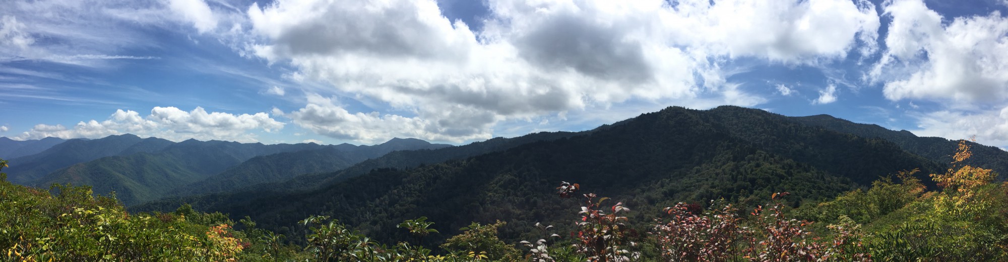
 Mt. Cammerer gets all the press for a great lookout view but Mount Sterling tower is a well kept secret. Surrounded by fairly dense Fraser fir trees, the site is also home to Campsite #38, which is another bucket list campsite I have yet to enjoy for a night. But I do plan to return soon. The view from the fire tower is spectacular, even better in my opinion than Mt. Cammerer and the reward is even greater knowing one has to earn the view. After many pictures from the tower and a good break and a stretch of the legs, It was time to find Baxter Creek Trail and head back to Big Creek.

View from Mount Sterling Tower
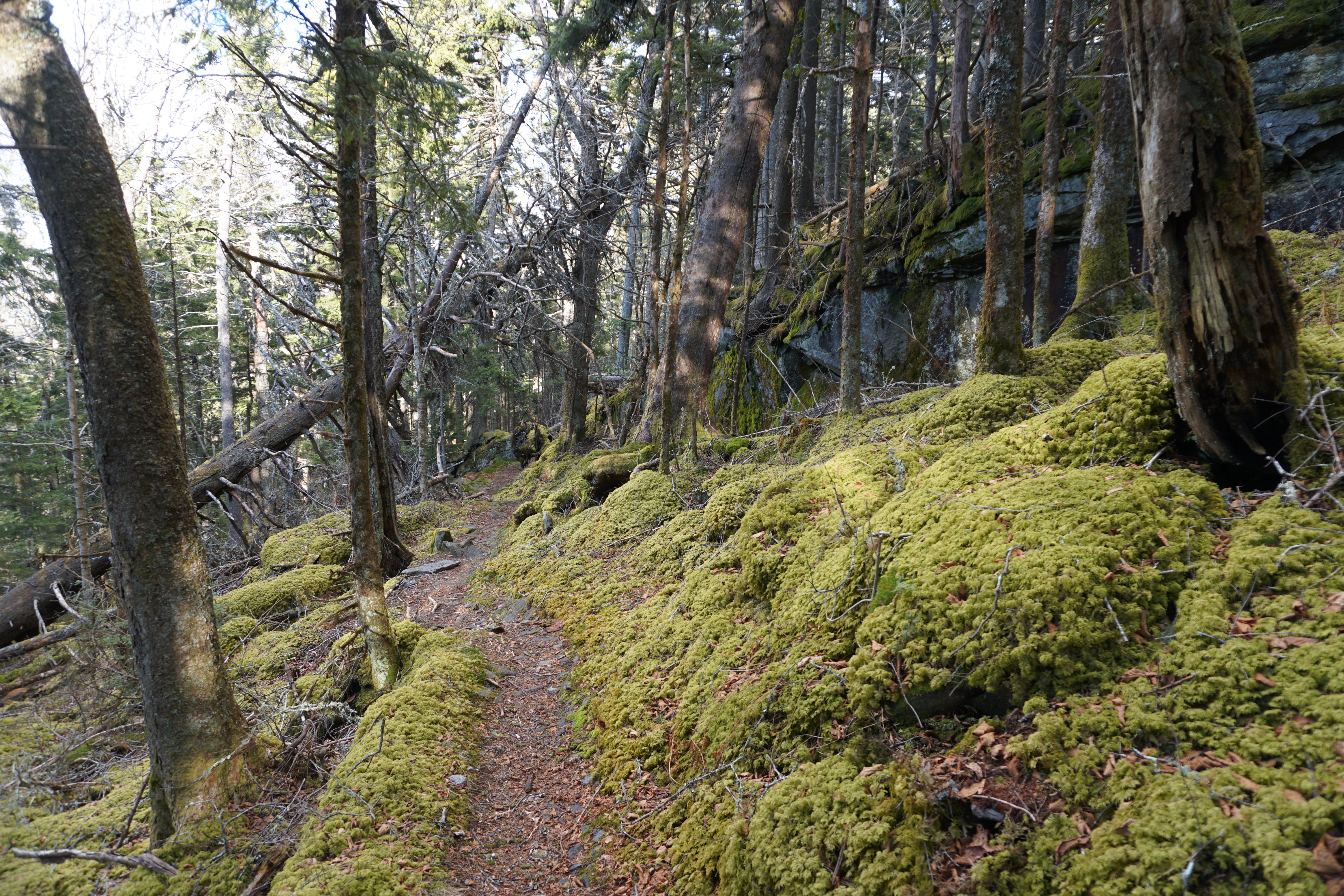
Middle Earth on Baxter Creek
The descent down Baxter Creek Trail is stark and wastes no time. The trail descends 4,000 feet over 6 miles for a 12% grade. Not the steepest but it is a steady 640 ft. per mile drop. After 11 miles of climbing, it is still a physical challenge heading downhill. The only charm of Baxter Creek Trail is the Middle Earth quality of the dense fir trees and the heavy green moss that carpets the ground. The water source for CS#37 is about a quarter mile down as the trail continues its descent. Fortunately, the trail is not very rugged. About a mile down, rhododendron show up but the conifers are still in firm control of the landscape. Along this section there are the standing skeletons of huge hemlocks that the Creator has not yet given permission to fall. Large conifers are the old men of the Smokies, keeping watch over the centuries and it is sad to see so many will fall in the next time but the cycle of life continues as the mos and new growth spring forth from the giants once they rest on the ground.
The conifers leave you by the time you are 2 1/2 miles down Baxter Creek Trail. With 57 years old knees, I find that steep downhills are less efficient than ascents. My rate is about 2.5 miles per hour and while the heart rate is less, the legs (knees) control the speed. There are few landmarks along the remainder save a switchback and a bend here and there. At 4.3 miles the sound of water music encourages you to pick up the pace toward the end. The descent levels a bit and the walking becomes more pleasurable. At this point, I noted that the most exciting aspect is watching the GPS count the mileage. About a quarter mile from the end, one can make out the pathway from the campsite across Big Creek until finally, the bridge comes into view and you cross over to the parking area.
It’s always good to get back to the car before dark although it was a bit too dark for a picture of the Creek from the bridge. But I’ll be back! It’s an hour drive back to Knoxville and burger at Aubry’s.

Strider Out!

Great hike! Big Creek is one of my favorites!