Author Archives: blogginggazelle

Maddron Bald Trail and Albright Grove Loop

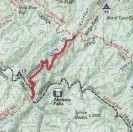
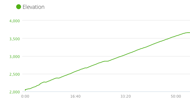
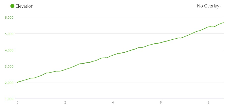
Miles: 7.2 miles           Elevation Gain:   3,762↑         Elev./Mi:   510        Grade:  10%          

Difficulty:  Class 5        Hiking Time: 3:51       Pace:  1.9  mph         Avg. Temp.:   35        

Total Hike:  15.1 miles            Total Hike Time: 7:32               Avg. Pace:   2.0 mi./hr.

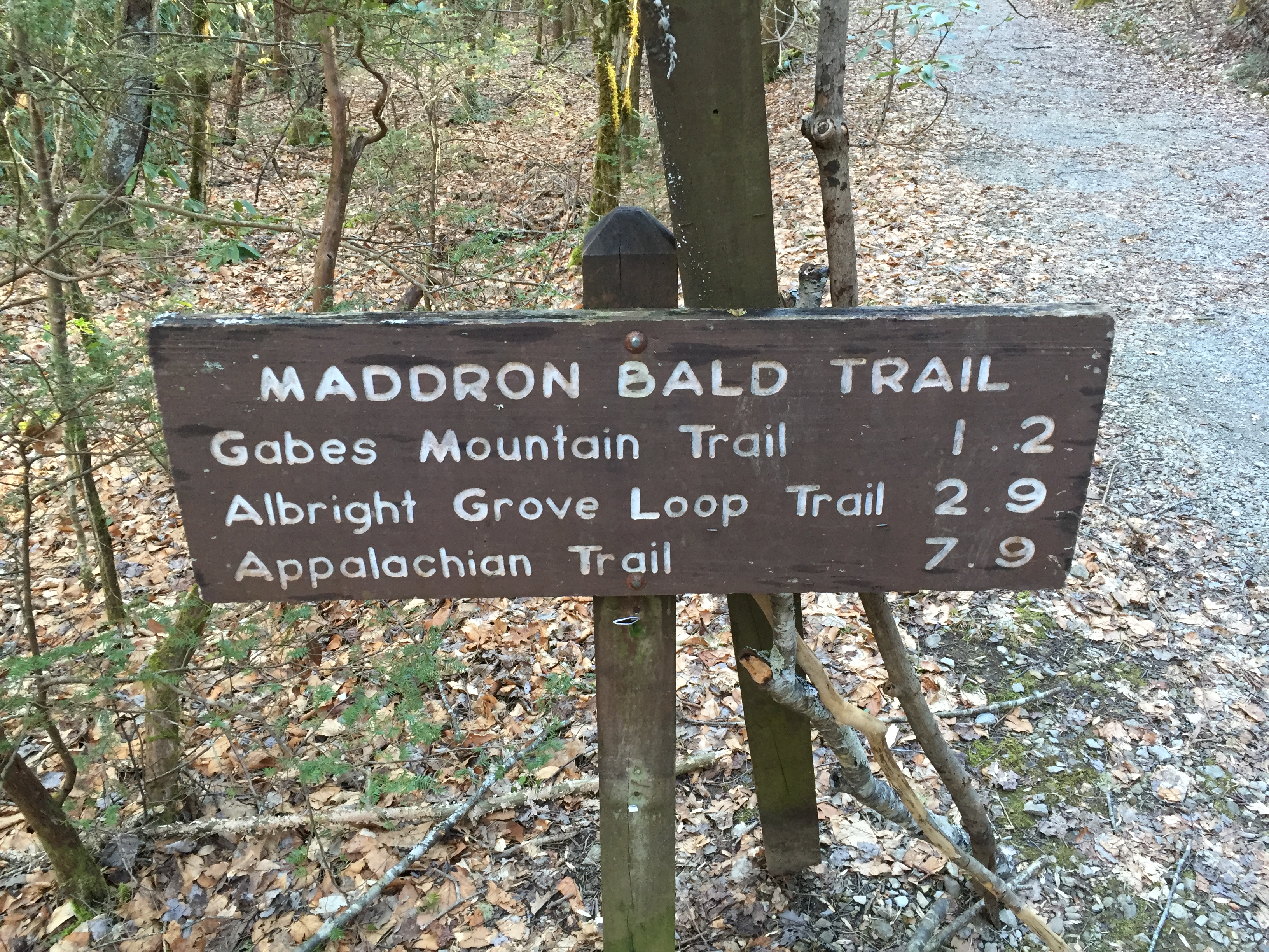
Section:  Cosby            Total 900 Miler Miles:   85.1          Total Miles Hiked:   117.1

Madron Bald Trail  Maddron Bald Elevation

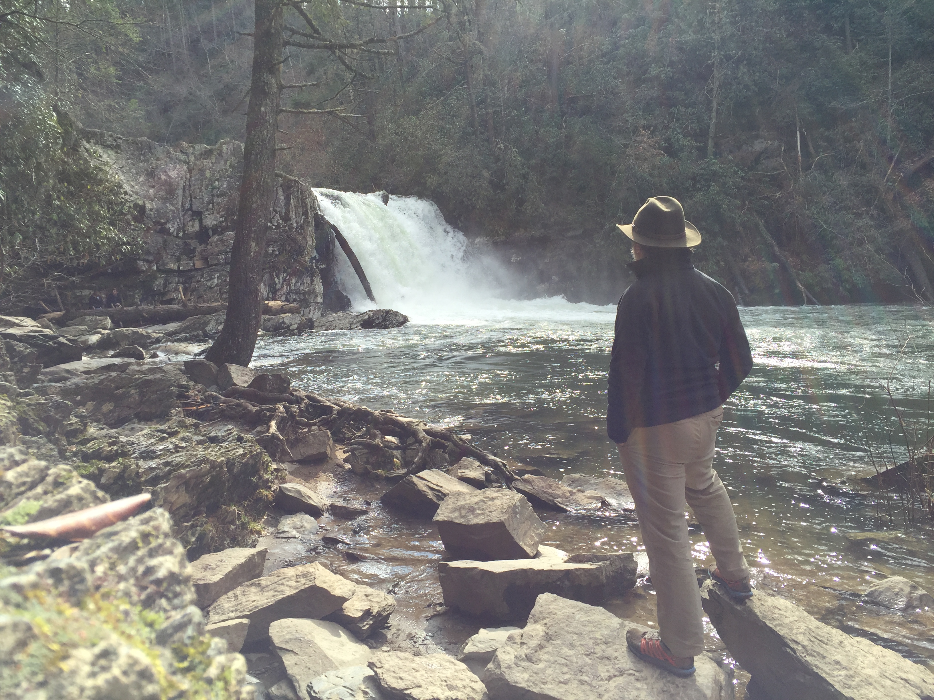
One of the great things about living in East Tennessee is the passing of the seasons.  And of the great things about being near 5,000-6,000 ft. mountains is the passage of seasons in one hike.  February 27 was one of those days where at 1,800 ft., there were near springlike conditions.  My hiking partner for the day was Annie O’Grady, a 900 miler to be with about 47 miles left on her first map.  She needed Maddron Bald and I had not bagged it yet for map #2.

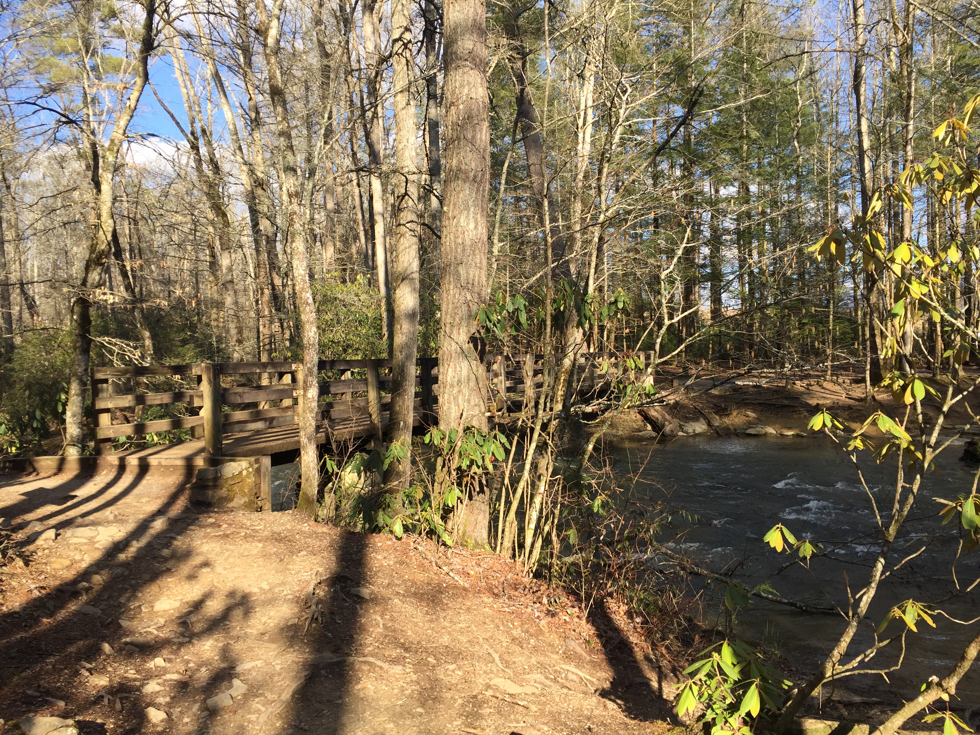
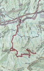
Maddron Bald can be part of a nice 21 mile backpacking loop out of Cosby Campground along with Snake Den Ridge and Gabes Mountain Trail.  We chose an out-and-back.  There is ample water along the trail and in fact, there are at least 3 potentially wet stream crossings.  Campsite 29 is also on this trail.

IMG_2453
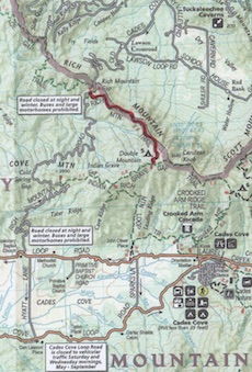
The first challenge was actually finding the trailhead.  You travel nearly three miles on US 321 out of Cosby and you have to be vigilant for a left turn called Baxter Road.  Keep to the right while passing through a residential section you come across a very small parking area at the trailhead.  The Brown guidebook mentions that the parking area may not be safe but I have never had a problem.

Our hike started at 9:00 am with a brisk 35 degrees.  The trail starts out as a wide double track and rises gently for the first mile through mixed hardwoods..  At 0.7 miles is the William Baxter Cabin dating back to 1889.  The Brown Book mention the cabin was built out of American Chestnut, perhaps even out of one tree.  These impressive giant tree people died out in the early 1900’s due to an Asian fungus called the Chestnut Blight.  Oh how our park would have been different with these gentle giants roaming the ridges.  There may be hope as several research projects are underway to develop a blight resistant Chestnut tree but our generation will never see them in their original glory.  The best we can hope for is to once again greet them as we saunter.

IMG_2403
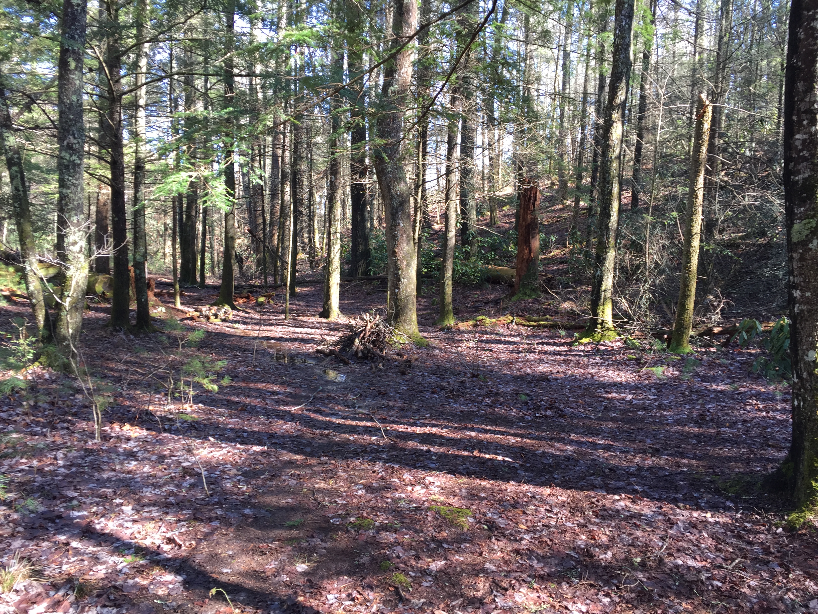
The trail begins its steady 500 ft./mile climb about a mile in and by at 1.2 miles is the intersection with Old Settler’s Trail.  By 2.0 miles, the trail become more single track and the climbing continues steady.  At 2.9 miles, you intersect with the lower part of the Albright Cove Loop Trail, a 0.7 mile loop that connects back to the Maddron Bald trail 0.3 miles further up.  According to the Brown Book, this short trail was named for Horace Albright who was the second director of the National Park Service and a strong advocate for the establishment of the Great Smoky Mountain National Park.  The grove is home to numerous examples of old growth trees such as Tulip trees and Eastern Hemlocks.


IMG_2406
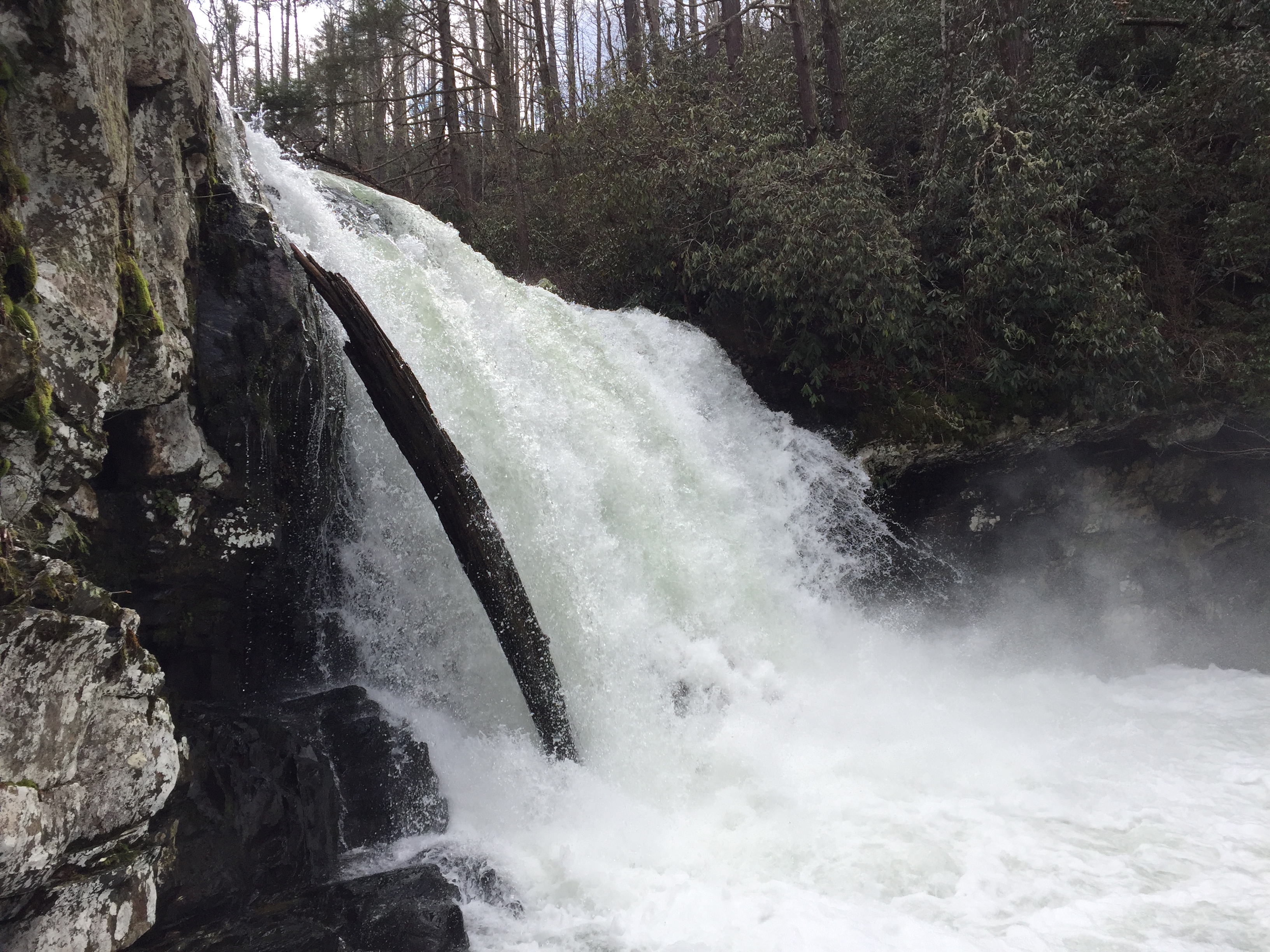
At 3.1 miles, you cross Otter Creek.  The thing about crossing streams, especially in the winter, is that you have an incentive to rock hop as much as you can.  The problem with winter rock hopping is that the rocks, although ordinarily slick, can become coated with thin, invisible  ice.  My contention is that I fall into the water more often when rock hoping, than I do when I plunge right on through, accepting the fact that I will get me feet wet.  This is the bargain I have made with creation.  Water is good.  The chances of getting your feet wet in any case are good.  Proper equipment and planning makes hiking with wet feet, even in the winter, a reasonable, if not somewhat comfortable option.  In this case our rock hop was successful.
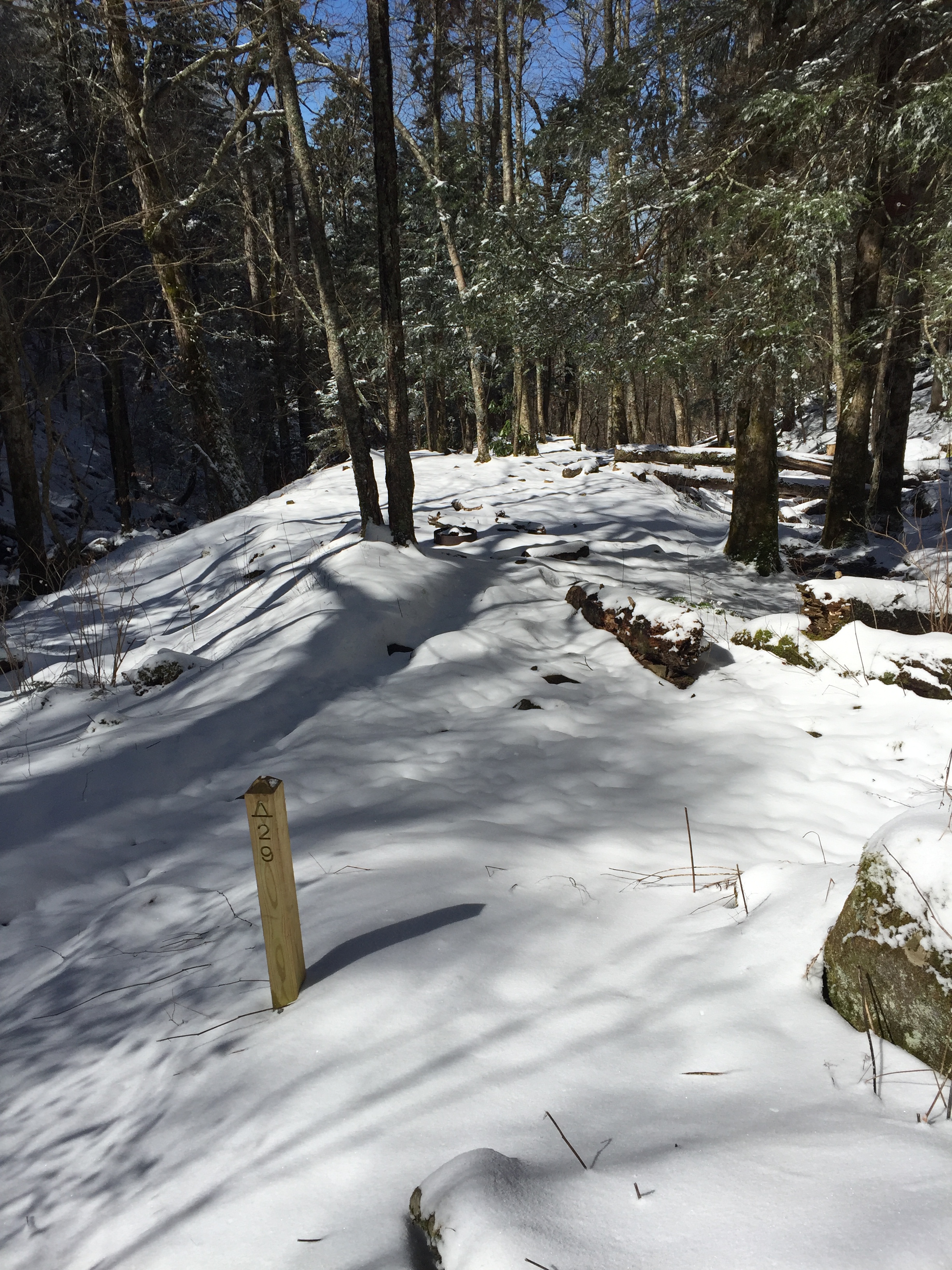
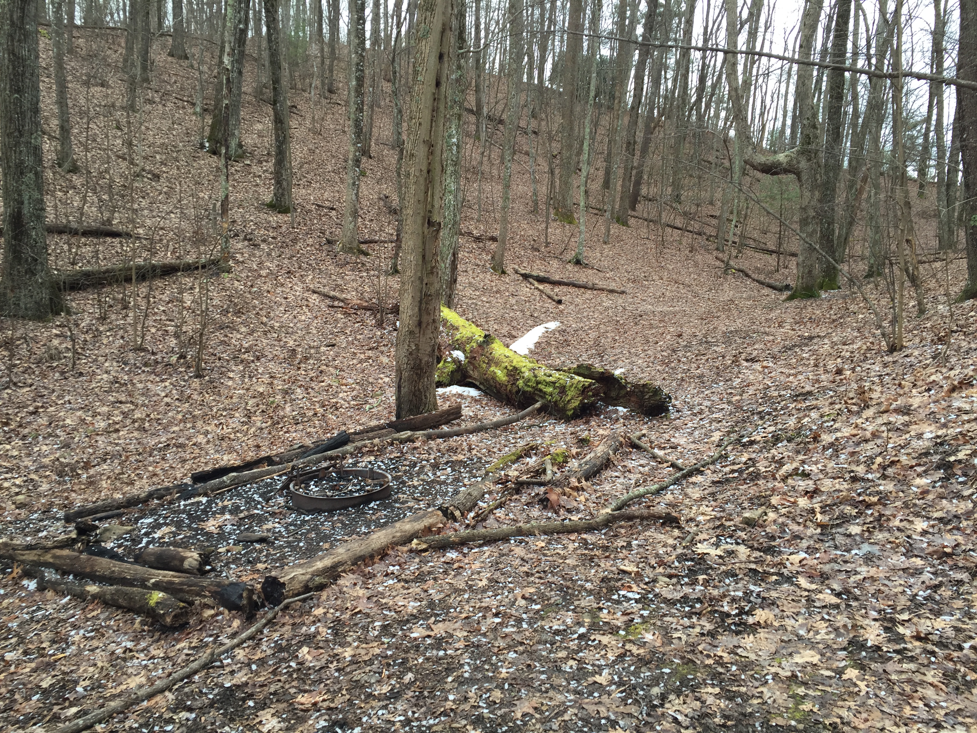
IMG_2412

Campsite #29

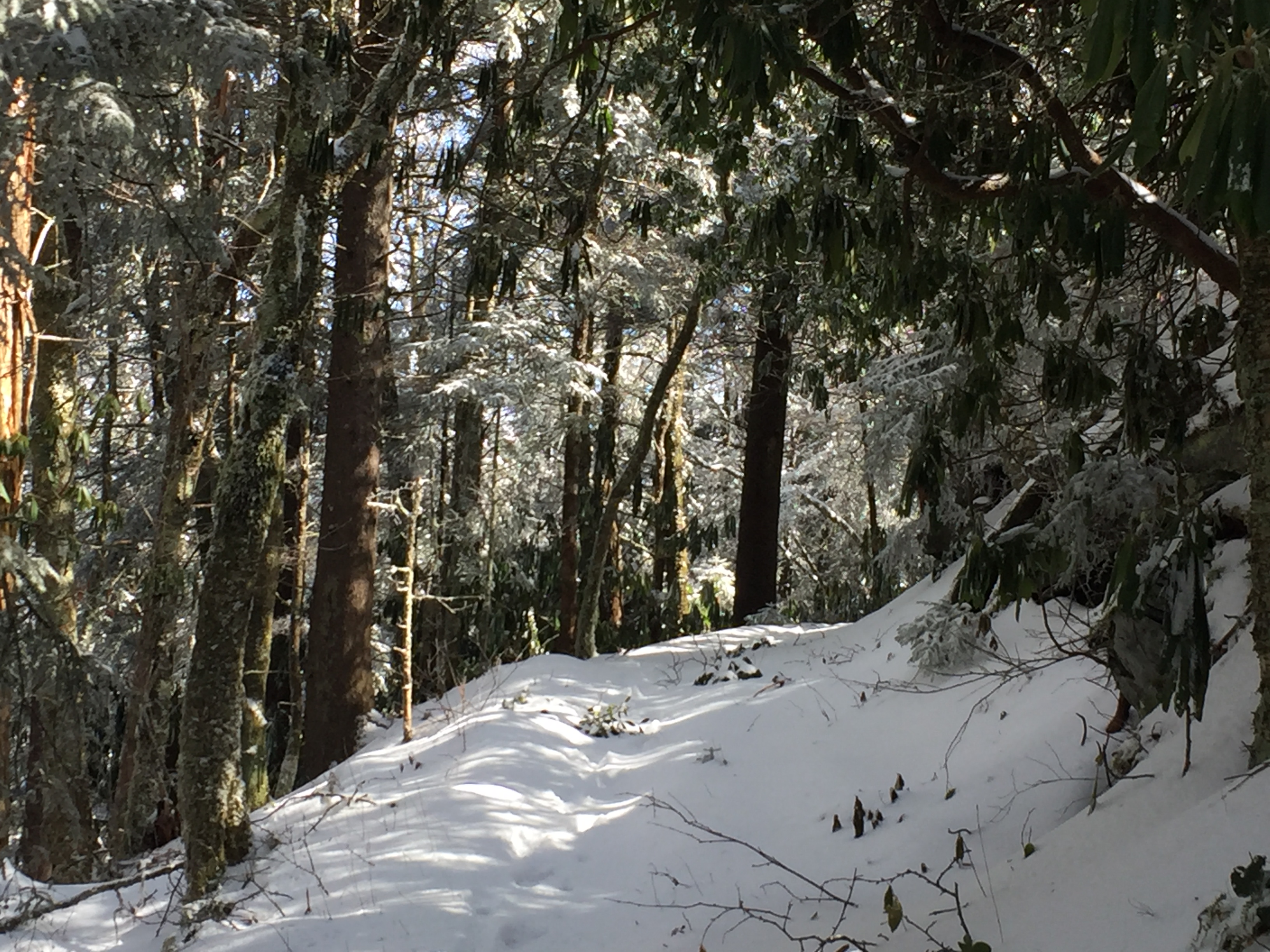
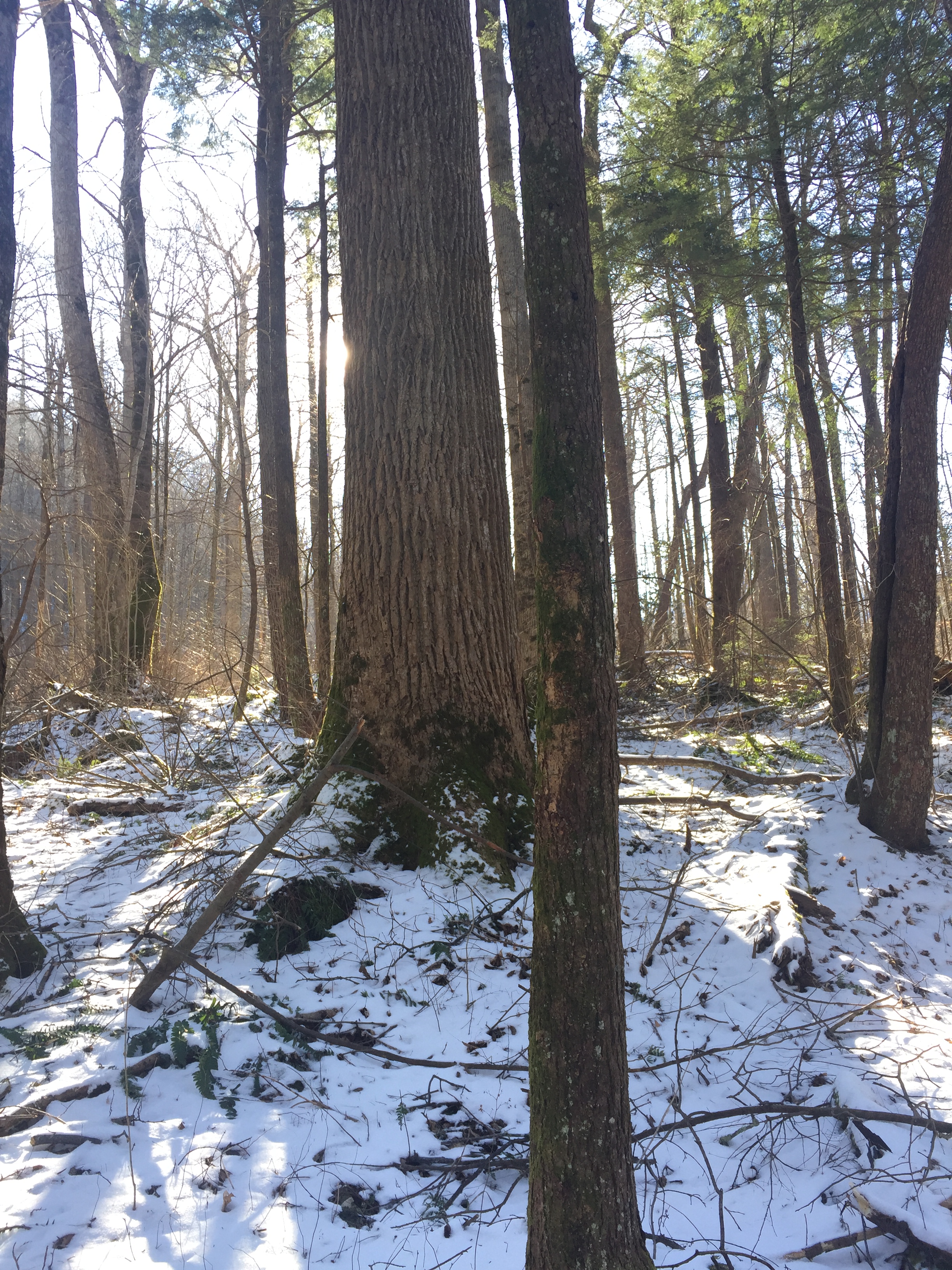
The trail crosses Indian Camp Creek three times over the next two miles.  At 4.7 miles, you have your second opportunity to moisten your feet at Coppoerhead Branch.  At 5.7 miles, you cross Otter Creek again in another wet crossing before you reach Campsite 29 at about 4,600 feet.  CS #29 is small but it seems to nice spot.  By this time there was about 6 inches of snow on the ground and the campsite was covered in a white frozen blanket.

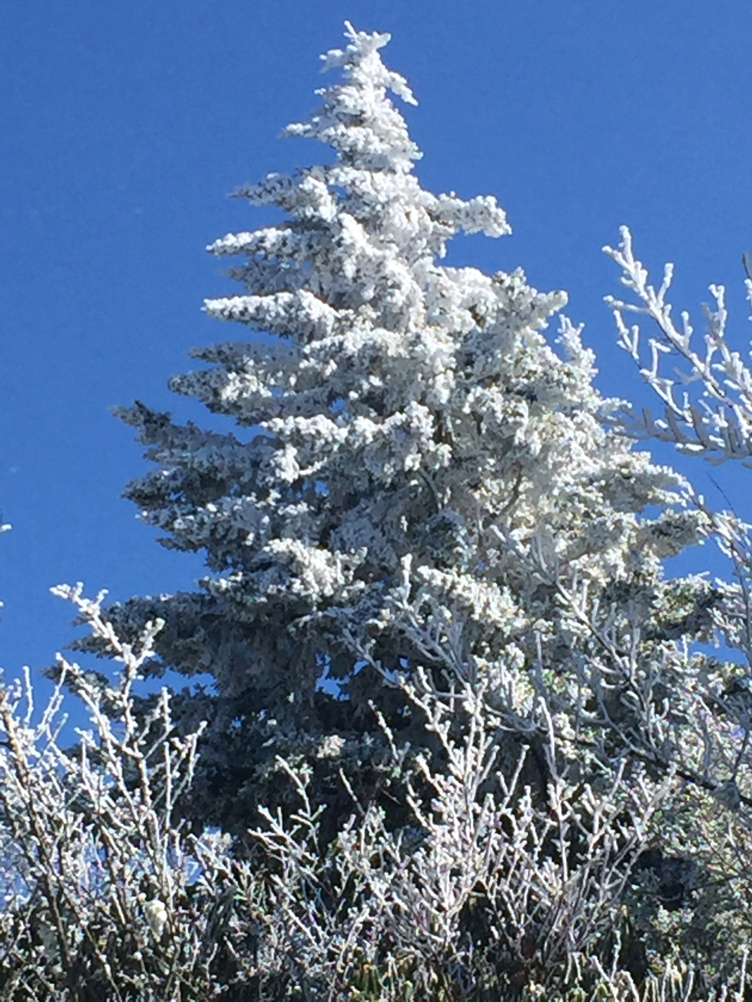
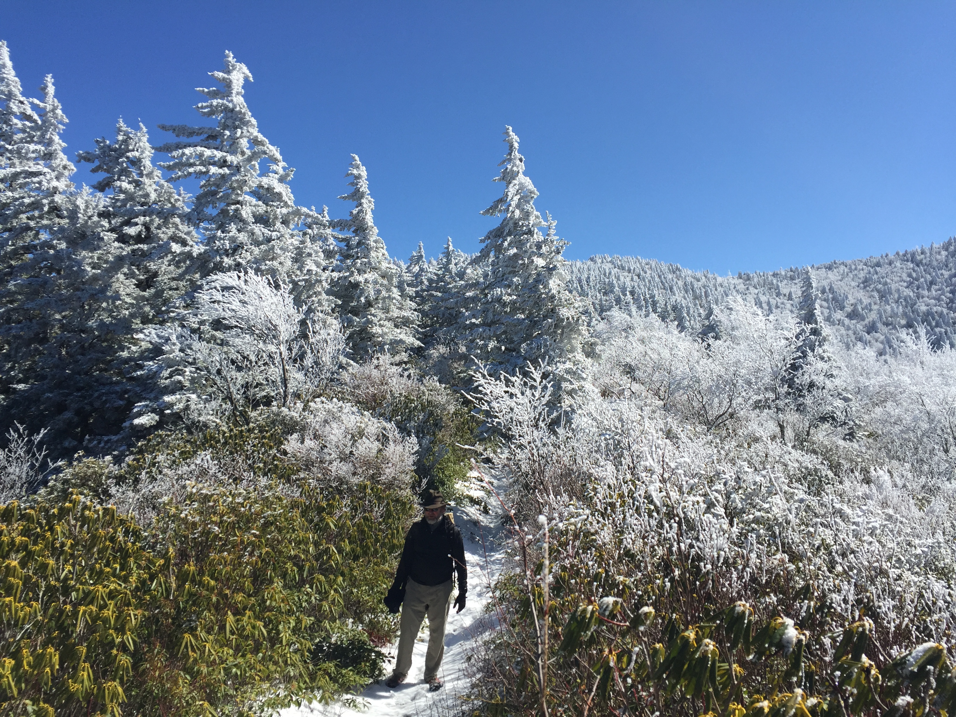
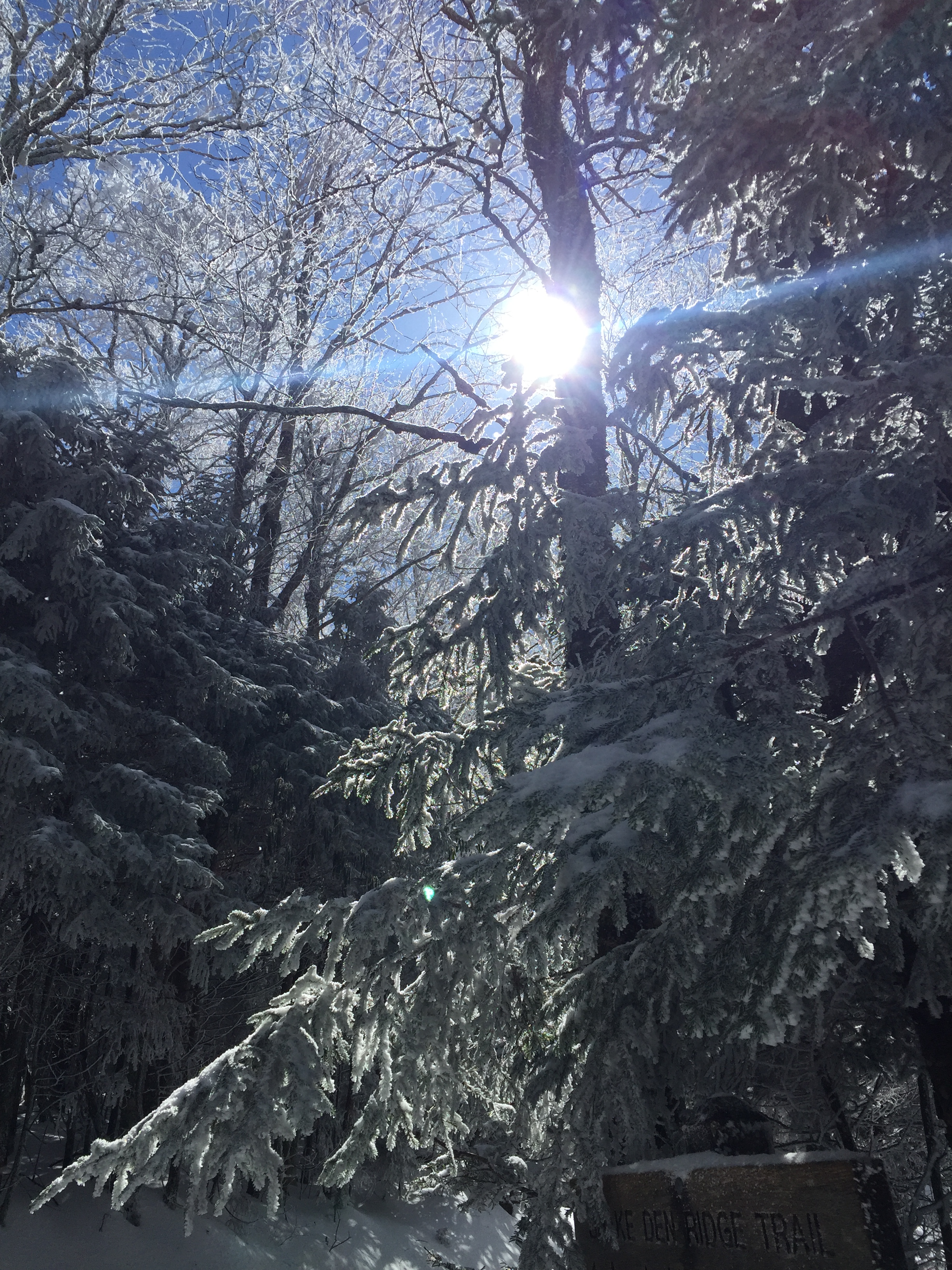
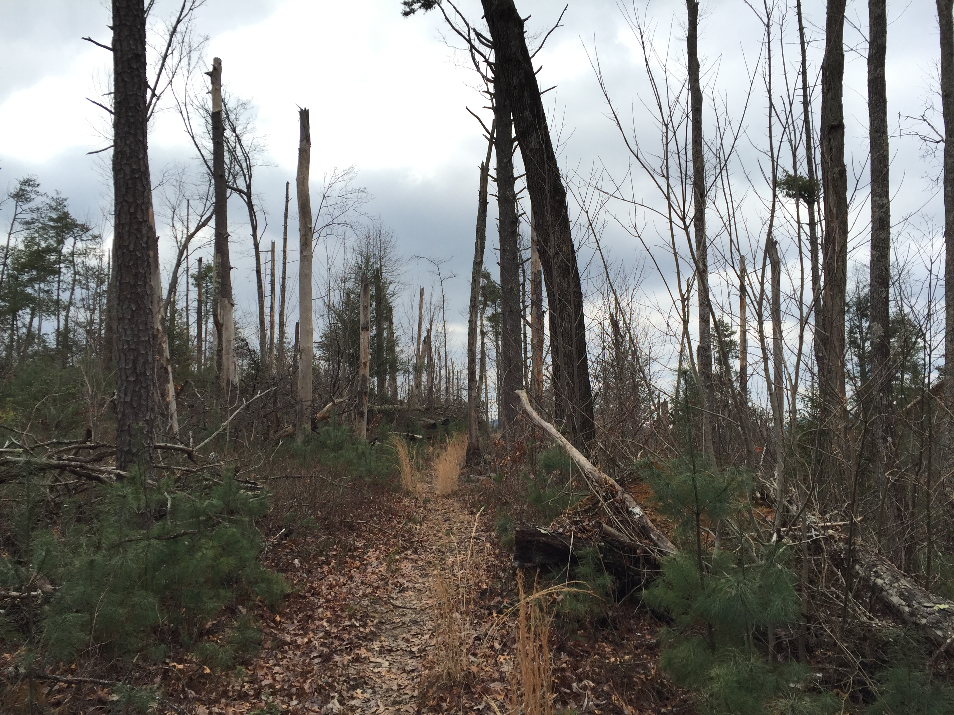
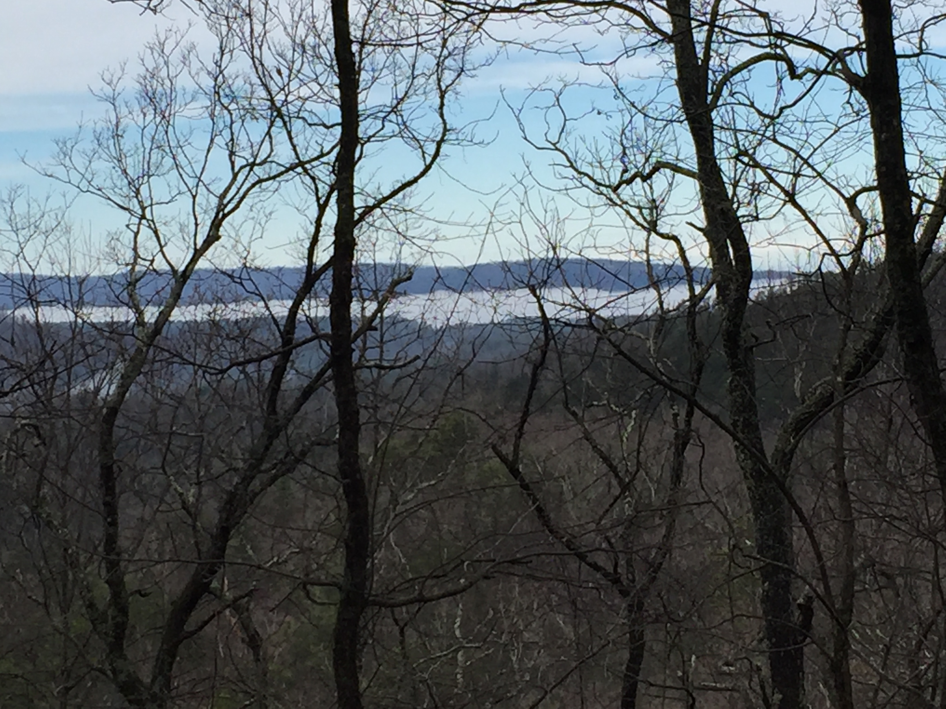
The trails narrows and become rocky until at about 6.3 miles, Maddron Bald opens up with fantastic views at nearly 360 degree.  We were hiking in about 8 inches of snow by this time and the trees were covers in a beautiful dusting of the stuff.  The trail intersects with Snake Den Ridge where we took our lunch in the deep snow before heading back down.


IMG_2417  IMG_2418  IMG_2429  IMG_2439

IMG_2435

HikerHead 2  Be well. Do good. Strider out!

Abrams Falls Trail

Date:    02.26.2016

Miles:  4.2 miles           Elevation Gain:   551↑         Elev./Mi:   131        Grade:     2%          

Difficulty:  Class 1      Hiking Time: 1:29       Pace:  2.8  mph         Avg. Temp.:   55        

Section:  Cades Cove       

Abrams Falls TrailAbrams Falls Elevation

IMG_2329Abrams Falls Trail is a marquee trail of the Great Smoky Mountain National Park.  It is very approachable for most any hiker and it features Abrams Falls, which is one of the most spectacular sights in the Smokies.  The trailhead is at a parking area off Cades Cove Loop Road.  The Brown Guidebook states that Abrams Falls was named for Cherokee Chief Abram.  There are no campsites on Abrams Falls Trail and there are no substantial water crossings.


Abrams Creek at Hannah Mountain Trail

Abrams Creek at Hannah Mountain Trail

Most hikers will take this trail from the trailhead at the parking area and return as an out-and-back.  But there are a couple loop opportunities that add depth and variety to the hike that are well worth considering.  This particular hike was documented in a loop hike that started at the Cooper Road trailhead just before the parking area for Abrams Falls.  This loop went from Cooper Road Trail to Hatcher Mountain Trail to the far end of Abrams Falls Trail which is how this hike is documented.  Another great loop is to take Abrams Falls to Hannah Mountain (fording Abrams Creek) to Rabbit Creek and back up to the Abrams Falls trailhead.  Note that the ford at Abrams Creek is normally passable in knee deep current but in times of high flow and swift current, the ford is too dangerous to consider.


IMG_2335The end of Abrams Falls is at the junction with Hatcher Mountain Trail and Hannah Mountain Trail at a beautiful place on Abrams Creek where you must ford the Creek to continue on Hannah Mountain Trail.  The trail starts out pretty level and continues for a half mile until it begins a gentle rise in elevation.  The trail follows Abrams Creek all the way to the falls proving company and a symphony of river music.  At about 0.8 miles there is a small creek crossing.  As you reach 1.3 miles, the trail moves away from the Creek causing the sound of the river music to change keys as though a different movement of the symphony began.  By this time the trail rises significantly above the Creek with a great view of the cascades down below.


IMG_2336At 1.5 miles, the falls come into view through the wintertime foliage.  At 1.7 miles,  you cross the foot bridge, which is a door of sorts to the inner sanctuary that is Abrams Falls.  This particular day, the Falls is flowing more than normal due to heavy rains in the past few days.  There are few visitors here giving a little solitude to the experience.  On a summer weekend, you will encounter dozens of visitors, many of which will risk a dip in the pool that receives the Falls.  I captured more of my personal experience in my entry for the loop hike.


IMG_2338  IMG_2362

IMG_2364

After a good break, I continued up the trail toward the trail head.  The elevation continues to rise gently and the trail widens.  At 3.3 miles  the trail starts to distance itself from the creek by veering away from the gorge.  At 4.1 miles you reach the bridge that leads across Mill Creek to the Trailhead just beyond.

Bridge at the trailhead

Bridge at the trailhead

HikerHead 2  Be well.  Do good.  Strider out…

Hatcher Mountain Trail

Date: 02.26.2016

Miles:  2.8 miles           Elevation Gain:   782↓         Elev./Mi:   279        Grade:  5%          

Difficulty:  Class 1    Hiking Time: 0:58       Pace:  2.75 mph         Avg. Temp.:   42        

Section:  Cades Cove       

Hatcher Mountain Elevation

IMG_2273Hatcher Mountain Trail is a remote connector between the Cooper Road Trail and Hannah Mountain Trail.  It can be utilized in a number of loop possibilities starting both from Cades Cove and Abrams Creek Campground.  It is also one of those trails a 900 miler will hike at least twice.  The original date of this hike was part of a loop hike that included Cooper Road Trail to Hatcher Mountain Trail to Abrams Falls Trail.  There are no major water crossings nor are there any campsites on Hatcher Mountain Trail.  The closest campsite is CS#17 about a half mile down Little Bottoms Trail.

The section starts at the intersection of Cooper Road Trail and Bear Cane Trail and heads southwest in a gently steady descent and continues to be a very pleasant hike for the entire length.  At about 0.5 miles, the trail comes out on a ridge with views across to Chilhowee Mountain, which is the ridge that hosts the Foothills Parkway. At 1.0 mile, the landscape opens up to great views due to what I presume was a windstorm or tornado of some years back.  The evidence of this storm is prevalent throughout this end of the park and can be experienced  especially on the Beard Cane Trail and in several other spots.  Here the trail is in good shape with very little underbrush and quite a but of new pine tree growth.

Devastation from a past windstorm

Devastation from a past windstorm

View of Chilhowee Mountain

View of Chilhowee Mountain

Widespread Devestation

Widespread Devestation

Just past 2 miles, the views to Chilhowee Mountain continue and you can see how widespread the devastation from the windstorm was across to the next ridge.  Here also you begin to hear the river music from Abrams Creek down below as it comes into view.  The descent continues to the intersection of Little Bottoms Trail at 2.6 miles, which leads to the Abrams Creek Campground.  The trail comes gradually closer to Abrams Creek until it ends the the trail junction of Hannah Mountain Trail and Abrams Falls Trail.


View of Abrams Creek from Hatcher Mountain Trail

View of Abrams Creek from Hatcher Mountain Trail

HikerHead 2  Be well.  Do Good.  Strider out…

Abrams Falls Loop Hike

Date: 02.26.2016      

Miles:  12.7              Hiking Time: 4:26              Total Trip:  5:21

Route: Cooper Road Trail to Hatcher Mountain Trail to Abrams Falls Trail           

Abrams FallsBy now, I have documented a few hikes made up of sections of different trails, which presents a bit of a problem with keeping a detailed record of each trail.  A 900 miler accumulates a number of trail segments from different trails at any given time.  It’s pretty easy to keep up with on a spreadsheet.  With a blog though, it presents a dilemma of sorts.  Should you write up the hike with incomplete trail sections or wait until all sections are complete before documenting the hike.  With this post I will attempt a shift in strategy.  Whenever I hike hike a number of different segments, I will present the experience as the total hike and reserve specific details when each segment is completed.

And so this hike started out to be a loop around Abrams Falls.  The original path was to be Cooper Road to Hatcher Mountain to Hannah Mountain to Rabbit Creek and out.

IMG_2271At 10:39 on Friday, Feb. 26, I parked the 4Runner at the Cooper Road trailhead.  It was a brisk 39 degrees and overcast.  Traffic in Cades Cove was non-existent which made getting to the trailhead a pleasure.  The trail climbs gently for about 3 miles and crests as it heads down to Hatcher Mountain.  Toward the end of the section, there is significant blowdown activity with brushy new growth and small pine trees returning.  At about 5.3 miles, I came across a couple older 900 milers on their 3rd map.  We exchanged information about trail conditions and one mentioned this would probably be their last map.  I rebutted his statement saying that you always start the next map but they seemed to agree together that too many birthdays had passed and 3 would be plenty.  After 2 hours and 20 minutes I made it to the Hatcher Mountain Trail.

IMG_2318

Hatcher Mountain breaks out with views across to Chilhowee Mountain and Look Rock.  The hike is steady and slightly downhill the whole way and very pleasant.  Once again, there are sections that suffered from significant wind damage with twisted blowdowns but the trail is clear and the openness makes way for some great views.  There was still snow on the peaks of the ridge.  At about 2 miles, you begin to hear Abrams Creek down in the gorge as it becomes visible through the open ridge.  The river music follows you all the way to the end of Hatcher Mountain Trail at the junction with Abrams Creek Trail.

Abrams Creek at Hannah Mountain Trail

Abrams Creek at Hannah Mountain Trail

The plan was to pick up Hannah Mountain Trail and continue on to Rabbit Creek Trail but upon arrival, you are met with an obstacle.  That being the fording of Abrams Creek.  Normally, the creek is no more than knee deep.  Conditions this day were as follows:  Temperature, low 40’s.  Water level: extremely high due to recent heavy rainfall.  Current VERY swift.  Total number in the group of hikers: one.  The thought of a waste deep ford through swift current induced me to reconsider my hiking plan.  To my great fortune, the Abrams Falls Trail also terminated at this Junction so discretion took the better part of valor and I headed back up toward Cades Cove on the Abrams Falls Trail.

For some time now, Abrams Creek accompanies you, providing a full choir of glorious river music all the way to the falls.  The trail gains about 600 feet over its 4 miles so the ascent is slight and gradual, making for a glorious walk all the way.  As the trail turns away from the creek and then returns back toward it, the magnificent sound seems change key like different movements of a symphony.  The rapids of Abrams Creek are always visible through the wintertime foliage.

IMG_2336At about 1.5 miles, through the trees, you finally see it.  The majestic Abrams Falls comes into view in all its glory and the reason for taking this unplanned route reveals itself in a wonderful surprise.  The flow of water over the falls is as full as I have ever seen it, spanning the full width of the falls without a single break in the swooping wall of water.  Excitement builds as you follow the sight for the next 300 yards.  Finally you come to the footbridge that leads you through a door  to the sacred place that is Abrams Falls.  As I entered the sanctuary, I was thrilled to see only a half dozen other pilgrims had made the trip.


IMG_2338  IMG_2362

IMG_2355Over the 45 minutes I spent at the falls, I was blessed with 20 minutes of solitude as the other visitors left for the trailhead.  The time was magic as all Creation performed its concert giving witness to the Creator in full glory.  When we are gifted with a glimpse of Heaven, we can only stay for a while before we must return to the domain of Man.  Such as it was with this visit and about 3:20 PM, I headed for the trailhead at Cades Cove.

The sun arrived during my moment in the sanctuary and it turned the day into perfection for the walk up.


Blessings tend to come when they are completely unexpected and today was exemplary of this fact.  Had I been able to stay with my original plan, I would have missed the falls in its full display of raw power and sound.  And yet, I would never have known.  This all makes one even the more thankful because the gift was precious and its giving was not anticipated.  This is the way of grace.

HikerHead 2  Be well.  Do good.  Strider out…

Campsite 5 – Rich Mountain

Campsite 5

Campsite 5

Campsite #5 – Rich Mountain

Rich Mountain Trail – 100 yards from intersection with Indian Grave Gap Trail

Capacity: 4

Rating: 5

Water: Available from a small spring down the narrow valley from the site, or from Hesse Creek a few hundred yd. down Rich Mountain Trail.


CS 5 is the former site for the Rich Mountain Shelter, the foundation of which is still there.  The site is a small one with nice ground cover and space for a couple tents.  There is little impact and although the site is within clear view of the trail, it is sufficiently off to the side.  There is a large fallen tree to provide wind break for tarps.

Rating Summary:

  • Ample Water
  • Bear Cables
  • Low Impact
  • Dry and Level Tent Sites

Rich Mountain Trail

Miles:  2.3 miles           Elevation Gain:   1,605↑         Elev./Mi:   697        Grade:  13%          

Difficulty:  Class HC    Hiking Time: 0:54       Pace:  2.55 mph         Avg. Temp.:   31        

Total Hike:  4.6 miles            Total Hike Time: 1:36                Avg. Pace:   2.9 mi./hr.

Section:  Cades Cove       Total 900 Miler Miles:   60.0      Total Miles Hiked:   78.1

Rich Mountain Trail

Rich Mountain ElevationStarted the hike at 10:20 am under a cloudy sky.  The temperature was 37.5 degrees and the ground was still frozen.  The trailhead is best approached out of Townsend on Old Cades Cove Road, which becomes the Rich Mountain Road that leads out of Cades Cove.  The trailhead is less than 50 yards from the gate at the park boundary.  The brown guidebook describes the Rich Mountain Trail as being upside down.  Often, trails in the park start along streams and creeks and eventually leave the music of the water as the trail moves up toward a ridge.  In the case of Rich Mountain, the creek is at the top of the trail near campground #5.


IMG_1693The climbing starts immediately from the trail head and moves steadily up the whole length.  At 1.3 miles, the trail achieves a ridge which looks out over Townsend.  On this day, there is a blanket of fog gently covering the valley which is the home of Townsend and the ridge rose above the blanket to a clear blue winter sky.  On day two of the creation story, YHWH created the firmament to separate the waters between heaven and earth.


Hiking above IMG_1696a layer of clouds finds one above the affairs of men and yet below the realm of the divine; sort of an interstitial journey above the firmament.  A half mile further, water music begins signaling the creek near the end of the trail. At 2.2 miles, Campsite #5 passes on the right and the intersection with Indian Grave Gap Trail is just 100 yd. beyond.  A quick bite and a break at CS#5 preceded the return back down to the trailhead, which was accomplished in 42 minutes.  A post hike conversation with a friend yielded anecdotal information that this section of the park is one of the more active areas for poisonous snakes, both copperheads and rattlers.  None were encountered as this is their hibernation season but it is information worth noting for the summer months.

HikerHead 2   Be well. Do good. Strider Out..

Ace Gap Trail

Miles:  5.6 miles           Elevation Gain:   1,082↑↓         Elev./Mi:   193        Grade:  4%          

Difficulty:  3                  Hiking Time:  2:04       Pace:  2.71 mph         Avg. Temp.:   47       

Total Hike:  11.2 miles            Total Hike Time: 3:44                Avg. Pace:   3.0 mi./hr.

Section:  Cades Cove       Total 900 Miler Miles:   65.6       Total Miles Hiked:   89.3

AceAce Gap Elevation

Ace Gap Trail is an interesting experience to describe.  It is one of those hikes that is not level, neither does it begin at a certain elevation and simply end at another.  Calculating elevation is difficult without GPS technology because the trail moves up and down along its length.  Although not strenuous, the walk is deceptive as the total elevation gain over the distance is 1,082 ft.  When hiked as a roundtrip, the elevation gain is over 2,100 ft. which is a good day by any measure.

Another thing to note about Ace Gap Trail is that on older maps and guidebooks, there are two campsites, CS #4 and CS # 7.  Both are no longer marked, neither on the official Park Map nor with the typical posts and signs.  One assumes they have been dismantled due to increasing housing developments on the border of the Park Boundary.  The remnants of CS #4 are still obvious from the trail but the location of CS #7 is not apparent.

The nice spot formerly known as CS #4

The nice spot formerly known as CS #4

The trailhead is on the Park Boundary where Rich Mountain Road meets Old Cades Cove Road, leading to Townsend.  In general it is a pleasant saunter through white pines.  The climbs are sudden but mercifully short and serve to raise the heart rate for a good physical workout.  I began this trek a little after the noon hour immediately following my hike up and down Rich Mountain Trail.  At about 2.3 miles, the trail passes through Kelly Gap with the remnants of Campsite #4, which is a pleasant spot for camping, although it is absent the typical fire rings and bear cables.  A water source is a few yards behind in a small stream.  However there is a rather large house visible a hundred yards or so beyond.

Since the trail follows the park boundary closely, there are a few large homes visible from the trail itself.  At 2.6 miles, there is a small side trail to a road leading to an very nice vacation home.  There are several stream crossings providing water and places throughout this section. The trail runs through Ace Gap at about 4.9 miles where a nice flat space is the remains of CS #7 but there are highly visible signs warning wayfarers not to trespass on the private property.  Just past Ace Gap, I ran into two older hikers who regularly hike the Tennessee trails.  These guys were a treasure trove of information about this section of trail, knowing all about its history.  They spoke of man ways and closed trails that lead to interesting locations throughout this side of the park.  I would have liked to sit down with them and a map to capture some of these locations for future adventures.

Intersection of Ace Gap and Beard Cane

Intersection of Ace Gap and Beard Cane

The trail intersects with Beard Cane Trail at 5.6 miles on a small rise which greeted my arrival after 2 hours of hiking.  CS #3 is about a half mile down Beard Cane.  The temperature was a quite comfortable 56 degrees and after about 10 miles of hiking in for the day, I was due for an extended lunch break.  The trail junction was open and fairly dry so I broke out some reading material and enjoyed lunch.  Time passed and I was back on the return trip.  I caught my gentlemen friends just past the area where CS #4 used to be and they were impressed with my speed.  I didn’t tell them I took a 30 minute lunch break.

Ace Gap is nice walk for a nice day.  It is easy to get to and probably never crowded.  If camping is in order, CS #3 is not far past the end of the trail.

HikerHead 2   Be well. Do good. Strider Out..

Wilderness Sabbath Part 1: The Fourth Commandment

View From Alum Cave Trail

View From Alum Cave Trail

The God Who Rests

Our Hebrew brothers passed along a wonderful gift they received from the Creator; “The God who rests”.  In the creation narrative, YHWH created the world in six phases or days.  On day one, the heaven and the earth were created and light was separated from darkness. YHWH gave names to the light which He called day, and night, which he gave to darkness.  This is a little confusing because how could there have been the first day until day was created and named.  But that was settled fairly early, probably by a committee, and things moved along to day two, where YHWH created a firmament or dome to separate the waters on the earth from the waters in heaven.  Day three was pretty busy because land was separated from the sea and then vegetation sprang forth.  John Muir might have conveyed this as the beginning of the tree and plant people.  Light, being what separates order from chaos, needed to come from somewhere so on day four,  two great lights were set in the heavens.  One to rule the day and one to rule the night, along with the stars which must have taken a while.  These lights were rather crucial because their arrival made possible the seasons and the passage of time.  Day five brought the birds and sea monsters.  And then, day six.  Walking beasts, crawling beasts, slithering beasts; all according to their own kind… and it was good!  But there was one more thing to do before sunset. YHWH needed to somehow manage this creation.  All the plants and animals needed names, not to mention the rivers and mountains (which they weren’t).  So YHWH gathered up some dust from the ground, breathed on it, and man became a living thing.  YHWH put man in a garden where they took longs walks in the evening and talked.  There was balance in Creation.

Now we can debate how things worked out since that moment but that’s not the point of this story.  The point is that after all the hard work that went into creating the universe, YHWH took a break.  And it must have been pretty important because He blessed the seventh day and hallowed it.  The God Who Rests.

The First Top Ten List

So after that, the narrative got pretty interesting because there were tales of romance and treachery and betrayal.  There were stories of kings and war and mighty nations.  YHWH had gotten pretty fond of one particular man named Abraham and promised him that his descendants would become a mighty nation and they did but there was a problem.  These descendants were under the rule of a dictator called Pharaoh.  Pharaoh ruled over the most powerful country on Earth called Egypt, and controlled all the food production in the known world.  Abraham’s children, by then were called Hebrews, and they were responsible for making all the bricks necessary to build the storage bins that held the world’s production of food.  Pharaoh apparently missed the part about resting on the seventh day.  YHWH was none too pleased because the seventh day is when He delighted in the fellowship of His people.  So He set a bush on fire near where a shepherd named Moses was hanging out in the wilderness.  Now many strange and wonderful things occur in the wilderness, where one is free from the noise of civilization, but to see a bush on fire that isn’t being burned up was really out of the ordinary.  Adding to this oddity was the fact that the burning bush was talking.  YHWH, being the creative force He is, tends to have a flair for the dramatic and during this conversation with the bush, it dawned on Moses that YHWH wanted him to lead these Hebrews to a new land.  The adventures of this mass exodus were epic.  There were plagues and fire and locusts and death angels and the parting of the sea.  Once it was all over, YHWH wanted to make sure that His people got the message that the seventh day is really important, among other things.  So Moses went out for a hike in the mountains and he and YHWH discussed the Top Ten Things for a Peaceful and Prosperous Life.  Moses didn’t have a blog at that time.  Nor did he have a piece of paper handy.  So YHWH helped out by carving the very first Top Ten List into tablets of rock, which Moses had to haul back down the mountain without a backpack while wearing sandals.  The first three of the Top Ten were YHWH’s expectations regarding His relationship with the Hebrews.  That last 6 were commandments for people respecting each other.  Love God with all your heart and love your neighbor as yourself.

The Fourth Commandment

It’s that fourth commandment that is the pivot point.  It’s the bridge.  YHWH knew He couldn’t just declare a set of rules and leave it at that.  Relationships are not about rules anyway.  Relationships are about spending time together; about being in each other’s presence.  This is important.  After all, YHWH started the whole idea in the very first week and somehow, it had gotten overlooked and forgotten.  And humanity paid a heavy price for it.  It’s tough to say which, if any of the commandments is most important but it is pretty clear that the fourth commandment is the one that holds it all together.  The God Who Rests wanted the Hebrews to remember the Sabbath and keep it holy.

And so the Sabbath is a day set aside for prayers and meditation.  It is a time for family and friends to sing songs and tell stories.  It is to be shared freely with visitors and guests.  It is a time of feasting and of fasting.  It is a time to cease from the activities of commerce and production (the making of bricks), which are the concerns of men, and to make time and space for long walks in the evening with The God Who Rests.  It’s the bridge between Heaven and Earth.  It began in a garden where YHWH put man to live and when man forgot, YHWH reminded him on a mountain top.  It seems that the wilderness is always around when God has something important to say.  And that’s a story for another time.

Sabbath As Resistance

I found Walter Brueggemann’s book, “Sabbath As Resistance: Saying No to the Culture of Now” to be of immense influence in forming my thoughts for this post.  It is a quick read but very rich in it’s brevity.

HikerHead 2   Strider Out…

Trail Names and 900 Milers

Holy Family Hiker Hostel in Pearisburg, Va.

Holy Family Hiker Hostel in Pearisburg, Va.

It was the at the Holy Family Hiker Hostel in Pearisburg Va. when it happened. It was early June and I had just arrived to find a gentleman checking out the hiker register.

“Hi, I’m Shawn.”

“I’m Warren.  When did you start?”

“May 6th”

“Wow, you’re a runner aren’t you?”

The Runner… THAT’S IT!  Some 600 miles into my AT Thru Hike and I had a trail name.  And it came from one of the folklore heroes of the AT.  Warren Doyle has hiked the AT 16 times and at one time, held the speed record.  I hadn’t chosen a trail name at that point but I was aware of the tradition.  Some chose their trail names before they begin their hikes.  Some believe it should be bestowed upon you while on the trail.  I guess in my case it was more of the latter.

Adopting a trail name is part of the long distance hiker community.  Most Thru Hikers on the AT and PCT alike take on some form of alter ego.  The name may come from a specific event or it may refer to some aspect of personality.  Mouse Slayer carried mousetraps to ward off the beasts in trail shelters. The Umbrella Lady carried, well you know.  There was The Snail, The Old Soldier, Hog, Moses, TomNBev and The Exodus and many many others.  From Pearisburg on, the thru hikers I met become known more by their trail names than their given names.  It always made introductions interesting.  A good trail name should come with a good story.  Being a fan of the Hitchhiker’s Guide, I even gave my pack a handle; The Runnership Jansport America.

The 900 Miler community hasn’t seemed to embrace the tradition, perhaps because most of us are not Thru Hikers.  Furthermore, there is no system of communication like the shelter registers in which to document our experiences through our chosen identities.  We tend not to congregate at campsites and hiker hostels.   Becoming a 900 Miler does not involve a full-time commitment like being a Thru Hiker.  We don’t leave behind our civilian lives for the duration of the trek, which diminishes the need for an alter ego.

And yet, there were 30 who became 900 Milers in 2015. There are more than 475 900 Milers registered with the 900 Miler Club.  Maybe there is a critical mass necessary to ignite the use of trail names in the 900 Miler community.  If you track the list of AT Thru Hikers over the past several decades, it wasn’t until the 1970’s that trail names started to show up at all. The critical mass seemed be reached in the 1990’s and by 2000, it was unusual for a Thru-Hiker not to have one.

This is not a call for the 900 Milers of the world to adopt trail names.  That said, it’s not a bad idea and I think I’m going to go there.  Perhaps the 900 Miler Club should include a column for trail names like the ATC and the PCTA and see what happens.  To this end, I have narrowed down to three possibilities:

Saunter – John Muir rejected the notion that he was a hiker.  Borrowing an idea from H.D. Thoreau, he explained that saunterers were spiritual pilgrims who traveled by foot and he preferred the term.

Wayfarer – is a person who travels rather leisurely by foot.  Plus, the name reflects my chosen form of protective eyewear.

Strider – reflects one who travels by foot but more swiftly.  It is the nickname used by Aragon in the Lord of the Rings while he was a Ranger of the North.  Mysterious! 

Let’s see which one takes…

HikerHead 2


The 10 Essentials

Every year, there is a least one story that makes the local press about an individual who got lost in the Smokies for a day or two until the park service found them, cold and hungry.  Recently, there was a family of four who spent a miserable cold night up on Mt. Le Conte.  It seems despite the fact that the trails are well marked and the availability of good maps, people still manage to venture out in street shoes with a small water bottle and little else.

In full disclosure, I must admit that I have been lost once.  The map I had was several years old and the Lakeshore Trail had more recently been rerouted.  The campsite we were bound for did not materialize within the expected timeframe and the topography on the map indicated a much different terrain than what we were currently hiking.  We were supposed to be on the Lakeshore Trail and the last sign we passed confirmed that in fact we were… on the Lakeshore Trail.  We were just on the wrong Lakeshore Trail according to my obsolete map.  Fortunately, we encountered a fellow wayfarer who was in possession of a newer and more accurate map.  Given that we were backpacking, we were never really at risk and we were soon properly oriented and back on track.  The point is, everyone gets lost, sooner or later.

Much of my hiking is done solo for personal and spiritual reasons and 900 milers hike trails that are in the far reaches of the park where the maintenance crews rarely visit.  The possibility for an obscure trail without a sign is there.  Even with a hiking companion, water bottles are lost and food is forgotten.  And in the case of injury, one of the party may have to get help while the other party hunkers down to wait for rescue.  With proper planning, the folks at home should know where you are going and when you plan to return.  So if you are somehow lost or injured, you need to be prepared to survive a night in the backcountry.

The concept of the Ten Essentials was originally developed and published in the book, Mountaineering, Freedom of the Hills in 1974.  The idea was to develop a fundamental list of gear one should always have in the outdoors to facilitate a night’s survival in the wilderness in the case of injury or disorientation.  Bearing in mind, the list was developed well before the advent of the smart phone, it is understandable that the device failed to make the list:

The Classic Ten essentials

  1. Map
  2. Compass
  3. Sunglasses and sunscreen
  4. Extra clothing
  5. Headlamp/flashlight
  6. First-aid supplies
  7. Firestarter
  8. Matches
  9. Knife
  10. Extra food

My first encounter of the Ten Essentials was through the Boy Scouts.  Every checklist of camping gear starts with the Ten Essentials and their list is quite similar:

The Boy Scout Ten Essentials

  1. Pocket knife
  2. First aid kit
  3. Extra Clothing
  4. Rain gear
  5. Flashlight
  6. Food
  7. Water
  8. Matches
  9. Sun protection
  10. Map and compass

New developments in gear and the movement toward lightweight have refined the concept into more of a systems approach and the list is now a set of categories rather than 10 specific pieces of equipment.  Also, there are seasonal and geographical considerations.  Here are the updated 10 Essential Systems along with some personal commentary:

  1. Navigation – To date, the National Geographic map of the Smokies has proven to be a stellar method.  I also carry a compass although it is rarely consulted.  My watch has an altimeter feature and a compass so with the map, I can usually locate my position within a quarter mile or so.  I have yet to be enticed to acquire GPS systems.  Cell phones can work but they cannot maintain a battery charge for very long.
  2. Sun Protection – Hat and sunglasses.  If I anticipate spending an afternoon on a bald, I may carry sunscreen as well.
  3. Insulation – At the very least, even in summer, I take a fleece and my rain jacket.  In the winter, I add layers, gloves, a warm hat (beanie, toboggan, ski cap, skull cap, or touk, eh?), rain pants and a down jacket.
  4. Illumination – Headlamp, always.
  5. First Aid Supplies – The outfitters have small lightweight individual first aid kits with all the essentials.  I typically add Vitamin I (ibuprofen), a small tube of Neosporin, and a chaffing cream of some sort.
  6. Fire – Waterproof matches in a plastic waterproof case. I also cary a lighter but the matches are lightweight and a good failsafe.  i also carry a couple sticks of fire-starter material.  It rains all year in the Smokies.  Scoutcraft aside, it helps to have a quick way to start a fire.
  7. Repair Kit and Tools – A lightweight pocket knife and a small bit of duct tape.
  8. Nutrition – I always throw in extra granola bars and plenty of GORP and nuts.
  9. Hydration – a water bottle and a Sawyer filter.
  10. Emergency Shelter – Interestingly enough, this list did not specifically call out rain gear, which is a serious oversight.  Although I included rain gear in the insulation discussion, I always carry a rain jacket.  In cooler situations, I’ll throw in the rain pants.  The advice here also calls for a light tarp, something which I rarely have carried on day hikes but I do have silnylon rain poncho that could serve as a tarp.
  11. Knowledge – There is always the “plus one”.  In this case it’s knowledge.  a compass won’t do you any good if you don’t know how to use it.  Starting a fire in a fireplace with dry newspaper and a lighter is easy at home, but in the rain with wet wood is a whole other matter.  Setting up a tarp in the wind requires some skill. Proper planning identifies routes and return times.

All of these items stay in my day pack or in close proximity.  The list helps to make sure the down jacket makes it in the pack.  There are most certainly other items you may consider essential so feel free to modify the list to include those.  And lightweight considerations need not be sacrificed.  My day pack rarely weighs more than 7 lb., even with water and winter gear.

Shawn's 10 Essentials

Shawn’s 10 Essentials