Author Archives: blogginggazelle

Lightweight 101 – Basics

On the heels of reading “Trail Life” by Ray Jardine, I decided to start a series of posts on the topic.  As we go, I will highlight aspects of my personal gear, how I chose to buy it and generally how well it has performed.  So to get things started, let’s talk a little about the essence of Lightweight Backpacking.

As any disciple of “The Ray Way” knows, it’s not about lightweight for it’s own sake, although every philosophy has it’s most ardent supporters (and shall we say extremists?).  The purpose is to lighten the load as much as possible to heighten the hiking experience, by extending the hiking day, adding mileage, reducing pain and injury and generally feeling better.

What Gets Left Behind

By far, the easiest and least expensive way to get started is to carefully scrutinize every piece of your gear and decide if you really need it or not.  In a typical 30 lb. pack, one can probably reduce up to 10 lb. by simply leaving stuff at home.  Here is a list of stuff I decided to live without:

  • Folding saw
  • Backpacking ax
  • Cooking kit (spatula, can opener, fork, knife, spice containers, extra lighter, etc.)
  • Backpacking coffee press (Yes, I am a coffee snob)
  • Stove windscreen
  • Poncho
  • Guide books (I photocopy specific pages and leave the book home)
  • Down booties
  • Teva sandals (man, those things are heavy!)
  • Candle lantern
  • Toothpaste (Water is fine for a weekend)
  • Filter pump (in lieu of lighter alternative)
  • Multitool
  • Repair Kit (wire, tape, string, extra tent pegs, stove repair kit)
I really liked my candle lantern...

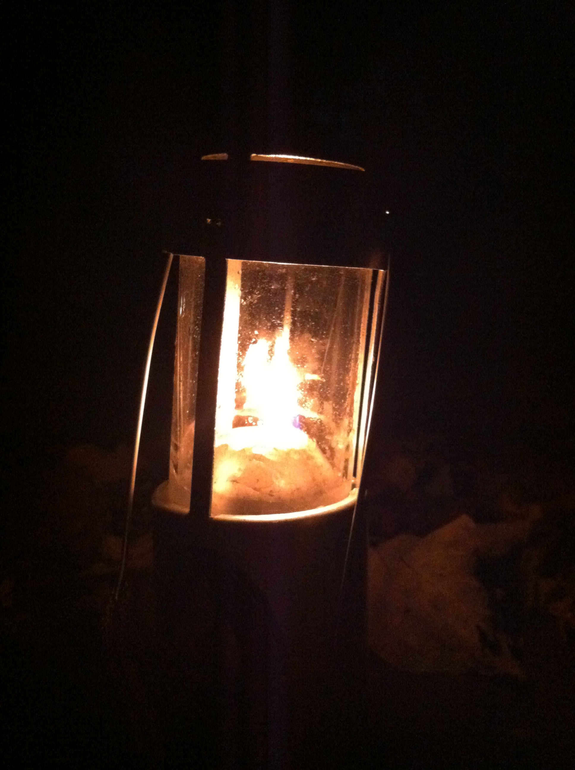
I really liked my candle lantern…

There, after you list all of your unnecessary stuff, it really adds up.  This list represents about 9 lb.

The Scales Of Justice
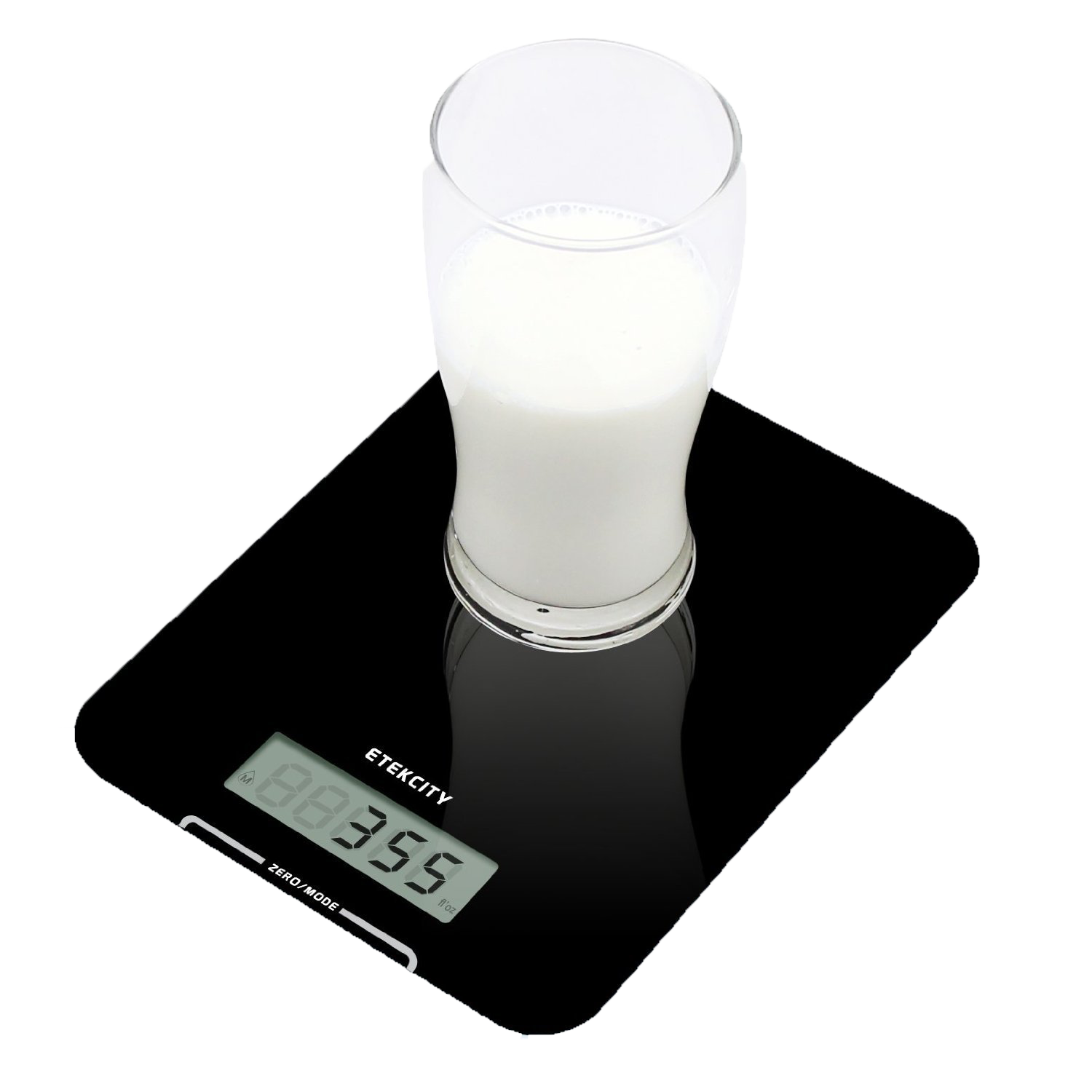
Etekcity Scale

Etekcity Scale

The next step on the journey of lightweight is to purchase a scale and weigh everything else.  I found a good digital scale on Amazon: the Etekcity 9310  It’s only about $12 and it has a large surface.  Start a list of your go-to gear and weigh each item.  Just knowing the weight gives you useful information.  Those desiring to lose body weight count calories.  Just having awareness of this information has an impact on the choices you make when deciding to order desert after that great pasta meal.  Being aware of the weight of all your gear puts you in a lightweight mindset.  From then on, you make more informed decisions about what to carry on a day hike or weekend backpacking trip.  Is the fleece lighter than the insulated jacket?  Extra pants that are never worn are more likely to be left in the dresser drawer saving a half a pound.  That can of beer or soda… is it worth an extra pound?

Developing an awareness of the weight of gear also has a positive impact on your buying decisions when replacing worn out gear.  For instance, the weight of packs varies dramatically among vendors and models.  Bigger and more featured packs can weigh up to 6 lb. whereas there are excellent choices that weigh half that.  Ultra light models are less than 2 lb.

Beginning at the End

A great habit to lighten your load is to review all the gear you carried at the end of your hike.  Look for any unworn clothing or any unused cooking gear.  The book you carried and didn’t read.  Did you carry more food than you ate?  Did you end up with a half bottle of fuel? What about the candle lantern?

Of course some equipment like rain gear is carried in hope that you don’t need it. But it should still be scrutinized as to whether it was absolutely necessary.  I used to carry a poncho and a Gore Tex Rain suit.  OK, the poncho doubled as a ground cloth but I never used it in the rain and there are lighter materials for ground cloths.

I go back and forth on camp shoes.  They are nice to have around camp but since I have started wearing lighter weight runners to hike, I often get home to realize the sandals I carried never hit my feet.  The same is true for hiking poles.  I used to carry a pair all the time but I began to realize that they were most helpful in fording creeks and the rest of the time, I was just carrying them.  I would get tired of that and lash them to the pack.  Now I find a good stick to get me across the creek and I toss it on the other side.

The Double Stand-in

Look for opportunities to get more than one use out of a piece of equipment so you can leave another behind.  Typical examples might include:

  • Using a rolled fleece jacket in place of a camp pillow
  • Using hiking poles for tarp poles
  • Wearing your rain pants to around camp rather than an extra pair of long pants.
  • Using a pair of whittled twigs as chopsticks instead of a fork (Only because I forgot my spoon but the chopsticks worked out fine.)
  • Eating out of food pouches and pots rather than carrying a bowl or plate.

So the first and most impactful step toward lightening your load costs no more than a cheap scale.  The next post will discuss tradeoffs and additional skills that are involved with lightweight hiking.

Reflections on “Trail Life” by Ray Jardine

Any cursory research into lightweight backpacking will inevitably lead to the name, Ray Jardine.  In fact, disciples of Ray’s hiking philosophy refer to it as “The Ray Way.”  Ray and his wife Jenny have logged numerous long distance trail hikes amassing over 25,000 miles.  Along the way they have systematically tried hundreds of equipment options and combinations to cut the overall weight of their packs to crazy minimum levels.  In the end, they make most of their equipment for a number of reasons but mostly, because they cannot find optimal designs in commercially branded products.

TrailLifeThe book is a combination of equipment and gear reviews, how-to DYI directions, a pictorial journal of several of their long distance hikes, all woven into an overall philosophy of hiking.  The whole lightweight thing is simply an enabler to enhance the hiking experience, making it possible to hike further with less effort and less injury.  The appendix includes their equipment list.  Ray’s base pack weight comes in at 8.44 lbs.; a far cry from the 40 lb. packs in the 90’s.  In a twist of irony, the publishers of the book produced it in beautiful coated paper with color photographs throughout.  The overall weight of the book is a whopping 2 lbs., 4oz.; something that definitely wouldn’t make the cut in The Ray Way.  Nevertheless, the book belongs, not in your pack, but in your library.  Here is a summary of the more notable tenets of The Ray Way…

Long Distance Does Not Mean Faster

Throughout the book, Jardine points out that although he and Jenny are able to cover 30 plus miles a day, they rarely hike faster than a normal day hike pace of 3 miles per hour.  In fact they probably rest more often then most, taking breaks every hour.  The combination of proper hydration, nutrition and light weight packs keeps them from exhausting themselves, which in turn allows them to hike several hours per day and still get a good night’s sleep.

Agony of De Feet

Jardine makes the bold statement that all of us know deep inside; Your feet are going to get wet!  There, it’s out there.  There is no form of footwear that will protect your feet from moisture and unless you are in special deep snow conditions, there is no need whatsoever for heavy insulated stiff soled boots.  All the heavy designs that include micro-pore membranes just add weight and cost.  Stiff boot designs actually hurt your feet by not allowing them to move in the way they were designed.  The ultimate solution is running shoes.  They are light, reasonably robust and when they get wet, they dry quickly.  They don’t build up heat and friction that can cause blisters the same way boots can.  And they break-in quickly which is good because on a long hike, you will run through several pair.

The Case for Tarps

Jardine makes the claim that tarps are actually drier and therefore cooler in summer and warmer in winter.  The basis for the claim is that tarps allow air to circulate and remove moisture generated by our bodies when we sleep. We exhale up to two pounds of moisture when we sleep. Tents accumulate this moisture causing more perspiration during sleep and higher moisture content in your immediate environment.  This higher moisture content impedes the warming efficiency of sleeping bags.  Furthermore, wet clothing dries much better under a tarp than in a tent.  Jardine is adamant that successful camping with tarps relies on the choice of the campsite, which is a topic he devoted much time to under the theme, “stealth camping”.

A Rant on Brands

Jardine is fiercely anti-name brand.  In a well thought out argument, he points out that the brand name equipment providers are in business to make a profit and one of the variables in making a profit is to minimize costs.  This manifests in cheaper and less quality components in even the best brands of equipment.  Zippers, seams, glues, fabrics, coatings; all things that are weak points in equipment thats lasts and performs well.  If he uses a branded product at all, he will take the time to cut off the label or scratch off the decal.  Equipment designers will compensate cheaper with heavier or larger.  Tents have way more fabric than they really need to do their job.  Sleeping pads are usually cut too big.  Clothing rarely fits well as it is sized to the average, including shoes.

If You Don’t Like ‘Em, Make Your Own

The Jardines ended up making most of their equipment and they generously provided their designs and patterns in the book.  They make their tarps, sleeping quilts, packs, and most of their clothing.  What equipment they choose to buy, Ray will make substantial modifications to eliminate useless parts and unnecessary weight.  All adjustment straps are cut off.  Tongues are cut out of shoes.  Waist belts are eliminated because they are not necessary with a pack weighing less than 20 lbs.

Mary Poppins Would Be Proud

Perhaps the most notable pieces of equipment the Jardines carry are their umbrellas.  They provide protection from rain, shade from the sun and when held properly, a little wind protection.  When hiking in the rain, there is virtually no way one can keep dry by donning rain gear.  The Jardines attest that an umbrella will keep the upper body generally dry, which is the best solution they have discovered.  Desert hiking can be treacherous and once again, the umbrellas are better than hats and sunscreen, especially when you adapt a piece of mylar (Space Blanket for the brand conscious) to fit over the top of them.  The mylar substantially reflects the heat away from the body.  Ray makes rather extreme modifications to the umbrellas by cutting off handles, springs and tyne supports.

ScoutCraft

Ray Jardine’s equipment designs require some skill in their use and in some cases, a change in the typical methods.  Using tarps requires some skill in choosing a site and in the setup.  Using non-processed foods requires a lot of preparation ahead of time.  Making your own equipment takes time and effort.  In every case, Ray provides the rationale for his choices along with details about how he employs the specific piece of equipment.  There are even chapters devoted to finance, choosing partners, personal hygiene, high milage hiking and what they term, “trail shock,”  which is the combination of physical and mental stress one goes through when embarking on a long distance hike.

The Ray Way is more than just a long distance hiker’s folklore philosophy.  There is plenty of wisdom for day hikers and weekend backpackers.  There are enough adventures and life stories to keep it a fun and light read and the pictures are beautiful.  Just don’t take it with you to read on the trail.

LeConte24 Part 4: Epilogue

“Anish Breaks the Appalachian Trail Unsupported Speed Record!” was the headline on the blog post: http://appalachiantrials.com/anish-breaks-the-appalachian-trail-unsupported-speed-record/

Anish is a woman some call “The Ghost” because she frequently hikes at night. Here’s the thing: Anish hiked the entire Appalachian Trail in 54 days. She hiked the PCT in 60 days. That means she averaged 42 miles a day and 44 miles a day respectively. And, she did both “unsupported” meaning there were no hot meals waiting for her in camp and probably zero “zero days”. Not only does she “frequently” hike at night, she most likely hikes every night.

View from Alum Cave Trail

View from Alum Cave Trail

Here is the text Brian sent me: “This lady just did our hike… 54 days in a row!”.

This is the backdrop as I am writing this summary of our own epic hike.  Three days ago, a young woman completed 54 days of hiking that we barely survived through one day.

All this said, I can say most humbly:

WE DID IT!!!!!!!!!

I set this blog up to keep track of individual trails I have hiked and will hike on this 900 Miler.  A hike like LeConte24 gets a little tricky to document because there are approach trails that don’t count as official miles and there are several miles that overlap like repeating a section of Trillium Gap to reach Brushy Mtn..  In short, Brian and I hiked a total 46.4 miles in 19 hours and 32 minutes, averaging 2.4 miles per hour.  Here are the data:

  • Total Miles:                             46.4 miles
  • Official miles:                         39.4 miles
    1. Rainbow Falls    6.6
    2. Trillium Gap       8.9
    3. Bull Head           5.9
    4. Alum Cave         5.0
    5. AT                        2.7  (Newfound Gap to Boulevard)
    6. Boulevard          5.4
    7. Brushy Mtn.      4.9
  • Total Time:                              19:32
  • Average Pace:                         2.4 mph
  • Total Elevation Gain:             11,924 ft.
  • Temperature Range:             60 – 82 degrees
Bull Head Trail

Bull Head Trail

Brian kept much better records than me and his post on www.leconte24.com  has a lot of excellent detail.  Having done this hike 4 years ago, we have some comparisons to make.  The first hike was completed in 22 hours. Our justification for the original route was to hike down the longest climbs.  An hour and a half was spent in shuttling from Alum Cave to Greenbriar; a technicality we fixed this time by changing the route.  We also took much shorter breaks between segments; typically  30 minutes or less.  In fact, our shuttle from Alum Cave to Newfound Gap was only 30 minutes complete.

Another subtle difference is that this year, we went ahead and did the Brushy Mtn. summit, which is a 0.4 mile spur trail from the junction for Trillium Gap and Brushy Mtn.  We passed it the first time because it was not technically an approach trail up Mt. Leconte.  The ramification for me was that four years later I had to go back and hike it to complete my 900 miler; a twist that required an 18 mile hike to snag 0.4 miles.  Brian agreed to go ahead and grab this section with me.  The 0.8 mile roundtrip took about 22 minutes so if we adjust for that, the “official” LeConte24 – 2015 hike was 45.6 miles in 19:10, 2 hours and 50 minutes faster than 2011.

View from the summit of Brushy Mtn.

View from the summit of Brushy Mtn.

Final Observations

The route we took this year seems optimal:

  1. Up Rainbow Fall – Down Trillium Gap
  2. Up Bull Head – Down Alum Cave
  3. Shuttle to Newfound Gap
  4. Up AT to Boulevard – Down Trillium Gap/ Brushy Mtn.

It was the shortest possible shuttle time and it minimized the total elevation gain.  We did not seem to suffer from taking shorter breaks.  Usually we would stop at the top for 15 – 20 minutes to eat something.  At the bottom, we would eat our “lunches” which for me included peanut butter sandwiches, fruit and chocolate.  This strategy worked perfectly until the final segment.  We reached the top on the Boulevard Trail around midnight and we elected to continue on down Trillium Gap with no break and no food.  By that time, neither of us was very hungry.  In fact we both had bouts of nausea and stomach aches.  This proved fateful because we both hit the proverbial wall.  The last five miles were rather excruciating because we were both completely out of energy and the Advil no longer took the edge off our weary legs and feet.  We would have been much better off to force down some nutrition.  It will was pretty dumb because we were both carrying plenty of food in our packs.  I guess with the finish line in sight coupled with upset stomachs, we both decided to grind through it.  Despite all this, we still averaged 2.4 miles per hour at the end.

Shawn on the Rainbow Falls Trail

Shawn on the Rainbow Falls Trail

This hike is doable!  Brian and I are both above average in fitness level but we are not ultra marathoners (although Brian has recently completed a half Triathlon).  The key is steady hydration and plenty of calories throughout the hike.  We both carried hydration bladder packs which made it possible to drink constantly.  I estimate I consumed about 5 liters of water in addition to 24 oz of Gatorade at each meal.  Brian kept a great record of his calorie intake on leconte24.com.  If I were to guess, we should have each consumed about 600 more calories on the last segment.

I hike mostly solo but I have to say there was a profound benefit to hiking with a partner on this hike.  Having great company goes without saying.  Especially in the last segment, it was good to have someone to help with pace but more importantly, when you are physically and mentally drained and your vision is drastically curtailed, you stumble a lot (more than usual) and although neither of us had any dangerous moments, the potential to injure yourself in the middle of the night, miles from help is ever present.

It took us three vehicles to do this.  We left one at Greenbriar where we finished up and drove one to Rainbow Falls Trailhead where we started.  We arranged for Brian’s wife Tina to meet us at Alum Cave and shuttle us to Newfound Gap.

My Garmin fenix 2

My Garmin fenix 2

This was the first time I have used GPS based electronics.  Garmin and others now have pretty powerful GPS systems in a watch configuration.  The mapping functions are not as useful during the hike itself as the typical hiking data.  I always knew how many miles we were into the segment and the elevation at any given time.  This allowed us to manage our pace so we would not blow it all out early in the hike.  Both our watches drained completely of battery power before the end of the hike.  There are ways to better manage power usage.  The data from the watch can be uploaded to a web app and all kinds of data and graphs are available for analysis.

Mt. LeConte, at 6,593 ft., is the third highest peak in the Smokies and the 6th highest east of the Mississippi. It is the crown jewel of the Great Smoky Mountain National Park and a prize one has to earn.  There are no roads or shuttles or ski lifts.  Only feet and horseback.  The trails are all well maintained and clearly marked with signs.  The ridge is lined with spruces and Douglas Firs giving the smell of Christmas all year long.  It is certainly worthy of an epic hike.

Thanks to my great friend and brother Brian Thomas who shared this time with me…twice!

IMG_9277

Mt Leconte from Clingmans Dome

Mt. LeConte seen from Clingmans Dome

LeConte24 Part 3: Inside my head…

Boulevard Trail

Miles:   8.8       Elevation:   3724 ↑       Grade: 8%          

Hiking Time: 3:15       Pace:  2.8 mph       Avg. Temp.:   60

Map Miles Completed:   8.8       Total Map Miles:  36.5       Total Miles Hiked:   36.5

Newfound Gap at the beginning of the end

Newfound Gap at the beginning of the end

9:00 is a better start time than midnight.  man i’m freezing.  it’s not that cold but i’m shivering.  pull out the fleece.  it’ll come off in 15 minutes but right now, i’m freezing.  let’s get this picture over with and get moving.  watch that guy in the broken down pickup truck.  looks a little suspicious.  oh, good, he’s leaving.  so glad that truck cranked.

“Brian, you ready to go?  I’d need to hit the head right quick.”

“Yep. I’m ready to warm up so let’s move.”

it’s amazing but I don’t feel that bad after hiking almost 30 miles.  advil helped a lot.  i should have eaten more dinner.  it’s all good cause i have plenty of trail food.

Shawn: “Make sure to thank Tina for me.  She really helped us out by shuttling us up here.”

Brian: “You bet.  I think we made the right decision on the routing.  It took a total of 30 minutes to transport, eat and load up for the next segment.  Last time it took 1:45 to go around to Greenbriar.”

“We’re going to break 5:30 am all to pieces.  Heck, we’re going to break 4:00.  Do you think we can hit 3:30?  That would take 3 hours off our time.”

“I feel pretty good right now.  I think it’s a good chance we can. look, there’s the AT blaze.”

“It’ll take you all the way to Maine…”

“wow, pretty quick time to the Boulevard Trail.  that was a fast 3 miles.  crazy that the Jump Off is not on the official map.  even more crazy that trails like the horse trail around Smokemont are. a mile of mud and horse poop.  it’s just as well, there wouldn’t be much to see tonight.”

“We’re going down now.  A lot!  I’ve already climbed this elevation! I don;t want to do it again.  Do you know how much we descend?”

“I think it’s about 1,000 overall.  We head down until about 6 miles in.  Then we have to climb back up to the ridge.”

gotta be really careful.  legs are tired.  every time i stumble, i head for the edge of the trail.  Trees and rocks.  my head.  broken ankle.  can’t see much.  nice and cool though.  the night is clear.  thought there’d  be more stars than this.

“There’s a sign.”

I think it’s for Myrtle Point.  Yep that’s it…”

High Point is just ahead.  I wonder if I can get a picture of it…”

there’s the shelter, those guys we met at the Alum Cave trail said they were staying there.  It’s midnight.  we should wake them up and ask how far it is to Rainbow Falls. we should probably be quiet…

Rock Pile at High Point at midnight

Rock Pile at High Point at midnight

Trillium Gap/Brushy Mtn. Trail

Miles:   9.1       Elevation:   4,564↓       Grade: 9.5%          

Hiking Time: 3:50       Pace:  2.4 mph       Avg. Temp.:   60

Map Miles Completed:   5.4       Total Map Miles:  41.9       Total Miles Hiked:   45.6

9.61 miles.  i wish we could have figured out how to skip the Trillium Gap trail and just do the Brushy Mtn. trail. we’ve already done it anyway.  i don’t know why we’re counting Brushy Mtn. anyway.  technically, it doesn’t go all the way to the top.

“Hey Brian, did Dave Worth hike all 6 trails?”

“Yep.”

dang it!  i guess we gotta do it.  it’s not like we can hitch around it now at 1:00 in the morning.  9.78 miles.  man, we’re going slow.  i’m not sure having this GPS watch is such a great thing.  i keep looking down and we’ve only covered a tenth of a mile.  maybe it’s better not to know.  that way you’re surprised when you’re done.  we finished Alum Cave sooner than i thought.  9.81 miles.  that’s the fourth time the “low battery” warning came up.  i don’t remember the rocks being so big the last time.  how can they make the llamas walk on this stuff?  9.83 miles.  CRAP! we’re going slow.  my legs hurt. my butt hurts.  EVERYTHING hurts.  these big step things they put in the trail don’t help a bit.  9.98 miles.  GREAT!

“10 miles in Brian.  We’ve descended about 1,200 feet”

Low battery again.  

“Hey Brian, my watch isn’t going to last much longer”

“Mine’s dead too.  Hopefully it saved the data.  Be a shame to lose the whole day.”

great!  spend $300 on a fancy watch that can tell you how many steps you take and it can’t last a whole day.  

Brushy Mtn. Trail Junction

Brushy Mtn. Trail Junction

FINALLY!  Brushy Mt. trail.  i love seeing those signs. 4.5 miles to Porters Creek.  i can make this. i hope we’re done with the rocks.  Brushy Mtn. trail is one of those old logging road beds right?  i don’t remember. 

Brian: “We did the right thing hiking the spur trail to the summit this afternoon.  I’m so glad we don’t have to do it in the dark.

Me: “It, would have been pointless.  We wouldn’t see much except the city lights would be cool”

the rocks are still here and now there’s overgrowth. at least there hasn’t been any blow downs to climb over. WAIT! don’t say that, we still have 4 miles to go.  don’t kill the mojo!  i thought the cicada’s or whatever these things are would be gone by now.  i guess it’s better than dead quiet.  i thought we would hear an owl or something.  at least there’s no motorcycles in the distance.  no bears today.  wonder what happens if we hear that loud huffing sound. 12.6 miles.

“Hey Brian, 4 miles to go and we’ve descended about 2,200 feet.”

“It’s 4 miles to Porter’s Creek.  We still have the gravel road.  It’s another mile.”

“Are you sure??!!!

“I’m sure”

CRAPPPPP!!!! now i’m playing mind games on myself.  5 miles to go and it hurts every step.

“Brian, how are you feeling?”

“OK”

he’s lying.  my whole body hurts.  we’re both slowing down.  i felt so good at Newfound Gap, even going uphill.  should have eaten something but my stomach hurts.  drink some water.  10.13 miles. “low battery” AGAIN!  i gotta sit down a second.  i’ll let Brian hike on ahead and i’ll catch up.  i could fall asleep right now.  just a little nap.  it wouldn’t hurt our time that much.  WHAT AM I SAYING???!!!!  get up slacker.  OOOOOO my legs hurt.  great, Brian waited on me.  

“Hey Brian.  I’m dead!

“You mean you or your watch?”

“Both”

now what am i going to do?  i can’t tell our progress.  that’s it.  it’s way better to know and keep looking.  now all i can do is suffer.  got nothing left to talk about.  can’t see anything.  those cricket things won’t shut up!  my headlamp is a lot brighter than Brian’s.  i should lead for a while but i need him to pace me now.  i could count steps.  no, that’s just stupid.  i could pull out my phone and check the time but then i’d have to hold it.  i could ask Brian to check the time, he’s got that belt pocket.  nah, just grind it out.  working through the pain sounded honorable at high school football practice but it just sounds stupid now.  at least the trail’s finally smoothed out.  it’s really flat here. we gotta be close to the road. there’s a switchback.  switchbacks are good.  change of direction. something’s different.

Brian: “It’s the gravel road”

Me:  “Finally. Do you think we can pick up the pace?

Brian: “I don’t have much left.”

Me: “Me either.  We’re almost there.”

i REALLY hope we were supposed to turn left.  Brian seems sure.  i should ask.  no i trust him.  i REALLY hope he’s right. maybe he’s almost delirious like me.  are you crazy if you know you’re going crazy?  wait, that’s a catch 22.  i can’t be crazy because i’m thinking about being crazy. i wonder where the other end of this goes.  what would we do if we turned the wrong way?  nah, Brian knows.  i should ask. no i trust him.  I REALLY hope he’s right.  we’re moving faster.  that’s good.  chocolate milk is waiting in the truck.  cold chocolate milk.  i REALLY love chocolate milk.

“There’s some sort of light ahead!  Was there a street light at the trail head?”

“Don’t think so.”

LeConte24 - 2015: THE END!

LeConte24 – 2015: THE END!

“Wait, it’s the reflectors on the gate.  WE”RE DONE!!!”

“4:05 am.  We cut an hour and a half off our planned time, which was two hours off our first time.  19 1/2 hours.  Plus we added the Brushy Mtn. summit. WE DID IT!!!!”

LeConte24 Part 2: Bull Head to Alum Cave

Bull Head Trail to Alum Cave Trail

Miles:   6.8       Elevation Gain:   3687↑       Grade:  12%          

Hiking Time: 2:47       Pace:  2.4 mph       Avg. Temp.:   80 – 64

Map Miles Completed:   6.8       Total Map Miles:   22.2       Total Miles Hiked:   22.2

Brian at the Bull Head Trailhead

Brian at the Bull Head Trailhead

At this point “Bull Head” is aptly named.  By now we have had a few interactions with other hikers, exchanging the typical pleasantries like:

“How far is the falls?”

“Oh, ’bout a mile, mile and a half.”  (Everyone knows this is the standard answer , even if it’s really 900 yards)

“Where ya’ll from?”

“Knoxville and Sevierville.”

“Ya’ll stayin’ up on LeConte tonight?”

Now the answer to that question get’s tricky.  We could say “no” and move on.  But if we say “sort of”, then we have to explain that we will, in fact, be spending the night somewhere up on the mountain, but we won’t be sleeping.  Choosing which answer depends on several factors.  First, are we due for a break?  If so then we go with “sort of.”  If the inquisitor is wearing street shoes, we quickly reply with “no” and tell them the trailhead is about a mile, mile and a half.  On the other hand, if their pack looks cool and they’re not wearing bear spray on their hip belt, we usually engage.

Reactions are always mixed.  Some think we’re crazy while others are duly impressed. Once the conversation starts, we know we are headed for the question.  “To see if we can do it,” is the answer Brian and I have agreed on.  Now back to the aptly named Bull Head Trail.  I imagine most folks walk away with some analogous notion of the two of us being bullheaded.

Early Signs of Fall on Bull Head

Early Signs of Fall on Bull Head

The Smokies benefit from having four distinct seasons and each is beautiful.  Winter brings the wonderland of snow and frozen waterfalls.  Spring and early summer bring laurel, rhododendron and the incredible wild dogwoods.  Summer is green and lush, and the Fall….  we are on the verge of a wildfire of color and some of the trees have gotten an early start.  Bright crimson red and against a backdrop of lush green, all under a deep blue sky.  Only one Artist is capable of this quality of painting.

Bull Head is a steady climb and not very rugged compared to Trillium Gap.  Much of it was in the afternoon sun.  About 2 miles in, a trio of college guys passed us and seemed excited to tell us about the bees up ahead.  They gave us a pretty clear description of the trail with a stump on the left and the trail turning into direct sunlight.  We asked them about how far ahead it was and they said, “about a mile, mile and a half.” (Who did they think we were, street shoe people?)  Turns out they were right.  For some reason, Brian insisted that I take the lead on this section.  It was only fair because four years ago, on this very same trail, our quartet ran into a yellow jacket nest in a water bar log.  Everyone got stung but me.  We turned on a bend and saw trail that matched the description.  We walked carefully looking for tiny flying beasts.  It’s amazing how many flying insects you see when you’re looking for bees…  We made it past the stump and I thought we were clear and then BANG!  A yellow jacket hit me about six inches above my left heel.  Could have been worse i guess.  Brian, my buddy… my hiking comrade, my brother in arms simply said, “Well, now we’re even.”  (How did he know???!!!!!!)

From this point on, we were obligated to tell anyone we met about the hazard.  It became a bit.  We would say hello and Brian would look at me and say:

“Should we tell them about the bees?”

“Nah, they’ll find ’em”

Of course we would pass on the description and wish them well.

The sun was headed down by the time we got to the Alum Cave Trail junction.  We stopped for water and a few granola bars.  We left the trail head with 80 degree temperature but it was 64 by the time we got to the top of the ridge.

Halfway Point!


Alum Cave Trail

Miles:   5.5       Elevation:   2419 ↓       Grade: 9%          

Hiking Time: 1:56       Pace:  2.8 mph       Avg. Temp.:   66

Map Miles Completed:   5.5       Total Map Miles:  27.7       Total Miles Hiked:   27.7

Shawn making sure of the right path on Alum Cave

Shawn making sure of the right path on Alum Cave

The first LeConte24 hike ended up descending on the Alum Cave trail.  We caught a beautiful sunset and this segment would prove no different.  Having already hiked to the summit on the Rainbow Falls Trail,  we opted to take a quick right on Alum Cave.  This year, the great folks in the Park Service and the Smoky Mountain Hiking Club are renovating the Alum Cave Trail to improve erosion control, shore up some of the rockslide areas and generally beef up the trail to handle all the traffic.  This construction necessitates its closing on Monday through Thursday through November 2015.  Fortunately for us, it was Saturday, at least for a few more hours.  The main thing was the fact that darkness would catch us before we reached the trailhead but we were prepared with headlamps.  A lot of hiking equipment has gotten cheaper over the years but not so with headlamps.  My brand-new Black Diamond has a 200 lumen bright beam, a wide angle flood light and if you hold the button down just right, the red lights will turn on.  All for a cool $50 bucks.

One of the cliff-side sections of Alum Cave

One of the cliff-side sections of Alum Cave

The improvements on Alum Cave became apparent as we got down the trail a bit.  Sections were wider and there are a number of step constructions that smoothened out some of the more treacherous parts.  There are still those sections on the edge of cliff one should take care to cross, especially in the fading sunlight.  Fortunately, the trail was dry and safe.

The sun was really fading fast and yielded some incredible views while we were still on the upper section.  We wanted to stop and contemplate the moment but the clock was ticking on so we snapped a few pictures and kept moving.

Alum Cave is popular for several reasons.  It is the shortest route to the top of Mt. LeConte and the parking area is large and easily accessible.  While steep, it is not as rugged as some of the other routes.  It has some unique features like the cliffs, Arch Rock and the famous bluffs.  After the renovations are complete it will be one of the best hiking trails in the park.

Sunset on Alum Cave Trail

Sunset on Alum Cave Trail

IMG_1429

Alum Cave Bluff at dusk

Shawn approaching Arch Rock carefully in the dark

Shawn approaching Arch Rock carefully in the dark

LeConte24 Part 1: And So It Began…

Rainbow Falls to Mt. LeConte

Miles:   6.7       Elevation:   3601↑       Grade:  10%       Avg. Temp.:   64

Map Miles Completed:   6.7       Total Map Miles:   6.7       Total Miles Hiked:   6.7

It was a dark and stormy night…  No it wasn’t.  It was a clear, cool, beautiful morning.  The kind that suggests what the 6th day of creation must have been like.  Except for the cars in the parking lot…

Brian and Shawn at the Rainbow Falls Trailhead

Brian and Shawn at the Rainbow Falls Trailhead

LeConte24 – 2015 got underway about 8:30 am on Saturday, September 19.  According to my hiking buddy and good friend Brian Thomas, it was this same weekend 4 years ago when we did this the first time.  We decided to hike all 6 trails on Mt. Leconte on a whim after we heard about Dave Worth’s record break
ing hike a few weeks earlier.  We had no expectations of breaking records; only completing the hike in 24 hours.  It became the impetus for completing my first 900 miler.

A complete account of it, plus Brian’s excellent post of this hike can be found on our blog: www.leconte24.com.  The goal this time was to cut a couple hours off our time of 22 hours.  Brian redesigned our route to minimize shuttles between trailheads and optimize elevation gain in our favor.

The new route: Up Rainbow Falls, down Trillium Gap; up Bull Head, down Alum Cave; shuttle to Newfound Gap; up Boulevard, down Trillium Gap/Brushy Mtn.

IMG_1348This time, rather than starting at midnight, we chose to begin in the morning after a good night’s sleep.  We dropped my vehicle off in Greenbriar where we planned to end the hike around 5:30 the next morning.

The hike to Rainbow Falls was pleasant.  We targeted a 2.5 mph pace but actually had a hard time keeping it under 3.  The time was spent catching up on our lives and greeting other hikers we passed.  Rainbow Falls flowed barely more than a trickle here in mid-September.  We stopped for a quick pic and moved on. We got to the top in about 2:44, 2.45 miles per hour which was right on target.  Time for some food and water then on to Trillium Gap.


Mt. LeConte to Trillium Gap

Miles:   9.6       Elevation:   3654↓       Grade:  8%       Avg. Temp.:   64

Map Miles Completed:   8.5       Total Map Miles:   15.2       Total Miles Hiked:   15.6

IMG_1390Finding the Trillium Gap trail at the top of LeConte can be a challenge because it’s kind of hidden in tall plant growth off to the side of the cabins.  Brian went right to it though and we were off.  Trillium Gap is pretty rocky most of the way.  It’s also the route the llamas take when they resupply the lodge.  The Park Service installed several step sections to control erosion but they are not a smoother alternative to trail.  This will become challenging later in the hike but with fresh legs, we descended steadily to the junction with Brushy Mtn.  Here we had a decision to make.

The last time we did this, we passed on the spur trail to the summit of Brushy Mtn.  It was not on the agenda for hiking the trails up LeConte.  However, it IS on the official park map so that means a 900 miler has to hike it.  This decision caused me to have to do an 18 mile hike later in order to complete the 0.4 mile section to the summit of Brushy Mtn.  Although it was an additional 0.8 miles, Brian was gracious to head off on the spur trail with me.

View from the Summit of Brushy Mtn.

View from the Summit of Brushy Mtn.

The effort was rewarded with some of the most incredible views we would have that day.  Brushy Mtn. is a bald, although the prodigious plant growth is worthy of the mountain’s name.  The only other time I was in this place, it was socked in and there were no views whatsoever.  The trail just ends at the top, kind of like a cul-de-sac.  We were up and down within 20 minutes and ready to continue down Trillium Gap.

A crowd of civilians enjoying Grotto Falls

A crowd of civilians enjoying Grotto Falls

Grotto Falls was a popular spot with dozens of people playing in the water and taking pictures.  A line formed on the trail at the edge of the waterfall as people wanted their picture taken behind it.  It’s good to see kids hiking and enjoying the park.  Nervous parents try to make sure the children don’t slip on the rocks.

Eventually we got to the parking area and the trail turned to follow the road back to the Rainbow Falls trailhead.  We debated whether or not this section of trail was official Trillium Gap Trail or just a connector.  My mind went back to thinking about how we could have bypassed it but that was wishful thinking.  At the trail head, the official milage included that section.  Oh, well.  At least the effort wasn’t lost.  The  8.9 mile descent took 3:15 including the spur trail to Brushy Mtn. at an average of 2.7 mph.  Right on schedule!  Time for lunch!

Prelude

Every journey has a beginning and an ending.  Given that humans are creatures bound by time and space, we tend to measure our journeys with various milestones and devices including clocks and maps and events.  All this effort serves to provide the stuff we use to tell the stories of our adventures.

The AT Thru-hiker starts somewhere, usually Springer Mtn., GA and ends, usually on Mt. Katahdin, ME.  Thru hikers will count the days and in some cases the hours.  They may track dates and locations and miles covered.  Rituals mark the start and finish such as signing in at the ranger stations in Amicalola State Park and at Baxter State Park.  Packs are weighed.  Pictures are taken.  Good-byes are said.  Tears are shed.  Memories are forged.

I suspect with 900 Milers, many don’t mark the beginning of their 900 miler journeys; at least the first time.  With me it was an awareness of having hiked several trails and then reaching the point where I decided to start tracking the mileage and the dates of which trails were hiked.  As a consequence, the actual “beginning” of the journey is not marked by any ritual or celebration.

But the second map is different.  A second 900 Miler is deliberate.  One begins with an awareness of what is to come and the challenges ahead.  Such an undertaking should be marked with a worthy kickoff.  Some sort of event that is befitting a four-year project such as starting on an iconic mountain.  Perhaps a unique challenge that is difficult and memorable.  Perhaps it is an activity for which the answer to the question “Why?” is difficult for the casual observer. Perhaps the answer to that question is simply, “because I wanted to see if I could…”

Mt. LeConte – Sunset from the Lodge

So why not hike all the trails up Mt. Leconte?  In 24 hours?  It’s a 45.7 mile challenge and it’s doable.  I know this because I did it 4 years ago.  That hike was documented in detail at www.leconte24.com.  My original hiking partner for that hike was Brian Thomas and he is joining me again for this chapter. From what we learned the first time, Brian designed a route that minimizes altitude climbing and shuttling between trailheads.  With this new route, we hope to cut 2 hours off our original time of 22 hours and it will save about 900 feet of climbing.

Here is the new itinerary:

  1. Park at Rainbow Falls/ Bull Head Trail head
  2. Up Rainbow Falls (4,000 ft.) – Down Trillium Gap
  3. Up Bull Head (4,000 ft.) – Down Alum Cave
  4. Shuttle to Newfound Gap
  5. Up Boulevard (3,724 ft.) – Down Brushy Mtn.
  6. Car at Brushy Mtn. Trailhead in Greenbriar.

Date and time:  Saturday, September 19, 2015, 9:00 am EDT.

And so it begins…

We Were Created To Live In A Garden

IMG_1321

View from Charlie’s Bunion on The Appalachian Trail

“We were created to live in a garden, and it is there we feel most at home.”

                                                                                                 Wendell Boertje

A good friend was fond of saying that human beings were created to live in a garden.  That sentiment has always stuck with me.  When I first heard him say it, it was one of those moments when one realizes a basic truth, which had been there all along but remained hidden for some reason.

In the Jewish and Christian traditions, at the beginning, The Creator called the heavens and the earth into being and set about separating the darkness and chaos from light and divine order.  Then came the plants, and animals.  By the end of the first week, The Creator made man in the form of Adam from the dust of the ground to be the guardian and steward over Creation.  Although it was late on Friday of the first week when Adam showed up, The Creator was able to wrap everything up by the weekend and declared that it was all very good.  There was harmony and balance in a perfect system that was fruitful and self sustaining.

Then The Creator took a break.

On Sunday of week 2, The Creator planted a garden He named Eden, which means “delight” and “garden of God”.  Norman Maclean said, “Eventually all things merge into one, and a river runs through it.”  And in Eden it did. By now, Eve showed up and everything was set.  The scriptures mention God walking through the garden in the cool of the evening, delighting Himself in the Creation and the company of Adam and Eve.

The scriptures tell of the prophet Elijah being sent by God to “Go out, and stand on the mountain before the Lord.” (1 Kings 19:11).  There was wind, an earthquake and a fire.  And then a small voice; a whisper asking “What are you doing here?”  The voice of God was in the stillness.

The Jump Off

The Jump Off

My hiking companion and I arrived at The Jump Off on a beautiful Friday morning and we were blessed to have the place to ourselves, which is quite unusual.  The air was clear and still.  A slight breeze whispered to us we were in presence of something greater than ourselves.  There was profound stillness and quiet.  You could hear the hawk calling far off as it soared over the mountains.  Wisps of white clouds stood out against the deep azure sky and the green ridges rippled out as far as you could see.  The fresh smell of the fir trees was warm and sweet like bread baking.  A small quiet voice whispered to me, “Where have you been? I have missed you.  I’m glad you are here.”

While we were held in awe at the sight of Creation on this day, my companion said to me that this must have been how The Creator introduced Adam to his new home.  Perhaps He said something like, “See all I have created before you.  I made it for my pleasure and I want you to take care of it for me. I will meet you here and we will walk together and talk”.

I think Wendell was right.  The Creator is delighted to be among His creation and to be in the company of human beings.  He made a garden just so He could take quiet walks with us and He invited us to live there.  The world we created for ourselves is full of noise and distractions.  Alas, the Garden of God was closed to us long before we started keeping track of such things.

But maybe not.

Maybe it’s right in our back yard and we never thought of it before.

The Philosopher’s Guide

When I thru-hiked the AT in 1984, there was a guy who published a small book called “The Philosopher’s Guide to the Appalachian Trail”.  It had all the low down on where the cheap hostels were in town and the AYCE restaurants.  It had commentary on shelter conditions where the short cuts were that got you in and out of town quicker.  It became as indispensable as the trail maps and the Data Book.  I’m not sure if he got the idea from Douglas Adams but the core idea resembled the idea of the Hitchhiker’s Guide to the Galaxy.

It is in the spirt of all these fine literary works that I offer the Philosopher’s Guide section of the 900milerblog.

REIThis year REI came to Knoxville.  I have been a member since high school, a time period I now measure in decades.  REI and our local outfitters have done a great job of providing us with more gear options and technology than we can consume.  My generation of long distance hikers has grown up to become entrepreneurs designing great high-end equipment that is durable and lightweight.  The clothing manufacturers have taken notice and now there are dozens of lightweight shoes and high performance fabrics available.  I have been fortunate enough to be able to try a number of different technologies over the years.  I pass a lot of it along to my son and occasionally, a local Boy Scout troop get’s a windfall.

In this section of the blog, I’ll share the equipment I have chosen and my general philosophies that shaped the choices I made.  I’ll convey how well it works and whether or not I would buy it again.  Although I am not much of a do-it-yourselfer, I have friends who make their own tarps and packs and stoves so when I come across something of interest in that respect, I’ll try to pass it along.

Other points of wisdom may find their way into the Philosopher’s Guide as they reveal themselves along the way.

IMG_0917

I have long carried a candle lantern despite the weight and limited utility. There’s something comforting about fire at night.

A new map, a new journey

This blog began with the start of my second “900 Miler” quest.

For those who don’t know, there is an informal club of people who have hiked all the maintained trails in the Great Smoky Mountain National Park.  It is called the 900 Miler Club, which is a misnomer really because there are only officially 800.4 miles on the list.  On the other hand, if you complete this quest, you manage to hike over 1,000 miles to log the official list.

IMG_1237

On the brushy summit of Brushy Mountain

On August 7, 2015, I summited Brushy Mountain in a rainy fog to complete the trek.  On my first “map” as it is called, I was fairly haphazard about documenting the experience.  The effort took many years and didn’t really take shape as a concerted effort until well into it.  On top of that, my main focus was to get it done.  I took a lot of pictures and tracked my mileage but there is no record of the experiences beyond the telling of tales around the water cooler.

I tend to hike alone mostly,  The reasons will be revealed as we go but for now let me say that one has a lot of conversations with himself and his Creator over a 900 mile odyssey.  One also meets interesting people, animals and as Mr. Muir would say, one also delights himself among the plant people.  So it seems appropriate this time that I should capture as much of the next experience as possible.

I intend to document the various hikes, of course, and we will end up with a fairly extensive photo account.  But I also want to share my encounters with Creator and Creation alike for this is the reason I saunter.  I’ll tell you about my gear and whether or not I like it or would buy it again.  We’ll talk about food and aches and pains.

If you’d care to reply, please do so.  I’d love to hear form you.

Enjoy the Smokies with me!

Mt Leconte from Clingmans Dome

Mt. LeConte – A Treasured Place Taken from Clingmans Dome